If you are interested in this driving tour as an audio tour, you may find our companion audio tour on VoiceMap. Tours are listed under Monterey Peninsula. To use VoiceMap, you will need to download the VoiceMap app from the Apple Store or Google Play. The app is free, the audio driving tour does have a cost. Happy Adventures and enjoy the tour!
****
Hello and welcome to this California Coast driving tour from Carmel-by-the-Sea to Big Sur. I am Lynn Momboisse and have lived in California all of my life and have been exploring Northern, Central and Southern California for decades.I love to discover new areas as a hometown tourist and bringing adventures to life on these tours.
My VoiceMap partner Dale Byrne lives in Carmel and is the founder of Carmel Cares, a non-profit dedicated to keeping Carmel beautiful, safe and inviting.We both encourage mindful behavior for locals and tourists to protect thisincredible part of the world. You can find our catalog of walking and driving tours at VoiceMap under Monterey Peninsula.
Starbucks Coffee Crossroads Shopping Center
This tour begins near the intersection of Rio Road and Highway 1 in the parking lot of Starbucks, located at 3650 Rio Road in Carmel at the Crossroads Shopping Center.Starbucks would be a great place to stock up on snacks, water or coffee for this trip. This is also a good time to make sure you have a full tank of gas.
On this 43 mile driving tour along the rugged coastline between Carmel and Big Sur and beyond, you will hear stories about Big Sur, its people, history, plant communities and animals. You will also have the opportunity to visit four state parks, a few beaches, and wild rocky coves, as well as hike headland meadows and redwood forested canyons.
Intersection of Crossroads Shopping and Rio Road
Alright, it is time to hit the road. Exit the parking lot of Starbucks and head in the direction of Rio Grill Restaurant. Turn left and pass Rio Grill then use the left lane to turn left at the traffic signal onto Rio Road.
At the traffic signal ahead, use the left turn lane to turn left onto Highway 1, which is also known as CA-1 and Cabrillo Highway. You will soon be on one of the most beautiful roads in the world and on your way for a great adventure!
While it took millions of years for wind and water to carve this coastline, marathon runners have only six hours to complete this 26 mile route. If you are Magdalena Boulet you will finish even faster.
Continue along the highway and cross over the Carmel River. The open space to your left was at one time an artichoke field, farmed by the Odello family for nearly 100 years.Artichokes only grow in a couple places in the world and Monterey County is one of them.
In 1995 a housing tract was planned for this land. But actor and former Carmel mayor Clint Eastwood, along with his first wife Maggie, purchased the property to ensure it was never developed.In the end, after stripping off the water rights and selling them to Carmel property owners so they could make property improvements, Clint donated 80 acres to the Big Sur Land Trust. A win/win situation.
Coming up on your right just past a grove of eucalyptus trees will be Monastery Beach.This beach gets its name from the Carmelite Monastery. The church steeple will soon be visible to your left.
Locals call this stretch of white sand Mortuary Beach, as its severe undertow and rip current have taken quite a few lives. If you stop at this beach, stay away from the water’s edge.
This beach as well as hidden coves along this stretch of California's rugged coast have often been used for drug smuggling. The most recent known incident occurred in 2013 when a boat carrying drugs landed at Monastery Beach. The smugglers dragged the contraband up to the highway on pallets, then left their pallets and boat behind.
After you pass the 55 mile per hour sign, there will be a rock wall on your left.This marks the entrance to the Carmelite Monastery. Run by cloistered nuns, their peaceful church is open to the public every day except Thursday.
The Carmelite’s have a long history with Carmel, in fact the name Carmel comes directly from this history. Three Carmelite friars accompanied Sebastian Vizcaino on his expedition in 1602. As they explored the area now known as the Carmel River, the friars told Vizcaino that it reminded them of Mount Carmel in Palestine. Vizcaino honored the friars by naming the river, “El Rio Carmelo.”
Our first stop on this driving tour is Point Lobos State Natural Reserve. With its rocky scenic coast, abundance of wild life, incredible hiking trails and wild ocean, this very popular park should not be missed. But please note that only 100 cars are allowed in the reserve at any one time. And because of its popularity the reserve fills up quickly after it opens at 8 am. When the parking lots are full in the reserve there will be a sign stating the park is closed to cars posted at the highway entrance.
We have four spectacular hikes planned for Point Lobos, though you don't need to take the hikes to enjoy the beauty of this park. So if the parking lot is still open turn right into Point Lobos and stop at the Ranger Booth to pay your entrance fee to this park.You may also purchase a map if you like.Keep your parking receipt as it is valid for parking at other State Parks you visit today.
After the ranger booth continue straight and take the first right to Whalers Cove.
Turn off to Whalers Cove
A sign (shown above) with an arrow points right to Whalers Cove. These roads are very narrow and many are two-way, so be careful while driving in the reserve and mindful of the 15 mile per hour speed limit in the park.
Continue driving and Whaler's Cove will come into view on your right. The parking area will be after the Whalers Cabin Museum which will be coming up shortly on your left.
Our first stop is the parking area.
It is straight ahead after the Whalers Cabin.
There is a public restroom in the parking area.
Point Lobos was one of the major shore whaling stations along the coast of California from 1862 to 1879. The Whalers Cabin Museum, which opens at 9 am when staffing is available, is worth a visit.
Built around 1851 by Chinese fishermen, this cabin museum displays various weapons used to hunt whale in the 19th century as well as tools used to process the whale skin and blubber.
Brown Pelican at Whalers Cove
Whalers Cove is the entrance for the Point Lobos Underwater Reserve and is a popular scuba diving location. In the area around the parking lot you will find a number of informational plaques about exploring this underwater reserve.
Make sure to check out the 3D model of diver landmarks created to help not only the diver’s but us landlubber’s visualize the underwater marvels.
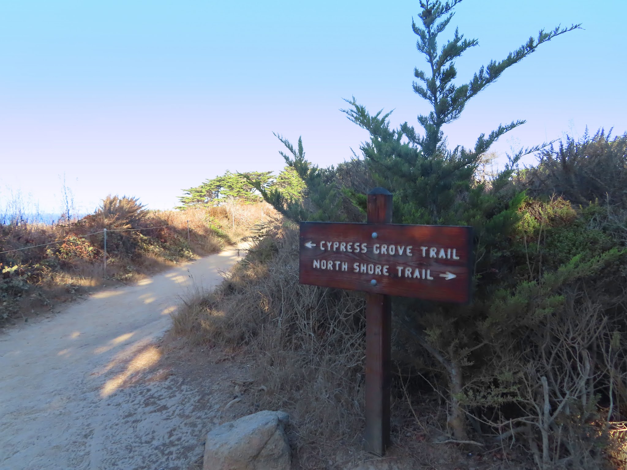
The map below shows where you will find the trailhead for a short hike off the north end of the parking lot. The trail is called North Shore Trail and is at the base of a set of stairs.
Map of trails around Whalers Cove
Before you set off to explore, here are a few notes of caution. If you leave the parking area, always cover all valuables in your car and lock the doors. When you hike anywhere in Monterey County, stay on designated trails and behind trail boundary markers. Do not climb on the rocks at the shoreline as they are slippery and never turn your back on the ocean. Sleeper waves arrive without warning and have knocked many people into the water. Familiarize yourself with what poison oak looks like and don't touch it! Remember “Leaves of Three, Leave Them Be.” And finally take nothing but photographs and leave nothing but footprints.
The trailhead is clearly marked North Shore Trail.
This 1/4 mile round trip loop around Cannery Point offers incredible views of Whaler's Cove and Carmel.
When you get to the top of the stairs turn
right and follow the loop around the point.
From this vantage point you will be rewarded with stunning views of Carmel-by-the-Sea in the distance.
Off of Cannery Point is a trail that leads further up the hill to Whalers Knoll.
This is an area where Portuguese whalers, who arrived in 1861, would watch the horizon for migrating gray whales. Once they spotted a passing whale, they would raise a flag to signal a crew in the cove, who would row out to sea and attempt to harpoon the 30 ton giant and tow it back to shore.
There is an old Portuguese whalers boat stored in the shed (shown above) next to the Whalers Cabin. This shed is rarely open but you can see a picture of the boat below. Pretty small when going up against a whale.
Below we came across a western gull feasting on a sanddab in Whalers Cove.
After you have explored this area exit the parking lot and drive back the way you came.
Pass the Whalers Cabin and when you get to the fork in the road (shown below), there will be three options, left to exit the park, straight or right.
Turn right, we are heading toward Cypress Grove and Sea Lion Point parking area.
A bit further on this narrow stretch, veer right and follow the sign to Cypress Grove. While you drive, we will give you a brief history of the Point Lobos area.
Shell fragments and mortars hollowed out of bedrock considered thousands of years old indicate that the Rumsien Native Americans were the first to occupy Point Lobos and fish from its sea.
Since 1851 groups of Chinese, Japanese, and Portuguese found their way here to carve out a living from the sea. Below is a label from the Point Lobos Canning Company c. 1905.
The Chinese were the first to commercially harvest abalone here. By the time the Japanese arrived, much of the shallow-water abalone had been farmed. The Japanese created a way to harvest deep water abalone by using diving suits.
This area has also been used as a granite and gravel quarry, a pasture for livestock and during the Prohibition the secluded coves hid vessels bearing forbidden liquors.
By the 1890s this land was laid out for a residential subdivision. The plan was similar to what was going on at the time in Carmel to the north. The community was called Carmelito and also known as Point Lobos City. You can see the plot map in the picture below.
In 1898, successful architect and real estate developer Alexander Allan purchased the land, but not for development. Instead Allan purchased the land to save it from development. He recognized that Point Lobos was a special place and should be preserved. Three years after Allen’s death in 1933, the land would become part of the California State Park System.
Parking lot for Cypress Grove
The road will end at the Cypress Grove parking area. Park in this lot. There is a a public restroom here near the information kiosk at the north end of the parking lot.
There are two great hikes out of this area, the Cypress Grove Trail and the Sea Lion Point Trail. Each is about 1 mile and you may see a map of these two hikes below.
If you only have time for one hike, we suggest the Cypress Grove Trail.
The trailhead is near the public restroom and information kiosk. After entering the trail, follow the arrow pointing to the left for the Cypress Grove Trail. The North Shore Trail, which goes to the right, will take you back to Whalers Cove.
This trail will wind through a field of coastal shrub and intersect with a loop through the Allen Memorial grove, one of only two naturally growing stands of Monterey cypress trees remaining in the world.
This loop may be explored starting from the right or the left. Today we chose to start our loop from the right.
This trail takes you up and down steps,
then out to the cliffs overlooking the ocean,
as well as a seasonal nesting
area for the brown pelican.
As you continue on your walk you will probably notice the red stuff on the trees and rocks. This is a species of green algae called Trentepohlia aurea. The vibrant orange color is a result of the species’ ability to synthesize an orange β-carotene pigment which aids in light collection for photosynthesis.
This airborne algae produces its own food and is not parasitic or harmful to the trees. It requires extremely pure moist air, which it finds in abundance here at Point Lobos. You will find it growing largely on the trunks of older Monterey cypress but it is also known to grow on rocks as well.
Continue to follow this loop around to the beginning, then backtrack through the field of coastal shrub to the parking lot.
The second walk is the Sea Lion Point Trail. If you take a look at the map below, you will see that this trailhead is off the southern end of this parking lot near the handicap parking area. The first part of this trail is wheelchair accessible.
Round trip from the parking area is just under a mile. The southern portion of this trail is the Sand Hill Trail. This connects to the South Shore Trail.
Today Sea Lion Trail is closed for maintenance, so we are following the Sand Hill Trail out and back.
Along the way we will have view of Sea Lion Cove where the noisy California sea lions can be seen on offshore rocks. Though sea lions are common throughout the year, there are fewer seen during the summer months, when they join the females at the rookeries in southern California.
California sea lion
The name Point Lobos is derived from the Spanish explorers name for this area, "Punta de los Lobos Marinos" which means "point of the sea wolves." It is thought that the barking of the sea lions aided the navigation of these early explorers, warning them of rocks hidden by thick fog.
Follow the trail past the intersection
to the North Shore Trail out to the point,
where you will see Sea Lion Rock in the distance. Then reverse your hike back to the parking lot.
Once you are back in your car, exit the parking area by driving past the handicap parking area and the trailhead to Sea Lion Trail.
Follow this road to the very end. We are on our way to our last stop in Point Lobos, China Cove and Bird Rock Trail.
Road to China Cove*
Continue past the parking area that will be to your right and follow the road to the very end, past the wild sea churning beneath jagged rock cliffs.
As you drive we will tell you a little about some of the wildlife that call Point Lobos home, at least for some part of the year.
The noisy California sea lion, found on the rocks off Sea Lion Point, is composed of mostly adult males which can reach a weight of up to 800 pounds.Most of these leave here in June and July when they join the females in the rookeries that extend south along the California coast.
Harbor seal at China Beach
The torpedo-shaped harbor seal is much smaller than the sea lion and though they live here year round, they are much harder to spot.The best time to see them is in April and May when they hang out on the beach and rocks with their newborn pups.
Brandt's cormorant
The long-necked black sea bird you see in the park is the Brandt’s and Pelagic cormorant.They live here at the reserve all year long and on our next stop you will have an opportunity to see a large group of Brandt’s cormorant that nests on Bird Island.
sea otter
The southern sea otter was once hunted to near extinction for its fur. Today, the sea otter is making a comeback. Keep an eye out amongst the seaweed for what looks like a floating brown log with a bump at each end. This would be the otters head and webbed hind feet.
gray whale
Between December and May, migrating gray whales surface and dive just offshore here at Point Lobos. They are over 45 feet long and weigh as much as 40 tons. Look for a spout of water that the whales blow in a V shape from their blowholes. Or, you might spot their tail, just before they dive deep into the water. Spotting a whale takes patience and a pair of binoculars is helpful. The one shown in the picture above was spotted while we were on a whale watching tour in Monterey Bay. The photo was taken by the docent on board as the rest of us were too busy ducking for cover.
brown pelican
Large colonies of brown pelican live at Point Lobos from June through January. Watch the sky for them as they glide along the water, or spot them sitting on rocks watching for their next meal. These marine carnivores which feed entirely from the sea on small fish can hold 3 gallons of water and fish in their pouch at one time.
Continue straight, this road will dead end in the Bird Rock parking lot, which is our next stop.
Bird Rock parking lot
If you choose to explore this area, there is one notable trail out of this parking lot, Bird Island Trail.It has two trailheads.The fully-accessible ADA-conforming trail is found to the left of the handicap parking area.This bypasses the set of stairs found at the beginning of the non-ADA trail which is to the right of the handicap parking.
Both converge together after the stairs.
Take a look at the map below to familiarize yourself with the area.
The hike is about 1 mile round trip.Your walk will take you through the woods
out to the sea where weathered rocks are surrounded by the jade-green waters of China Cove.
Along these rocks brown pelicans nest.
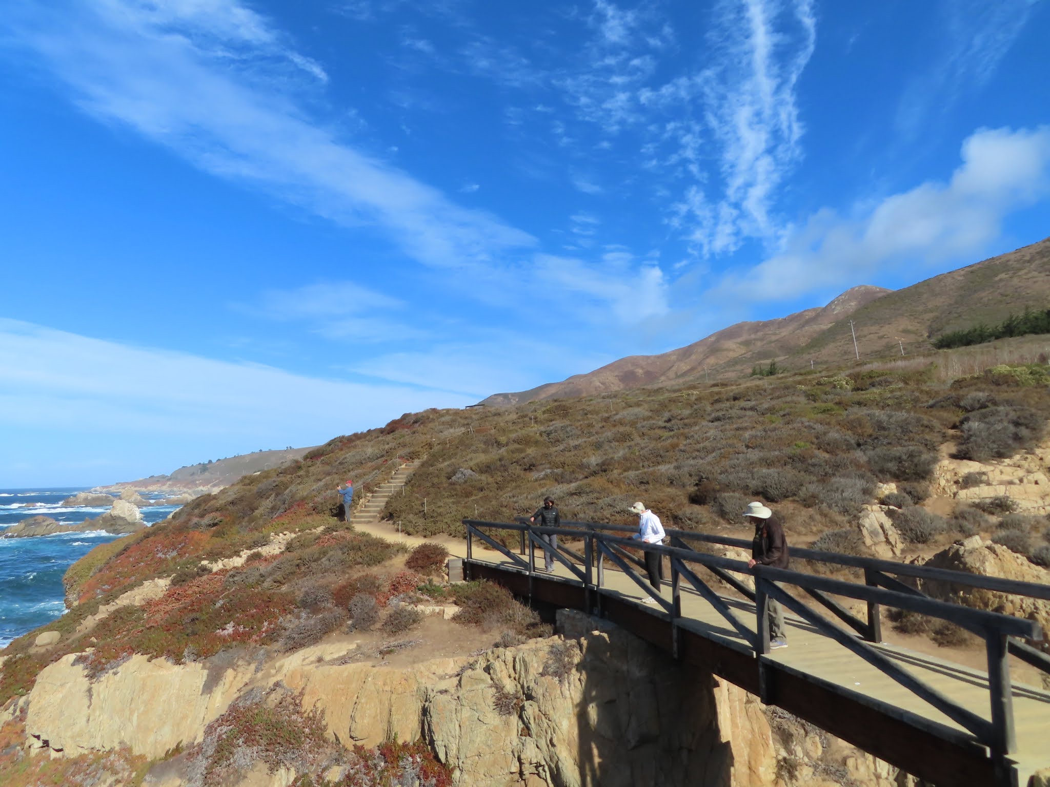
Just after China Cove follow the trail left.The trail T’s at the Gibson Beach overlook. To the left is the South Plateau Trail which leads to...
a very steep set of stairs down to Gibson Beach. We don't suggest taking those stairs. Instead, turn right at the T intersection...
Stairs to Gibson Beach
...to the wooden boardwalk which overlooks Gibson Beach and Carmel Highlands in the distance.
Gibson Beach
Carmel Highlands
Then continue following the trail in a loop around Pelican Point to overlook Bird Rock and nesting Brandt’s cormorant.
When you are done, reverse your hike back to the parking area.
We are now headed out of the park and back to Highway 1.Exit the Bird Rock parking lot and drive straight. Do not take the first right turn as that will lead to another parking lot.
Continue straight and this road will fork.The sign at the road to the left reads Do Not Enter.Take the fork to the right to exit the park.Be mindful as you drive, you share this narrow road with two-way traffic, pedestrians and bicyclists.
At the next intersection turn right to exit the park. The exit will be in about three-quarters of a mile.
While you drive we will tell you about the trees and plants of Point Lobos, most of which remain green all year long. The one major exception is poison oak which drops its red fall leaves and becomes a bare stem in the winter.
The Monterey pines found on the reserve are one of only three native stands of this tree species in the world. The Monterey cypress as we mentioned before is native to only two areas. Though the pine and cypress thrive in the cool climate and frequent fog, they both require the heat of fire to release seeds from their cones.
Between the trees of the forest and the ocean, evergreen shrubs create a variety of textures, colors and fragrances here in Point Lobos. For much of the year the slender stems of silvery light gray California sagebrush and bushes of Carmel creeper with tiny blue flowers add color to the ground cover. Then, during the spring wildflower season, the meadows here come alive, bursting forth with a rainbow of colors: golden yarrow, orange seaside painted cup, deep blue sky lupine and purple lavender just to name a few.
Point Lobos State Natural Reserve is considered the crown jewel of California’s State Park system and attracts over 600,000 visitors a year. Believe it or not, you have just visited a small portion of this natural wonderland.
Continue straight and pass the entrance booth,
then turn right back onto Highway 1.
Video of hikes in Point Lobos
Soon you will be entering Carmel Highlands, the northern gateway to the Big Sur coastline.This unincorporated community was laid out in 1916 by the co-founders of Carmel-by-the-Sea, Frank Powers and Frank Devendorf. We talk more about Powers and Devendorf in our Carmel-by-the-Sea Downtown in One Hour Walking Tour.
View of Carmel Highlands from Point Lobos over Gibson Beach
Finding their inspiration in the rocky coastline, many painters and photographers built rustic cabins here in Carmel Highlands during the early 20th century. Probably the most famous were Ansel Adams and Edward Weston.
The photo above taken c. 1950's by Pirkle Jones is of Edward Weston and Ansel Adams in front of Weston's Carmel Highland home and photography studio, Wildcat Hill. This was built by Weston's son in 1938. The photo below by Beaumont Newhall shows this 800 square foot cabin in 1940.
Weston’s studio home, Wildcat Hill has been preserved and is now occupied by his grandson, photographer Kim Weston. But, for the most part those early rural cabins have been replaced by multi-million dollars homes. Real estate in the Carmel Highlands is some of the most expensive in the United States.
Continue straight along the highway. At our next stop, Carmel Highlands Viewpoint, you will have a nice view up the coast to Point Lobos.
California Market and the Pacific Edge Restaurant Hyatt Carmel Highlands
On top of the hill overlooking this viewpoint is the Hyatt Carmel Highlands, which Frank Devendorf opened in 1917 as the Highlands Inn.
To your right notice the tall stone wall.This wall will continue to step down in height. The pullout for the Carmel Highland Viewpoint is at the end of the stone wall.
Stop here for a moment. From this location you may take in the view back toward Point Lobos and the rocky coast.
Bird Rock Point Lobos
Take a look behind you, across the street and up to the top of the hill.That is the California Market and Pacific Edge restaurants at the Hyatt Carmel Highlands.
The photo below of the Highlands Inn is by Louis Slevin c. 1920.
Highlands Inn opened in 1917 and rented cabins in the Monterey pine forest.Original owner Frank Devendorf said that his inn “combined the rustic qualities of its setting, yet offered travelers all the luxury that the progress of the new century could offer.”After various ownerships and several expansions, the Highlands Inn became a Hyatt property in 1995.
If you would like to visit the Hyatt Highlands Inn or the equally historic Tickle Pink Inn you may do so by taking a sharp left on Highlands Drive just 500 feet after getting back on the highway.Highlands Drive will wind past the lobby of both hotels and then back to Highway 1.
Wildcat Creek Bridge*
Up ahead before you cross the Wildcat Creek Bridge is an inconspicuous road marked only by the number 251 on a wooden box. You can see a picture of this area above. There is a red heart on the tree next to the mailbox. This private road leads to Wildcat Hill, the home of photographer Edward Weston.Tours of the property must be arraigned in advance of any visit with Weston's grandson Kim.
After you cross Wildcat Creek Bridge take the first right onto Spindrift Road.
Spindrift Road is famous for being the film location for both movies and television. We will point out the addresses which will be on your right. If the gates are open it is fine to peek in, but stay on the street side and do not cross past the gate. These are private residences.
The first address is 162 Spindrift. It is the fourth driveway from Highway 1 on your right. Currently the owners are doing work on their front gate.
167 Spindrift is the film location of Dave's House in the 1971 psychological thriller Play Misty for Me. Clint Eastwood, who starred and played Dave, made his directorial debut in this movie, which co-starred Jessica Walter and Donna Mills.The home was built in 1949 and sold in 2018 after a major renovation for nearly $8.5 million dollars.
Continue driving two driveways down the road to 157 Spindrift where you will find a red brick driveway and a wooden gate with a stone fence. The address 157 is on the mailbox just as the fencing changes from wood to stone.
Scenes from Basic Instinct a 1992 thriller starring Michael Douglas and Sharon Stone were filmed here.
It was also the location of a scene from episode 5 “Kill Me” from season 2 of Big Little Lies.This is where Ed and Madeline MacKenzie, played by Adam Scott and Reese Witherspoon, attended a healing institute in hopes of repairing their marriage.
For many years 157 Spindrift was the home of Steve and Peggy Fossett. Steve set world records in air balloons, sailboats, gliders, and powered aircraft. In 2005 he made the first solo, nonstop unrefueled circumnavigation of the world in an airplane, a Virgin Atlantic GlobalFlyer, single-engine jet in 67 hours. Steve Fossett disappeared in 2007 while piloting a light aircraft over the Great Desert between Nevada and California. Mrs. Fossett sold the property in 2018 for almost $14.5 million dollars.
Steve Fossett
The current owner of 157 Spindrift, spent over 12 years acquiring four consecutive ocean front properties on this street.During that time he renovated and built them up to what is now known as Seven Coves.This property has 1,000 feet of dramatic ocean vistas and five separate homes which collectively provide 17,000 square feet of living space. As of this writing it is on the market for a cool $52 million.
Steve in cockpit of GlobalFlyer
Continue driving along Spindrift. Use caution as this narrow road is two-way. After you pass along the rocky coast, Spindrift will connect back up with Highway 1.
Turn right back on to Highway 1 and take the next right onto Yankee Point Drive. We are going to drive by the house used as the residence of Celeste and Perry Wright, played by Nicole Kidman and Alexander Skarsgard, in the HBO miniseries Big Little Lies.
Continue along Yankee Point Drive. After you pass Yankee Beach Way, look for a white stucco wall with a black iron gate.
The address 40 will be on the stucco wall.
This home was used for many of the outdoor and interior shots of Celeste's home, however her bedroom and bathroom were filmed on a sound stage in Los Angeles.
Follow Yankee Point Drive back to Highway 1 and turn right.
Continue straight along Highway 1 and cross Malpaso Creek Bridge.
Malpaso Creek Bridge*
This open-spandrel concrete arch bridge is one of 32 bridges built to cover the rugged 100 miles from Carmel to San Simeon.
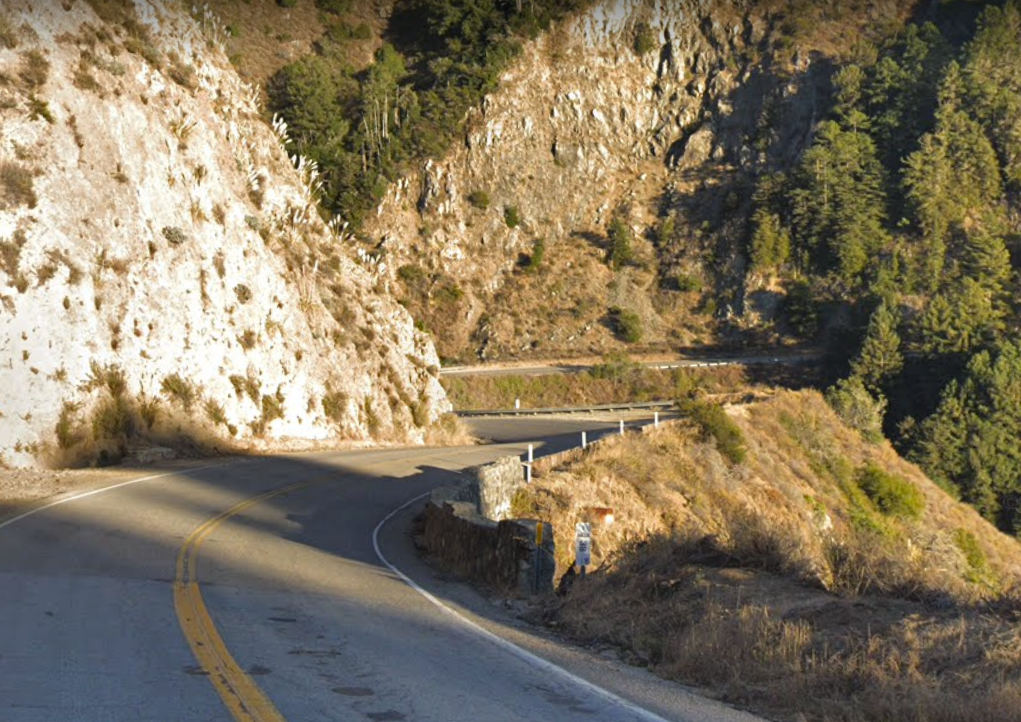
Highway 1 is considered one of the most scenic driving routes in the United States. It has been described as the "greatest meeting of land and water in the world" and is both a California and National Scenic Highway.
Garrapata State Park*
Nestled at the base of the Santa Lucia Range, Garrapata State Park’s nearly 3000 acres encompass the next four miles of rocky shoreline. The park offers, or I should say offered, a diverse set of trails that ran from the ocean beaches high into the dense coast redwood groves to the east. During the summer of 2016 this park was mostly destroyed by the Soberanes Fire, which was caused by an illegal campfire. It took three months to fight and cost in excess of $200 million to contain. The majority of trails have re-opened and hiking is spectacular again in Garrapata.
Periodically as you drive you will see a parking pull out to your right. There are 19 of these associated with trailheads for Garrapata State Park. And though there are many wonderful hikes here in Garrapata we have picked two of these to highlight.
The parking pull out for the trailhead for the first hike, Garrapata Bluff Trail, is located just after the Monterey County Mile Marker #66.
Gate to Garrapata Bluff Trail
Pull out and park here for the
1/4 mile Garrapata Bluff Trail.
The trailhead is toward the southern end of this parking area. Here you will find a set of stairs alongside a wooden fence.
Descend the stairs and follow the trail to the left. You will cross a small bridge over Soberanes Creek.
Continue along the trail to a wooden overlook to view the rock monoliths just offshore. The trail continues around the headlands, but this is where we suggest turning around as there is a lot more to see on our drive down the coast.
When you are done taking in the spectacular view, reverse your walk back to the parking area and continue driving south on Highway 1.
The trailhead for the next hike, the Calla Lily Valley Trail, is in about 2-1/2 miles. While you drive we will fill you in on the history of this portion of Highway 1.
Our story begins on April 21, 1894, when Dr. John Roberts was summoned to treat the survivors of the S.S. Los Angeles near Point Sur, 21 miles south of Carmel.It took him 3 ½ hours by horse-drawn cart to reach the sight of the accident.
As well as being a physician, Dr. Roberts also was a land speculator, and he recognized the value of what a road could bring to this remote corner of the California coast.He convinced State Senator Elmer Rigdon that a road could be built between Carmel and San Simeon along the coast for $50,000.Rigdon promoted this road as a military necessity and the project was approved in 1919.
But engineers quickly discovered major challenges in constructing this highway. Access to construction areas was difficult, explosives were necessary to penetrate the rocky hillsides, numerous bridges were needed, and accidents, equipment damage and rock slides were frequent. Finally the two-lane road opened in 1937. The final cost, $19 million, a bit more than Dr. Roberts estimate.
Now the trailhead for Calla Lily Valley kind of sneaks up on you. And there really are not any landmarks as you approach the pull out. The best we can do is remind you that the pull out is about 2 and 1/2 miles from the Garrapata Beach Bluff trailhead and it is pictured above.
The picture above shows the trailhead marked with the number 18. You will find the trailhead at the end of the parking pullout. Directly across the street from the trailhead is the private property of Doud Creek Ranch. That is shown in the picture below.
If you choose to take this 1/2 mile hike, just follow the trailhead to the left. The path is very narrow, about 2 feet at its widest, and eventually comes to a set of steps that descends into a valley.
Beyond the valley is a small beach.
As you can see from the picture below the path can be very narrow.
The beach is accessed by a tiny footbridge.
We never seem to time it quite right for a full bloom of lilies, but the "Little Grunt" family did as you can see in their picture below.
Alright, time to reverse your walk back to the parking area and carefully pull back onto Highway 1 going south. While you drive we will review a brief history of this rugged coast.
Before the Spanish first sailed along this coast in 1542, this area was home to the Oholone, Esselen and Salinan native peoples who were hunter-gatherers and followed different food sources through the seasons.
In 1770, the Spanish landed near what would become Monterey, and by 1776, Monterey had become the capital of Alta California. In 1833, the area of what would become Big Sur was divided into two land grants, the Rancho El Sur and Rancho San Jose y Sur Chiquito.
After California became a state in 1850, the owners of these land grants were required to prove valid ownership, and when they could not, the land reverted to the public domain.
By the mid 1800s, a small community of hearty pioneers had begun homesteading the area. The Homestead Act of 1862 made it possible for citizens to claim 160 acres of surveyed government land. Homesteaders were then required to build a dwelling and cultivate the land. After five years, they owned their land free and clear.
As we continue on this driving tour we will pass through small communities named after these early pioneer families, including the Notley's, Post's, Pfeiffer's and Partington's.
Up ahead on your right will be a sign for the Rocky Point restaurant This restaurant, which is perched cliff-side, has spectacular views of the Pacific Ocean.
At the time this tour was published, the family that owns the restaurant has closed it down due to the COVID-19 shelter-in-place mandate from the State of California. But, when this has been lifted they will be open again. When they are stop in for a drink and a meal. Sometimes you can spot whales in the distance from their patio deck.
In less than 1/2 mile from Rocky Point look for the green Palo Colorado sign.This area was the former logging community Notley’s Landing. The only historic structure still standing is a cabin, barely visible to your left, hidden by an old stand of eucalyptus trees.
The Notley brothers, who homesteaded this location, found a lucrative source of income in harvesting the tanoak trees here. After cording the bark the wood was brought by mule down the hillside to their landing (see the historic picture below). Here the wood was loaded onto waiting vessels bound for San Francisco. This small settlement of Notley's Landing lasted only five years, disbanding after the lumber was all clear cut in 1907.
From here, our next stop will be in 1/2 mile at the Rocky Creek Bridge Viewpoint. The pull out for this stop will be to your right before crossing the Rocky Creek Bridge. From this vantage point you will have a lovely view of the open-spandrels and arch of this historic bridge.
Pull over into the turnout on your right. If you get out of your car, make sure to stay behind the boulders away from the cliff while you view this bridge which was completed in 1932, five years before this highway opened.
Continue driving across the bridge. All of the arch bridges along this section of Highway 1 have an open barrier rail. This is meant to enhance your experience of viewing the ocean while driving across the bridge.
Our next turn off is in about one-half mile.This will be the parking area for the Bixby Creek Bridge Viewpoint. This iconic bridge has been used in movies and television. One classic scene is the opening credits of each episode of Big Little Lies where Madeline Mackenzie, played by Reese Witherspoon drives over this bridge on her way to Monterey.
Bixby Bridge is considered Big Sur’s version of the Golden Gate Bridge.When it was completed in 1932 for just over $200,000, (just one year before the Golden Gate) this concrete span was the largest arched highway structure in the Western United States.
But one look at the canyon’s steep and crumbling cliffs, it is clear that this was a difficult piece of engineering.Besides building the bridge, getting the wood, steel and cement here was pretty difficult too.
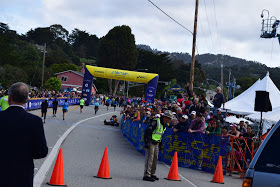
This bridge is also the half way point on the Big Sur Marathon.During that race local musician Michael Martinez sets up his Yamaha grand piano here and serenades the runners as they cross.It is quite a sight.
Michael Martinez at the 2016 Big Sur Marathon
So take some time and explore this area before we cross the bridge.Make sure to stay behind the boulders and away from the edge of the cliff as it is very unstable.
Once you are ready, carefully pull back onto Highway 1 and continue south across the Bixby Bridge. Our next stop, Hurricane Point Viewpoint, is in one mile.
Once across the bridge you will be driving along side Brazil Ranch. The ranch was established by Antonio and Mary Brazil in the late 19th century. Two generations of their family worked the ranch until it was sold to television personality and creator of “Candid Camera,” Allen Funt in the 1970’s.
Brazil Ranch c. 1889
Mr. Funt raised quarter horses and cattle on the land and expressed his desire that the property remain undeveloped.Yet after his death in 1999, the land was sold to a land developer for $9.5 million dollars. This developer declared that he planned on building nine mega-mansions on the property.
Community leaders were not pleased and joined together to prevent this. The property owner agreed not to develop if someone would buy the property from him for $25 million.In 2002 the U.S. Forest Service stepped up to the plate and purchased the land for $23 million, protecting an 11-mile stretch of coastline between Bixby Bridge and Andrew Molera State Park.
Shortly after you see the 30 mph sign that is shown in the picture below, the turnout for Hurricane Point Viewpoint will be on your right. There are boulders lining the side of the highway at this turnout.
Stop here and park at the turnout.Hurricane Point is one of the highest points on Highway 1 in the Big Sur region.
At an elevation of 560 feet, it is also the toughest climb on the Big Sur International Marathon. Runners begin their accent two miles earlier at the base of this notorious hill. Then with the help of the riveting beat of the Taiko Drummers who occupy a sandy area on the side of the highway at the beginning of this hill, runners fight through their fatigue, and the hurricane like winds that at times push them backward. Keep that in mind when you step out of your car to observe the view from this spectacular vista.
On a clear day you will have views to the north across Brazil Ranch to Bixby Bridge. To the south you will be able to see Point Sur Light Station. Please stay on the highway side of the boulders, as the cliff is very unstable.
Okay carefully resume driving south on Highway 1.Our next stop will be in about two and one-halfmiles at the Great Sur and Little Sur River Beach Overlook. While you drive downhill think about those marathon runners climbing this hill after having initially run 9 miles.
Julia Stamps
And if you need a visual, here is Julia Stamps facing a serious headwind in the 2016 Big Sur International Marathon. She is a force to be reckoned with hailing from Santa Rosa, Julia went to Stanford University, where she had a freak accident skateboarding to class in 2001, completely shattering her left leg. Must have done an amazing rehab job as note the tape she's using is on her right leg, not the previously injured one. Julia finished 5th in the female division in 2016, with a time of 3:13:25.
Back to our tour, as you drive, look off to your right. In the distance off the coast is Point Sur. This large rock has been a mariner’s landmark since the days of the Spanish explorers.
Watercolor picture of Point 1859
Though President Andrew Johnson reserved Point Sur for a lighthouse in 1866, it wasn’t till the wreck of the Ventura in 1875 that Congress would approve $100,000 for construction of the lighthouse on this volcanic rock 361 feet above the Pacific Ocean. This lighthouse was erected in 1889 and has stayed in continuous operation ever since.
Of course, there were many construction issues, possibly the greatest being how to get building materials up the steep grade without a road. The answer was to build a set of 396 stairs. For years anyone who lived or worked at the lighthouse traveled those steps daily. A road up the rock was finally built in 1900.
Marker for crash site of U.S.S. Macon on Point Sur
Even with the lighthouse, ships continued to run aground on the rocky shores of Point Sur, including the ship Los Angeles in 1894 which initiated the plan for construction of Highway 1, the Majestic in 1909 and the Howard Olson in 1956.
But probably the most famous was the U.S.S. Macon a rigid helium airship that served as one of the Navy's "flying aircraft carriers." It was damaged in a storm and crashed off the shore of Point Sur in 1935.
Macon in Hanger I at Moffett Field, California
Before the lighthouse was automated in the 1960s, lighthouse keepers lived a very isolated life out on this windswept rock. Today a U.S. Coast Guard crew services the lighthouse regularly.
Continue driving straight. Up ahead the highway curves to your left away from the ocean, then it makes a big U, crosses the Little Sur Bridge and comes back out to the ocean at the Great Sur and Little Sur River Beach Overlook.
Taiko Drummers base of Hurricane Point 2016
When you reach the middle of the U in the road, notice the large turnout area on your left.There is usually a sand pile here where residents fill sand bags during the rainy season.This is also where the Taiko Drummers are positioned during the Big Sur International Marathon. The rhythmic beat of their drums first signal runners to the huge challenge ahead, then serve as their motivation as they fight their way uphill against the wind.
Approach to Great Sur and Little Sur River Overlook*
Just past the 30 mph sign (shown above) the highway will curve to your left and there will be two turnouts. We will be using the second turnout, it is paved.
Pull into the paved parking area on your right. This is the Great Sur and Little Sur River Beach Overlook. From this vantage point looking north, you will have a view of the mouth of the Little Sur River.
The 25 mile long Little Sur River has its main tributary headwaters deep in the redwood forested canyons of the Ventana Wilderness to the east. It is considered by the California Department of Fish and Game to be the most important steelhead spawning stream on the Central Coast of California.
As you continue driving south you will be driving along side the El Sur Ranch.
Originally part of the Rancho El Sur land grant deeded to Juan Batista Alvarado, El Sur Ranch has been a cattle raising operation since the 1930s. The ranch's 7,000 plus acres straddle Highway 1 for the next six miles.
Access road off Highway 1 to base of Point Sur
Since 1955, it has been owned, and preserved by the Cortlandt Hill family who manages a commercial cow-calf operation. This is a method of raising beef cattle in which a permanent herd of cows is kept by the rancher to produce calves for sale later.
As you get closer to Point Sur you might be able to see the lighthouse and other buildings on the rock.
The Hill family granted an easement to the State Parks System across their ranch from Highway 1 to the road at the base of the Point Sur headlands which leads up the rock to the lighthouse.
Just past the gnarled Monterey cypress tree up ahead is the turn out on your right to our next stop, the entry gate for the Point Sur Light Station. Pull over and stop for a moment outside the locked gate of the Point Sur Light Station.
Guided tours of this light station are given periodically throughout the year. The tours are extremely popular and well worth the price of admission. We took this tour a number of years ago during the winter whale watching season and had no trouble spotting gray whales during their annual migration off the coast.
Now look several hundred feet ahead of you. You will see another stand of cypress trees. This marks the entrance to the Navel Facility at Point Sur.
From January 1958 to October 1984, this was an active naval facility. It has a fascinating history. At the time of its operation, the general public was told that the station was engaged in oceanographic research, but actually it was built to detect Soviet submarines during the Cold War.
The facility used a long-range acoustic listening system called the Sound Surveillance System. It was basically hydrophones placed on the ocean floor, connected by underwater cables. These cables were connected to a network of 30 defense listening stations around the world that tracked the movement of Soviet submarines.
After the operation closed, the building was donated to the California State Park System in 2000 and it is currently open to the public on a limited basis for guided tours most Saturdays and Sundays.
Alright, carefully pull back on to the highway and continue south. On your right ahead will be the sign and driveway for the Naval Facility.
Our next stop will be in just a little over 2 miles, 2.2 to be precise. Here you will find a parking pull out and the trailhead to visit the Cooper log cabin, a three-room structure built out of hand-hewn redwood logs, roofed and sided with hand-split redwood shingles.
Trailhead off Highway 1 to Cooper Cabin
Monterey sea captain John Rogers Cooper acquired this land from his nephew Juan Bautista Alvarado in 1840.
Captain Cooper
Cooper had a number of structures built on the property, but this cabin which remains largely intact was built in 1861 by George Austin.
The cabin originally served as a dwelling for Cooper’s ranch hands. Today it is the oldest surviving structure in the park as well as on the Big Sur Coast.
The trail from the highway to the cabin is less than 1/4 mile. It is the only way to see the cabin, as the trailhead that leads out of the parking lot of Andrew Molera State Park to this cabin is currently flooded.
Cooper Cabin
Once you have visited the cabin, carefully pull back onto the highway and continue driving south. The entrance for Andrew Molera State Park in is less than 1/4 mile.
This park is open from 8am to sunset. A parking receipt from another state park issued on the same day as your visit, is valid for parking here at Andrew Molera. The same is valid for Pfeiffer Big Sur and Julia Pfeiffer State Park which we will visit later on this tour.
This park is named after Andrew Molera, a dairy farmer and rancher who controlled the land from 1915 to 1931. His sister Francis bequeathed the ranch to the state of California for a park in 1968.
If you do stop here check with the ranger on duty about what trails are open when you visit. When we were there in November 2020 much of the park was closed to the public.
The Creamery Meadow, which is always popular with surfers and paddle-boarders was open.
This 2 mile hike out and back from the ranch house to the beach seemed like a good idea until we got to the Big Sur River and realized the seasonal footbridge had been removed at the end of October. Maybe we will try again in the spring.
There are a few other historic buildings on the property including a bunkhouse and barn (shown in the picture below). However, these two structures which house the Ventana Wilderness Discovery Center and an exhibit on the California Condor are currently closed to the public.
When you are done exploring Andrew Molera State Park, exit the parking lot the way you arrived, following the road back up to Highway 1 and turn right onto the highway going south.
But just a word of caution here, take your time when making this right turn back onto the highway. This is a very tight turn and if not done properly you could find yourself heading into on coming traffic.
Our next stop is in about 2 and one-half miles, the Big Sur River Inn and Restaurant. There is also a Valero gas station here if you want to top off your tank.
This restaurant is a lovely place to stop for a meal. The deck off the back of the restaurant overlooks the Big Sur River. When the weather is warm enough we like to take our lunch down to the river and sit in the wooden chairs with our feet cooling in the river. Even if you don't have time for lunch, stop and take a walk behind the restaurant and the hotel to the river. It is a very tranquil spot.
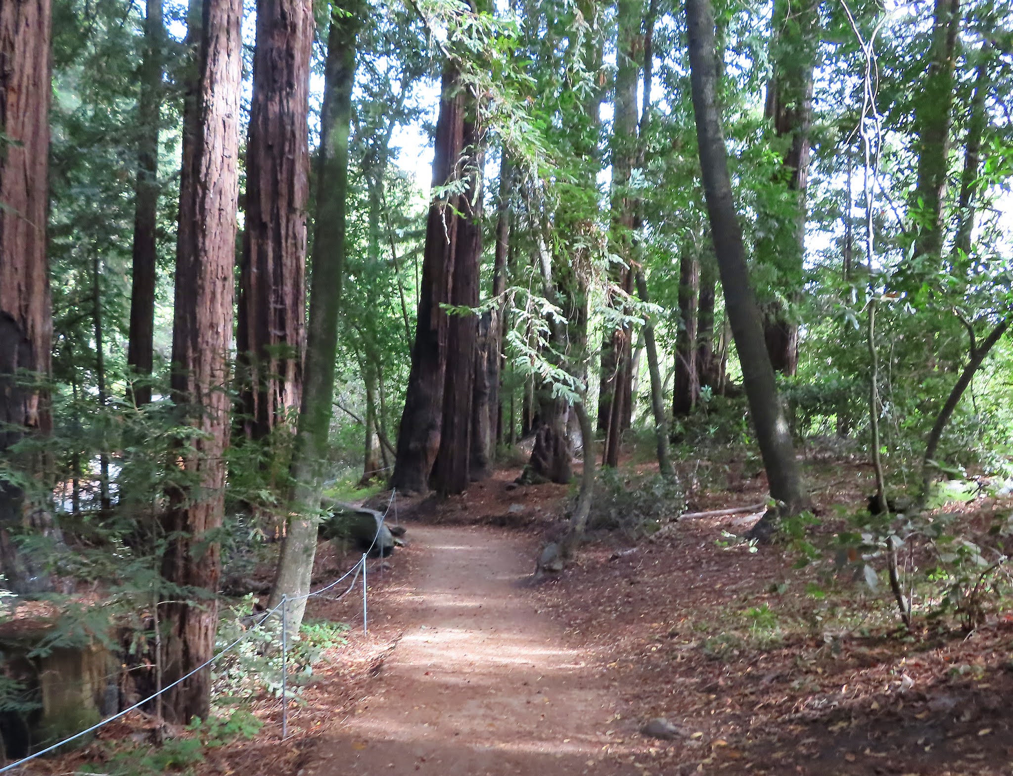
Once you leave Big Sur River Inn you are headed into redwood country. For the next few miles the road is shaded by a tall majestic forest of coast redwoods.
The coast redwood grows naturally in a very narrow strip along the coast of California. This area, about 500 miles long, rarely reaches more than 20 or 30 miles wide. The trees grow rapidly in their preferred environment, thick summer fog, moderate year round temperatures and heavy rainfall.
A 20 year old specimen might average 50 feet in height, while mature trees range from 200 to 240 feet tall. The really giant redwoods can measure more than 360 feet.
Our next stop is Pfeiffer Big Sur State Park. Named after Michael and Barbara Pfeiffer, farmers and beekeepers who settled this area in 1869, this land passed to one of their children, who sold the family homestead to the State of California for a park in 1933.
Although there are a number of trails available to explore, we'd like to point out two hikes that we enjoy at Pfeiffer Big Sur. The easiest is the Self-Guided Nature Trail behind the Big Sur Lodge. This 1/4 mile loop through a coast redwood forest is wheel chair accessible and features a number of stops with interpretive signs.
The other, is the Valley View Trail. This moderate to challenging hike is about 2 miles round trip through the redwoods. It is really quite special.
You will see the Pfeiffer Big Sur State Park sign (shown above) on the right side of the road about 1/2 mile before the entrance to the park.
Entrance to Pfeiffer Big Sur State Park*
The entrance (shown above) for Pfeiffer Big Sur and Big Sur Lodge will be on your left. If you want to visit this park, turn left and follow the signs that point to the Park Entrance, Camp Grounds, and Day Use Parking.
Before you get to the ranger booth the sign shown in the picture below will be on your right just outside the restaurant to the Big Sur Lodge. This is the location of the trailhead for both of the Self-Guided Nature Trail and the Valley View Trail.
When you get to the ranger booth show a valid receipt or pay the parking fee and request a map of the park then continue straight to the day parking area.
Locate the River Trail at the southwest edge of this parking area. Use this trail to get back to the Big Sur Lodge.
Here you will have access to the Self-guided Nature Trail and the Valley View Trail. Both may be found near a large round sign which pictures the rings of a redwood tree on one side and animals of the forest on the other that we pointed out earlier. This sign is outside the Big Sur Lodge near their restaurant.
First we explore the Nature Trail.
This trail is wheelchair accessible and you will have a wonderful view of the coast redwood.
Then we head off to hike Valley View.
This trail though level at first does get quite steep as it heads further up the hillside.
We suggest following it as far as you want then turning around and heading back to the parking lot.
If you do make it to the top you are rewarded with views of forested hillsides.
Alright it is time to get back on the road. Exit the park the way you arrived and turn left back onto Highway 1 going south.
In 1/2 mile on your left you will see the Big Sur Station sign.
Besides being the starting point for the Big Sur International Marathon (shown below in 2016), this is the main ranger station for the Big Sur area and offers a very informative visitors center if you're interested. Otherwise continue straight on Highway 1.
In about 1/2 mile we will cross Pfeiffer Canyon Bridge.
Pfeiffer Canyon Bridge*
In January 2017, heavy rainfall caused a landslide that damaged this bridge so badly that the California Department of Transportation determined the bridge was beyond repair and in need of replacement.
Closing this bridge posed a large problem for residents and businesses to the south, cutting them off from necessities such as propane and food.
But the residents of Big Sur are a hearty bunch. Once the bridge was down, they carved out a hiking path off the Pine Ridge Trail in Pfeiffer Big Sur State Park that switched back up the hillside and connected at Highway 1. Thus creating a walking path connecting the north to the south. You can see this in the edited trail map above.
Residents and restaurant workers walked these 2 miles twice a day for the next eight months until the Pfeiffer Canyon Bridge was rebuilt. We walked it once,
rewarding ourselves with lunch on the Nepenthe terrace, before turning around and hiking back to our car in the Pfeiffer Big Sur Parking lot.
After crossing the Pfeiffer Canyon bridge we will be passing through downtown Big Sur, where you will find a post office, general store, the Big Sur Bakery and your last opportunity to top off your gas tank for awhile.
Coming up on your left in 1/2 mile will be a red New England-style building and sign for the Ventana Inn. Turn left onto the road that leads in front of this red house.
Though no sign is visible, this is Coast Ridge Road. Continue up the road and stay to your right as you head up the hill and past the art sculptures. Stop in about 1/4 mile at a parking area that overlooks the coastline. When you arrive I will fill you in on the fascinating story of the Ventana Inn and Post Ranch.
Parking area on Coast Ridge Road
William Post arrived in Monterey in 1848 and spent the next few years hunting grizzly bear in the Santa Lucia Mountains. In 1850, he and his wife became one of the first homesteaders in the Big Sur region, claiming 160 acres right here for a cattle ranch. With the help of their children, the Post’s built their cabin in 1867. That was the red house you passed just a moment ago. The picture below shows the house in 1920.
Four generations of Post’s worked this ranch. When traditional ranching fell into decline the Post’s were approached with the opportunity of turning their property into an inn. Their homestead evolved from a working ranch to a luxury resort now known as The Post Ranch Inn.
This opened in 1992 with cabins and cottages which cling to Big Sur’s rocky-ridge overlooking the Pacific Ocean. The entrance to the Post Ranch Inn is directly across Highway 1 from the Post's red house. But without a reservation you won't be able to get very far up the road.
Now, directly up the hill from where you are currently parked is another luxury Big Sur hotel, the Ventana Inn and Spa. Unless you have a reservation you may not visit this swanky hotel either.
The Ventana Inn received national acclaim in 2013 when Sean Parker, co-founder of Napster and first president of Facebook, held an extravagant “Lord of the Rings” style wedding on their grounds. You may view photo from the wedding at Vanity Fair.
The couple’s multimillion dollar wedding included digging an artificial pond and erecting a stone bridge and elevated dance floor amid the old-growth redwood forest near the inn. Though they attempted to make sure the event did not harm the environment in any way they forgot to do one thing, get a permit, and thus incurred a $2.5 million dollar fine from the Coastal Commission.
Entrance to Post Ranch Inn
Alright, it is time to head back down the hill the way you came back to Highway 1. When you get to the intersection with Highway 1 stop and look directly across the street. There you will see the entrance to the Post Ranch Inn.
Our next stop is in less than 1 mile. It is Nepenthe Restaurant where views of the Big Sur coast can only be topped if you are a condor.
Sam Trotter homesteaded this area in 1925 and built a cabin. In 1944 author Henry Miller arrived in Big Sur and would live in this cabin for a short while. Trotter sold the home to actors Orson Welles and Rita Hayworth in 1944. Three years later as part of the Welles Hayworth divorce settlement, Bill and Lolly Fassett purchased the property for $12,000.
The Fassett's moved into the tiny cabin with their five children. Two years later they built the Nepenthe Restaurant off of the cabin.
The Fassett Family in front of their cabin 1950's (from My Nepenthe by Romney Steele)
The restaurant with its large terrace and brick fireplace reminded Lolly of the piazzas of Capri where she spent years traveling with her grandmother Jane Gallatin Powers. Jane was the wife of Frank Powers, co-founder of Carmel-by-the-Sea.
Look for the Nepenthe sign ahead and turn right into the parking lot for Nepenthe Restaurant. This is one of our two favorite places to stop for lunch when we drive this section of Highway 1. The other is the River Ranch Inn and Restaurant we passed earlier.
The original 1925 wooden cabin (shown earlier in a black and white photo with the Fassett Family), which is now faced with tan brick, is still owned by decedents of Bill and Lolly Fassett. The restaurant is built off the cabin.
Take some time now to explore the area, visit the store, have a light meal (which is always cooked with love) or a glass of your favorite beverage on the terrace.
You will be in good company as this restaurant has been visited by many famous people over the years, including Elizabeth Taylor and Richard Burton.
Rehearsing The Sandpiper folk dance scene on the Nepenthe terrace(from My Nepenthe by Romney Steele)
In fact the folk dancing scene from their 1965 film The Sandpiper was choreographed and rehearsed here on the Nepenthe terrace while the cast was filming in the Big Sur area. The actual scene was filmed on a sound stage built to resemble the restaurant.
We have a few more miles to cover on this driving tour. So it's time to head south on Highway 1. Almost immediately after leaving the Nepenthe parking lot, take a look to your left at the ultra modern Hawthorne Gallery designed by legendary architect Mickey Meunnig.
Coming up next on your left, will be the Henry Miller Library, named in honor of American author Henry Miller who called Big Sur home from 1944 to 1962. The library houses two major Miller collections, making it the second most extensive repository for his books, manuscripts and letters in the world.
And finally take a look left to view the rustic wooden Deetjen's Inn, part of which was built in the 1930s from reclaimed redwood from Monterey's Cannery Row. Deetjen's closed in early 2020 due to COVID-19 but they plan on reopening in early 2021.
Our next stop, Partington Cove is in about 5 miles. As you continue your drive, the highway curves along the shoreline where the waters are home to sea lions, harbor seals, sea otters, blue whales and gray whales.
But Big Sur is also something of a birdwatcher’s paradise. Here you will find everything from the common seagull, brown pelican and Brandt’s cormorant to the very rare bald eagle.
The next stretch of coastline is also home to the California condor, the largest North American land bird and currently protected as an endangered species. The condor is a master of the air, riding the winds effortlessly for hundreds of miles at a stretch.
Before the California Condor Recovery Program began in 1987, the last wild condor seen in Monterey County was in December of 1980, and with only 27 counted in the wild at that time, the condor was on the brink of extinction.
In 1987, in an effort lead by the U.S. Fish and Wildlife Service, the entire population of 27 California condors were rounded up so that they could be bred in captivity.
By 1992, Ventura County Condor Sanctuary had raised 80 condors in captivity and began releasing them back into the wild. The first condors from this project appeared in Monterey County eight years later and since then the condor population continues to grow in the county as pairs form new nest sites, breed and hatch their young in the wild. Sadly, an unknown number condors were lost in the recent 2020 Dolan fire.
We will be arriving at the trailhead for Partington Cove in a few minutes. Before we get there, here is some background on the area.
Centuries ago, Native Americans launched their tule canoes from the small coves off this area of coastline. From here they traveled up and down the coast trading their goods with other native communities.
Tule Boat (by Linda Yamane, Rumsien Native American)
In the late 1800's, John Partington and his wife homesteaded the land here and began a logging operation, clear cutting redwood for lumber and tan oaks for bark.
Partington dug a 60 foot tunnel through the mountain, and transported the timber from the forests down to the sea landing in a hidden cove. From here, the lumber went by ship north to San Francisco.
During Prohibition, Partington Cove was known as a favorite landing site for smugglers.
Monterey Mile Marker 38*
We will arrive at the trailhead for the 1 and one-half mile hike of Partington Cove shortly. Parking for this trailhead is a bit tricky. There are a number of pull-outs but we want to get you as close as possible to the trailhead. The parking pull-outs will start after Mile Marker 38 (shown above) and a short stone wall. Park in the second pull-out after the second stone wall (shown below).
Parking for Partington Cove *
The trailhead is near the steel gate
at the southern edge of the pullout.
The map below shows this hike separated into three sections. All worth the walk and each very unique. But if you take this hike do not venture past any of the overlook areas as the rocks are unstable. Also surf conditions here, as they are everywhere along this rugged coast, are extremely rough. Never turn your back to the water or wade into the surf.
After descending about 1/4 mile from the highway you come to a nice overlook of the area and a switchback.
Follow the switchback to the left...
...until you get to the intersection.
If you continue straight a few hundred feet you will reach the Partington Creek. This small area is surrounded by redwoods and lush ferns.
Backtrack to the intersection and turn left. This will bring you to another fork in the trail. Take the fork to the left.
This leads through Partington's1880s tunnel, then along a path framed by a wooden fence...
...out to a cliff where remnants of Partington's Landing are evident in the rocks.
It is hard to imagine anyone launching a boat from this area.
Reverse your walk back to the intersection and turn left. This path winds down to a rocky landing on an isolated beach at Partington Point. Stay back from the breaking waves as you watch the surf crash against the rock walls and spray several yards in the air.
Once you have taken all this in, head back to the parking area. The most difficult part of this hike is the final 1/4 mile ascent back up to the highway.
Before we get there we are going to stop at the Julia Pfeiffer Burns State Park Vista Point. This large paved area will be on your right and it is marked by a blue Vista Point sign.
Julia Pfeiffer Burns State Vista Point and another opportunity to take in the spectacular views and search the sky for condors. There are also some informational plaques here that give the history of the California condor.
Once you have explored the viewpoint and taken in some iconic Big Sur coast views continue south to Julia Pfeiffer Burns State Park.
This area, which was homesteaded by a number of pioneers in the late 1870s, including the McWay and Partington families, was purchased in 1924 by New York Congressman Lathrop Brown and his wife. They leased the area to Julia Pfeiffer Burns, the sister of John Pfeiffer of Pfeiffer Big Sur State Park fame. In 1962, the Brown’s donated their land to the park system requesting it be named for Julia Pfeiffer.
Julia Pfeiffer Burn State Park Entrance*
The entrance to Julia Pfieffer Burns State Park will be on your left. Turn into the park, pay your parking fee, or show a current parking receipt from a state park you visited earlier in the day.
The 2020 Dolan Fire caused significant damage to this State Park. The majority of the trails at the time of this writing are closed for repair. But the McWay Waterfall Overlook Trail is open!!!!
Scenes from this hike, which we highly recommend taking, are iconic and captured in many professional photographs and on many an artists' easel.
For years, this waterfall poured directly into the ocean, but the fire and subsequent landslide of 1983 filled the cove with enough material to form a sandy beach. Now the waterfall, which spills through a narrow notch in the rock, lands on the beach below instead.
The trailhead is near the ranger booth. Look for a set of stairs and a trail marked McWay Falls.
Follow the Overlook Waterfall Trail signs through a tunnel to the overlook.
Then turn right and walk along side the cliff to view McWay Falls.
Now, this is where we will be leaving you. We want to take this opportunity to thank you for joining us today on this driving tour from Carmel to Big Sur and hope you have discovered some hidden treasures and made some lasting memories.
There is so much more to discover and we have a number of other VoiceMap tours in Carmel-by-the-Sea and Monterey that we encourage you to check out. Just tap the explore tab and search MontereyPeninsula.
Until next time, Happy Adventures.
______
All pictures by L. A. Momboisse unless listed below:
Picture of Portuguese Whalers Boat - Point Lobos Foundation NoeHill Travels Label Point Lobos Canning Company in 1905 (public domain) Carmelito plot map 1890 (public domain)
California Sea Lion (Wikipedia -public domain) Brandt's cormorant (Wikipedia - public domain) Sea otter (Wikipedia - public domain)
Gray Whale photograph taken by docent on our whale watching tour (public domain)
View of Carmel Highlands from Point Lobos over Gibson Beach (Wikipedia - public domain) Weston and Ansel Adams in front of the 1948 addition to Wildcat Hill (Photo by Pirkle Joneswikimapia) Photo of Wildcat Hill by Beaumont Newhall Highlands Inn (photo by Slevin - postcard public domain) Basic Instinct House from real-estate listing Steve Fossett (Smithsonian Air and Space Washington D. C. 2002 - Wikipedia -public domain)
Fossett at NASA Kennedy Space Center's Shuttle Landing Facility seated in the GlobalFlyer cockpit (Wikipedia - Public Domain) Calla Lily Valley Garrapata in bloom (Little Grunts Blog) Notley's Landing (Wikipedia - public domain)
Black and white watercolor picture of Point Sur by Lieutenant Alden, U.S. Navy, labeled "El Sur, Cali, June 14, 1859. (1:00pm.), East." This is one of two images showing Point Sur before top of rock was removed. (Images of America Point Sur, Carol O'Neil, Arcadia Publishing, 2003), p10.
Post Ranch Inn 1920 - public domain Umbrellas at Nepenthe by Erin Gafill (Erin is the daughter of Holly Fossett and granddaughter of Bill and Lolly) The Fassett Family in front of their cabin in the 1950's (Steele, Romney. My Nepenthe Bohemian Tales of Food, Family, and Big Sur (Andrews McMeel Publishing, 2009), 76-77. Rehearsing The Sandpiper fold dance scene on Nepenthe terrace (Steele, Romney. My Nepenthe Bohemian Tales of Food, Family, and Big Sur (Andrews McMeel Publishing, 2009), 118-119. Sign for Henry Miller Memorial Library (Wikipedia - public domain) Tule Boat (by Linda Yamane Rumsien Native American)


Comments
Post a Comment