Driving Tour Lake Tahoe: South Lake Tahoe to Tahoe City
Interested in being your own tour guide? I have over 20 published GPS audio tours with VoiceMap (Carmel, Monterey, California Gold Country, Folsom, Tahoe, Sacramento) and over 40 tours published with GPSmyCity (Carmel, Monterey, Big Sur, Folsom, Sacramento, Boston, Cinque Terre, Kotor Montenegro, Copenhagen, St. Petersburg, Helsinki, Stockholm, Estonia, Covadonga, Spain, Montserrat, Spain, Manresa, Spain, Loyola, Spain, Santiago de Compostela, Spain, Fatima, Portugal, San Sebastian Garabandal, Spain, Lourdes, France, Santarem, Portugal). Happy Adventures!

If you are interested in this driving tour as an audio tour, the companion audio tour to this blog is available on VoiceMap and listed under Lake Tahoe. To use VoiceMap, you will need to download the VoiceMap app from the Apple Store or Google Play. The app is free. There is a cost for this audio driving tour, which is one of three that takes you entirely around Lake Tahoe. All three of the tours are available as a bundle here. Happy Adventures and enjoy the tour!
+++


Tallac Hotel and Casino

Harvey's Wagon Wheel c. 1950

Harvey's next door to Harrah's c. 1955

Sahara Tahoe 1973

Next door to the Hard Rock is Harvey’s where in August 1980 a bomb planted by disgruntled gambler, John Birges exploded and caused $18 million in property damages.

Harvey's Bombing 1980
Directly across the street from the Hard Rock is the Montbleu. It first opened as the Park Tahoe Casino in 1978.

After a $40 million Roman theme makeover it was rebranded as Caesars Tahoe, hosting some big name celebrities' like Dean Martin and Cher. Caesars sold in 2005 for $45 million and became the Montbleu.


After crossing Stateline to your left are the shops and restaurants of Heavenly Village. This is also the location of the Heavenly Gondola, a 2.4 mile scenic ride up Heavenly Mountain. If you take this gondola make sure to stop at the Observation Deck and Cafe Blue for an incredible photo opportunity. Then get back on the gondola and ride to the end at the Tamarack Lodge. Here you may ride the Ridge Coaster an exhilarating gravity-powered alpine ride through a pine forest and natural rock formations.
If you are interested in exploring Heavenly Village or riding the Heavenly Gondola turn left onto Heavenly Village Way.

That mountain ahead, is Heavenly Mountain, where you can ski in two states on the same day.


Henry van Sickle
But Henry is probably best known for killing the worst desperado Virginia City, Nevada ever knew, Sam Brown. Sam carried a pistol with 11 notches, one for every man he’d killed. Fortunately Henry's quick duck behind the bar of his Genoa Ranch saved him from becoming the 12th notch. A gun fight ensued, and Henry killed Sam. Henry was fully exonerated by the judge as the death was ruled "a just dispensation of an all-wise providence.”

Entrance to Van Sickle Bi-State Park

View from Waterfall Trail


On November 10, 1965, the Tahoe Daily Tribune reported – “California’s newest city, the highest in the state was created yesterday when voters cast their ballots in favor of incorporation.” On December 1, 1965 the Lake Tahoe News proclaims "South Tahoe becomes State's 398th City."

South Lake Tahoe, a combination of the unincorporated communities of Tahoe Meadows, Al Tahoe, Bijou, and others, held its first council meeting at Heidi’s Pancake House.

Heidi’s, the yellow A-Frame with a clock tower, is coming up on your right. Today South Lake Tahoe is the most populous city in El Dorado County and Heidi’s is still serving breakfast!

At the stop signal ahead, turn right onto Lakeview Avenue. We will be on Lakeview Avenue for several blocks. This quaint community Al Tahoe was named after Al Sprague who arrived here in 1907.
But Al Tahoe’s story goes back much further, back to the Washoe people whose lives were centered around this lake for at least 6,000 years before Al arrived.

Louisa Keyser (Dat So La Lee), Washoe Basket Weaver

In 1844, John Fremont was the first to record a sighting of Lake Tahoe. A few years later the Gold Rush brought thousands of immigrants to the area. They carved wagon roads, logged the hillsides and built small communities in the Tahoe Basin, subsequently depleting the area of its natural resources and displacing the Washoe native people from their home.


At the corner turn left on Alameda Avenue. Ahead on your right behind an iron fence is an old cemetery.


After years of neglect, the cemetery has been entrusted to the Lake Tahoe Historical Society. In a few blocks turn right onto Sacramento Avenue. Then immediately left onto Tallac Avenue which we will be on for four blocks as we make our way back to Highway 50.
In 1907, Al Sprague purchased Thomas’ property and built hotel number 3, the Al Tahoe Hotel lakeside. The entire area took Al’s name in 1908.
In 1924, Frank and Ester Globin purchased most of the Al Tahoe community, and ran the Al Tahoe Hotel until it was demolished in 1965.

Hotel Globin's Al Tahoe
Frank built the Globin's Hotel, along Highway 50 in the early 1930s. Today this building is Rojo’s restaurant. I will point it out shortly when we drive by. For now, at the traffic signal ahead, turn right onto Highway 50. Immediately merge into the left lane in preparation to turn left to visit the Tahoe History Museum. I will tell you when to turn.
Use the shared center lane to turn left off of Highway 50 into the Tahoe History Museum driveway. There is a blue and white mural on the side of the Museum. Continue straight through the parking area to the two log cabins and park near the log cabins.

John Fremont Mural on the side of Tahoe History Museum

OsGood House undergoing renovation (2021)

1931 Log Cabin
After exploring the grounds of the museum, while staying in the parking lot and turn right after the museum and drive past the mural that depicts John Fremont when he first came upon Lake Tahoe in 1844. Follow this to the end of the parking area and turn left back onto Highway 50.

Although it is commonly believed that Lake Tahoe, which straddles the California and Nevada state line, as formed by the collapse of a volcanic crater, the Tahoe Basin was actually formed over millions of years ago by a series of geological events called faulting.


Lava from the now extinct Mount Pluto and debris left by glacier activity would also help form the Lake Tahoe Basin, specifically the area around Emerald Bay. Portions of informational plaques found around Lake Tahoe on the creation of the lake are shown above.
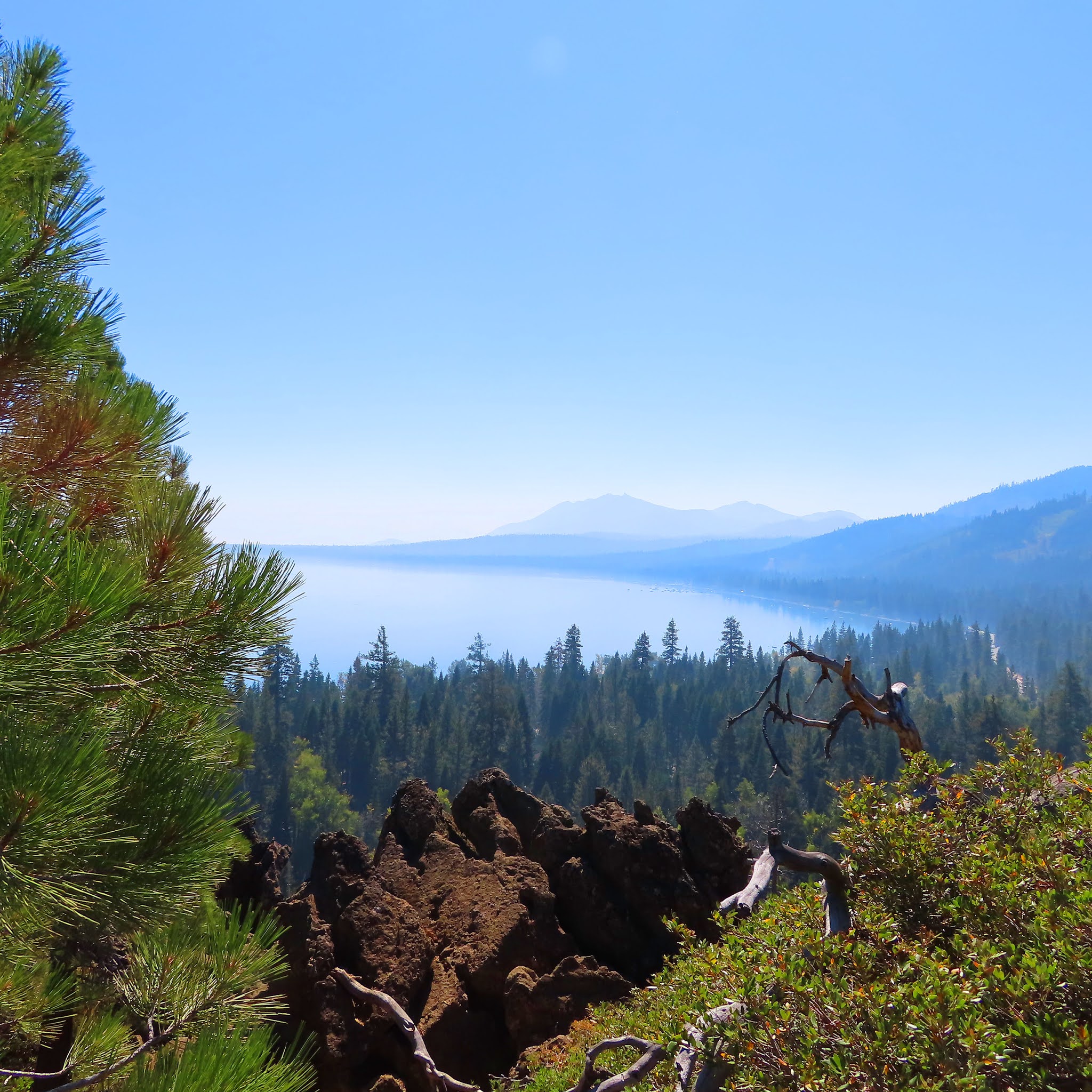
Today Lake Tahoe, the largest alpine lake in North America, sits approximately 6,224 feet above sea level, is 1,645 feet deep, 22 miles long and 12 miles wide, and has some of the clearest, bluest water you'll ever see.
Now I bet you didn't know that Lake Tahoe was actually officially called Lake Bigler until 1945. Well its true! Here is the story.

Close up of the mural on the side of the Tahoe History Museum

John Fremont
Fremont named the lake Bonpland after the French botanist Aime Bonpland. His cartographer, Charles Preuss, however labeled the lake Mountain Lake. In the early 1850s the California legislature officially named it Lake Bigler after John Bigler, California's governor at the time. Bigler turned out to be a Confederate sympathizer which did not sit well with early Tahoe pioneers, who suggested the name Tahoe an Anglicization of the word “da ow” used by the Washoe people.

An 1860s map of "Lake Bigler"
In about a quarter of a mile use the right lane to turn from Highway 50 onto Highway 89 north toward Tahoe City. Our next stop will be Camp Richardson.
Camp Richardson
The earliest records of ownership of the land around Camp Richardson are from 1875 when M. C. Gardner purchased several thousand acres of timber holdings from the U.S. Government and built a sawmill and railroad line there. He paid 25 cents an acre for the land.

“Lucky” Baldwin bought out Gardner in the late 1800s and built a lakefront summer home for his family and the Tallac Hotel for visitors.
Over the years Lucky sold off units of his land to families who built homes on the adjoining properties.
One of those units was purchased in 1924 by Captain Alonzo Richardson. Richardson built cabins and a lakefront pavilion; he added a hotel in 1926, a dining room, and gas station. In 1927 he built the long wharf which is now used as the Richardson Resort pier.

In the early 1950s after Richardson died, the resort was passed to his widow Cora and his daughter and son-in-law Florence and Ray Knisley. By 1967 the operation of the Resort was becoming more difficult and less profitable, and there was great pressure on the family to sell the land for commercial development.
Ray approached the United States Forest Service with the option of taking over the land. There were lots of behind the scenes back and forth negotiations before an agreement was reached. Today the Richardson Marina remains privately owned, and the Camp Richardson Resort is operated under a Special Use Permit from the United States Forest Service.

For decades now multiple generations of families have stayed in the cabins and played on the beach at Camp Richardson, creating lasting memories.
Up ahead on your left you will see an ice cream parlor and coffee house, across the street a General Store and the Captain Richardson Hotel.


Beacon Bar and Grill Camp Richardson

the Pope Boathouse.

Tallac Historic Site

The map below shows a number of trails that can be accessed by the Tallac Historic Site parking lot. If you only have time for one follow the purple line from the parking area to visit the Baldwin, Pope and Heller-Valhalla Mansions of the Tallac Historic Site.


Another trail out of this parking lot is the Rainbow Trail. It is depicted by the red loop near the Taylor Creek Visitor Center. It is especially interesting during the fall spawning season when a walk through the stream profile chamber offers view of kokanee salmon, and rainbow trout.

Visitor Center


Stream Chamber


Desolation Wilderness sign Eagle Lake
The large forest area to your left here is known as Desolation Wilderness. Famous for backcountry hiking, these almost 64,000 acres were set aside by the Forest Service in 1969. Here backpackers are rewarded with sparkling granite basins, azure-blue alpine lakes, sweeping vistas, towering forested peaks and lovely Lake Tahoe views. Day hikers are required to obtain a free day-use permit to hike the wilderness. We will have an opportunity to venture a short distance into Desolation Wilderness when we reach Eagle Falls and Eagle Lake Trailhead.
Up ahead the pine forest will give way to quaking aspen. Sometimes referred to as trembling, because the stem of their leaf, which is flat, causes the leaves to quake or tremble in the slightest of alpine breeze.
Aspen in the summer


Aspen in the fall

Aspen in winter
The aspen is at risk in the Tahoe Basin, often losing out to the more prevalent pine and fir trees for light, nutrients and space. The Aspen Community Restoration Project is restoring at-risk groves so that the aspen will remain part of the Tahoe forest for years to come.
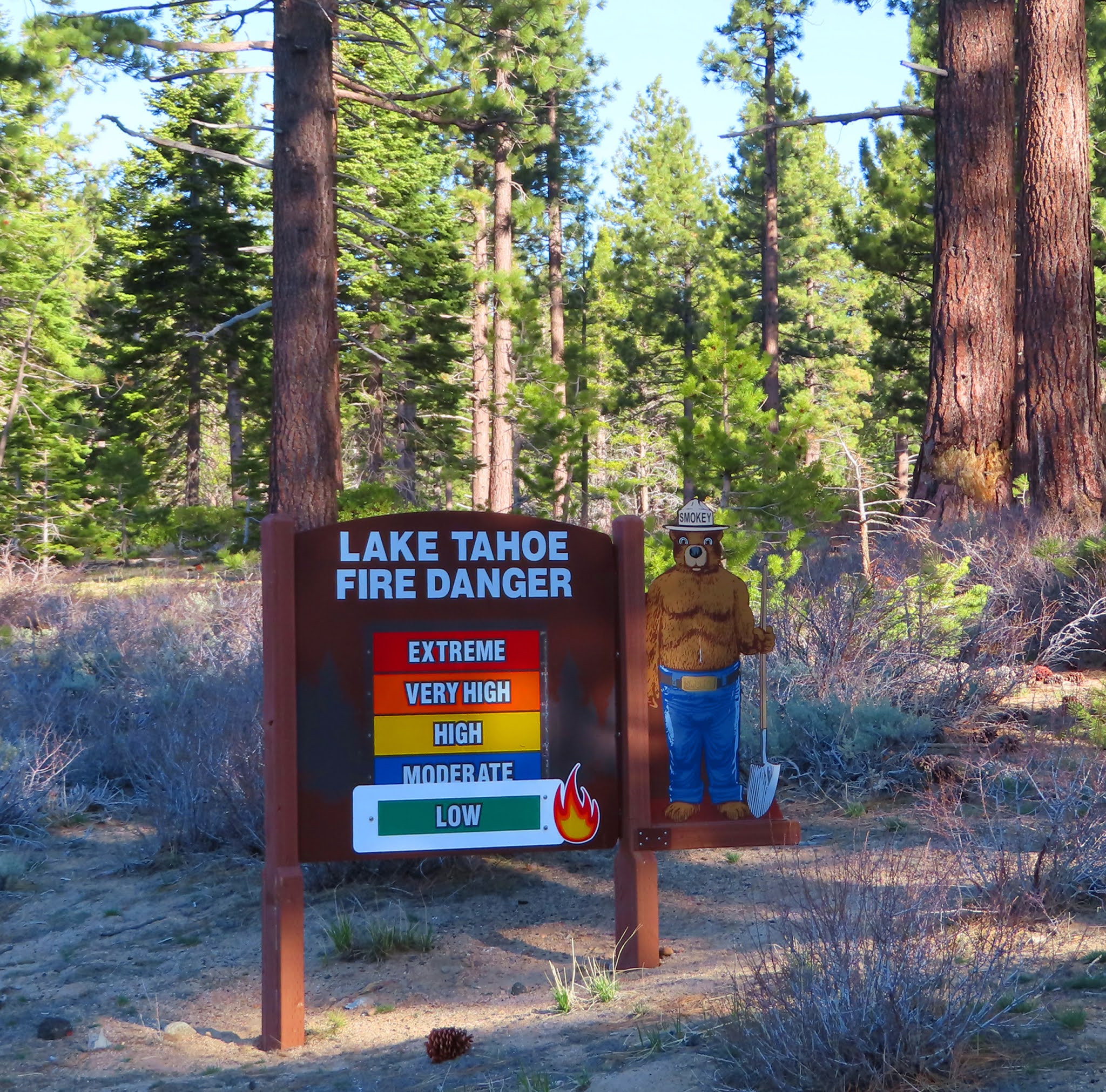
Lake Tahoe Wildfires
As you continue along Highway 89 you will pass from the stunning quaking aspen to a hillside with barren sticks.
 |
| Emerald Fire 2016 |
This was the site of the October 2016 Emerald Fire where 176 acres of forest burned in four days. Though evacuation of 500 residents was necessary, no structures were damaged and no fatalities occurred.
The cause of this fire was a tree snapping in high winds and falling through a power line. By May of the following year volunteers began reforestation efforts, planting native seedlings including Jeffrey Pines and Cedars. It will take more than 100 years for the area to return to what it was before the fire.

Wildfires are a constant threat to the Tahoe Basin. In 2002 a discarded cigarette butt caused the destructive Gondola Fire where over 600 acres burned near Heavenly. The most destructive fire here to date was the Angora Fire in 2007. Caused by an illegal campfire, costing over $11 million dollars to fight this fire destroyed 254 homes in one day in South Lake Tahoe.


Emerald Bay

Fannette Island

Informative Panels

Here is a general note on this hike and the rest of the hikes on this driving tour. If there is any snow or ice on the ground hiking here can be quite hazardous. Only those prepared with the appropriate footwear, clothing and supplies should consider this hike during the winter.
During other times of the year, what makes this 2 mile hike challenging is the altitude. Take your time, go as far as you want, you can always turn around.


From the parking lot head to the interpretive sign and study the trail map. Or take a look at the one I have provided above. Then follow the signs to Eagle Loop, the first 1/4 mile to the bridge is uphill on dirt, stone or wood steps. You can by-pass this and take the path to the left to Eagle Lake.


Eagle Lake trail and the bridge that crosses over
Upper Eagle Falls. We hiked this in October 2020
and the fall were dried up. We can say that this
is much more dramatic in the early summer.


Eagle Lake

In 1860, stagecoach entrepreneur Ben Holiday was the first to construct a home on this land. The property had a few more owners over the years until 1928 when it was purchased by Lora Knight for $250,000.


It was equipped with all the modern conveniences of the time and Ms. Knight enjoyed her home and the surrounding Emerald Bay and Fannette Island every summer until she died in 1945. In 1953 this property became part of the California State Park system.


There is a short ¼ mile trail from the Visitors Center that leads to a viewing area of Lower Eagle Falls, which is quite dramatic in the spring and early summer but by fall it is nothing but a trickle.


Lower Eagle Falls from the base during October 2020
We find the hike down not to be too difficult, but the steep hike back up makes this walk moderately challenging. Keep that in mind before taking this hike.

and Lower Eagle Falls (pictured below).

Lower Eagle Falls March 2021
While you drive to D. L. Bliss I will tell you a bit about Tahoe's National Forest and Duane Leroy Bliss himself.

The Jeffrey is often confused with the Ponderosa Pine which is far less common, has a much less furrowed bark and is quite a bit taller. In fact the Ponderosa Pine (shown below) is the second tallest tree in the Tahoe forest.


The Jeffrey, Ponderosa and Sugar Pines are all conifers or cone-bearing seed plants. It is their cone that most easily differentiates them from one another.
The Sugar pine cones are produced from mid-August to early October and are recognized at a distance by their foot long cone as it hangs down from tree branches shown in the pictures above.

The Jeffrey and Ponderosa cones are more easily distinguished when found underneath the tree. Though the Ponderosa has a bit smaller cone, both average about 6 inches in size. There is another way to determine the difference, the Ponderosa’s prickles stick up making the cone painful to hold. The Jeffrey’s cones have prickles that point inward. A good way to remember the difference is “prickly ponderosa” and “gentle Jeffrey.”

D. L. Bliss State Park was named for Duane Leroy Bliss a 19th century American timber and railroad entrepreneur.
In 1873 Bliss founded one of the largest lumber operations in the Tahoe Area, the Carson and Tahoe Lumber and Fluming Company and supplied the wood necessary to support the Comstock lode mines in Nevada. He eventually grew his business to control every facet of moving the lumber with ships, barges, flumes and a railroad.
By 1881 more than two billion board-feet of timber had been removed from the Lake Tahoe area and the logging era was beginning to dry up. So Bliss converted his ships, barges and railroad into passenger services and focused on bringing tourists from San Francisco to the area.
In 1929 the Bliss family donated some of their land to the State Park system for the D. L. Bliss State Park.

D. L. Bliss State Park is open from May until late October. If the park is open, turn right off the highway onto Lester Beach Road. Pass the Visitor's Center which will be on your right and you will come to a ranger booth. Stop and pay the parking fee or show a receipt from a state park you visited earlier in the day. Also ask for a park map.


There are two trailheads out of the parking lot. They are 60 feet apart and located near the P1 marker on the map above. The pictures below are both taken at the Lighthouse Trailhead. The one on the left point to the Rubicon Trailhead and the one on the right is the Lighthouse Trailhead.


to the lighthouse. Follow the stairs
down to the lighthouse to view this
more closely and then
back up to the trail.


The trailhead for Balancing Rock is off the parking lot to the right of the Galis Dungals, or traditional winter home of the Washoe native people.

Follow the path and in less than 1/8 of a mile the Balancing Rock will come into view. It kind of looks like something out of Star Wars or a smiling fish.


Lake Tahoe's “Gold Coast,” is a coveted area for real estate on the Rubicon Bay. It is marked on its southern border by four discretely marked "Ring Roads". Each of these private roads is marked by a tree ringed with old fire hoses.


The homes that sit at the end of these private roads occupy level lakeside lots each with private docks. No, you may not drive down the private roads, it is against the law. So you will just have to imagine the opulence of the homes that occupy this secluded private area. I only make mention of this because I always wondered what the fire hoses were for so I did a little investigation.
As you drive along this well paved road on your way to Ed Z'berg Sugar Pine Point State Park, you might wonder what it was like to travel this area before the road was built. Even if you don't want to know, I am going to tell you.

Road around Cave Rock on the Eastern Shore

Railroad Truckee Donner
Before a paved road was established around the lake, steamers provided transportation from one side to the other, delivering people, supplies as well as mail. There were many steamers, but the most famous was probably the S. S. Tahoe. At 170 feet long, it was the largest and most elegant ship on the lake. Starting with it inaugural voyage in 1896, the S. S. Tahoe transported passengers for over 40 years.

SS Tahoe docked at Tahoe City c. 1906
As the automobile became more popular in the early 1900s, there was a big push to build a decent road around Lake Tahoe. The first highway completed is the one you are on now, California State Highway 89, which linked South Lake Tahoe to Tahoe City on the west shore in 1913. State Highway 28 was completed in 1915 from Tahoe City to the Nevada Stateline in North Shore. Following the timber industry flume lane, Highway 28 was paved on the Nevada side from Stateline to Glenbrook in 1932. And finally the road around Lake Tahoe was completed with the section of Highway 50 between Glenbrook and South Lake Tahoe in 1931.
Continue along the highway and to your right through the trees is Meek’s Bay. The first to enjoy the beauty of this area were the Washoe native people who used the bay as a summer fishing camp for thousands of years.

The miners were next to populate the area, displacing the Washoe from the Tahoe Basin. Then brothers Stephen and Joseph Meek, pioneer mountain men, settled here for a short time in 1862 and became the namesake for the bay. In the 1920s the Kehlet family built the Meeks Bay Resort here and ran it for almost 50 years.

Today, Meeks Bay Resort, which is coming up on your right soon, is owned by the US Forest Service. They lease it to the original residents of Meeks Bay, the Washoe Tribe, who run the resort from May to October under a Special Use Permit. -- Our next stop is Ed Z'berb Sugar Pine Point State Park.
You might be wondering about the Ed Z’Berg portion of the park name. Well, California State Assemblyman Edwin Z’Berg authorized a bill that created the Tahoe Regional Planning Agency in 1969, which was instrumental in protecting the environment of Lake Tahoe. Thus Z’Berg’s name was added to Sugar Pine Point in 2004 in his honor.
With 2,000 acres of Jeffrey, ponderosa and the park’s namesake sugar pine, Ed Z’BergSugar Pine Point is Lake Tahoe’s largest state park, and the only Tahoe-area park where snow camping is allowed.

Artists rendering of the Phipps Cabin


 |
| Sugar Pine Point State Park Visitor Center |


When you are finished exit the park the same way you arrived and turn right onto Highway 89.
As you drive this area you will notice a designated biking and walking path to your left. There are a number of these on the west side of Lake Tahoe. This one runs from Tahoe City out to Ed 'Zberg Sugar Pine Point Park and is a lovely ride.


On the next portion of our driving tour we will pass through Chambers, Tahoma, and Homewood, three tiny but unique westshore Tahoe communities.
Chambers Landing was founded as Hunter’s Retreat in 1863 by John McKinney. The Chambers Landing Bar was built in 1875, and a main stop for the S S Tahoe steamer. In 1920 the property was purchased by David Chambers who renamed it Chambers Lodge.


If the iron gate to Chamber Landing is open venture in. Park and explore the beach area and historic Chambers Landing Bar. We enjoy dining lakeside. If you are so inclined you might sample their signature Chambers Punch, a frozen combination of 151 rum and tropical juices. Of course you might also want to designate a driver.
Continuing past Chambers you will enter the sparkling west shore area of Tahoma and Homewood. Both communities boast shoreline homes which back onto mountainous escapes.

January 2021
During the 1960 Winter Olympics in Squaw Valley, Tahoma was selected as the site of the cross-country skiing and biathlon. Its name Tahoma is a combination of Tahoe and home.
The district of Homewood was laid out in 1889. Today it is home to the Homewood Mountain Ski Resort which we will pass shortly.

April 2021


In less than a mile a metal fence with red brick pillars will mark the beginning of this property. Eventually you will pass the entrance gate, with the estate name on the stone fence.


In 1979, Fred Sahadi purchased the property and created a luxury development here of 22 homes.

Our next stop is in less than 1/4 mile, the very popular Eagle Rock Trailhead. This 3/4 mile round trip hike to the top of a large dormant volcano rock outcropping offers epic panoramic views of the surrounding mountains, lake and highway below. The view of Eagle Rock shown above is from the highway traveling south on 89 from Tahoe City. This dramatic view of the rock is not seen when driving north on 89 from Sunnyside.
If you are interested in hiking Eagle Rock, slow down to prepare to park on the left after the low stone bridge ahead. There is limited parking for this trailhead on your left.


difficult to discern when you come to the base of the rock wall.

View from top of Eagle Rock looking south


View from top of Eagle Rock looking north
Continue driving straight on Highway 89. As you come around the bend ahead on your right you will have a stunning view of Lake Tahoe framed by the snow capped mountains in the distance.

Hurricane Beach
This is also the location of Hurricane Bay Beach, a public half mile of pebble shore lined with homeowner’s docks. Continue straight, our next optional stop is Sunnyside Restaurant and Lodge in 3 miles.
Coming up on your right in about ½ a mile is the rustic Sunnyside Restaurant & Lodge, a Tahoe landmark since the 1950s.


Sunnyside Dock

With its location right on the west shore of Lake Tahoe, its outdoor lakeside dining is a favorite among locals and visitors alike. It is definitely a place to consider for a meal at some time during your stay in Tahoe.

Ahead on your left is the wooden A-frame Corpus Christi Catholic Church. Built in 1911, it is the second Catholic Church established in Tahoe and the daughter parish to Assumption of the Blessed VIrgin Mary Parish in Truckee established in 1870.
In about one mile we will pass Granlibakken Road. It will be on your left. At the end of this road is Treetop Adventure Park where visitors traverse the forest of pine on zip lines during the summer and ski and sled during the winter as well as the charming Granlibakken Lodge.
The area, originally called Ski Canyon by locals in the early 1920s, became so popular that by 1926 the Southern Pacific Railroad “Snowball Special” was bringing visitors here from Sacramento every winter.
Rusty Rustad leased Ski Canyon in 1947 and renamed it Granlibakken, meaning “hill sheltered by fir trees.”
Enter the roundabout ahead and stay to the right. Exit onto West Lake Blvd. for Tahoe City. Up ahead just after the driveway to Bank of the West turn right into the parking area for Gatekeeper's Museum.

Tahoe City offers a true Tahoe experience, both summer and winter. Along with the stunning lake views you will find museums, parks, specialty shops, coffee houses, and eateries scattered along the cobblestone sidewalk.
If you have time to explore this area, you may use the map above to visit the Gatekeeper's Museum, Fanny Bridge, Tahoe Dam and North Lake Tahoe Visitors Center. The Gatekeeper's Museum which was originally the home of the dam gatekeeper is now a museum run by the North Tahoe Historical Society. There is a charge to visit the museum which is open Wednesday to Sunday from 10 am to 5 pm.

From the museum it is a short walk along the path to the historic Fanny Bridge, Tahoe Dam and the North Lake Tahoe Visitors Center. Along the path you will find a number of informational placards that explain the rich history of the area.
If you are hungry, you will find two great places to grab a bite across the street, the Bridgetender and the Dam Cafe.
Until next time, Happy Adventures!
Lake Tahoe Driving Tour: Incline Village to South Lake Tahoe
Color photo postcard of Harvey's Wagon Wheel c. 1950 (Western Nevada History Photo Collection)
Color photo Harvey's and Harrah's c. 1955 (WNHPC)
Black and white photo Sahara Tahoe 1973 (Harvey's Wagon Wheel Facebook)
Color Harvey's Bombing 1980 (Wikipedia)
Caesars 1980 (Harvey's Wagon Wheel Facebook)
Henry van Sickle (Carson Valley Nevada - The Demise of Bad Man Sam Brown)
Louisa Keyser (Dat So La Lee), Washoe Basket Weaver (Wikipedia)
Washoe Native People c 1866 - Library of Congress
Lake Tahoe News and Picture of first South Lake Tahoe City Council - Tahoe Journal
Black and white photo Hotel Globin's Al Tahoe (WNHTC)
John Fremont Portrait (Wikipedia)
An 1860s map of "Lake Bigler" (Wikipedia)
Black and white picture of Tallac Hotel (WNHPC)
Black and white picture of the inside of the Tallac Hotel (WNHPC)
Ponderosa Pine (Wikipedia)
Pine Cone 101 - Sunnyside Gardens
Road around Cave Rock on the Eastern Shore (Nevada State Park)
SS Tahoe docked at Tahoe City (Wikipedia)
Meeks Bay (Pinterest)
Tour de Tahoe (Facebook)
Godfather II Wedding Party Scene
Comments
Post a Comment