Driving Tour Lake Tahoe: Tahoe City to Incline Village
Interested in being your own tour guide? I have over 20 published GPS audio tours with VoiceMap (Carmel, Monterey, California Gold Country, Folsom, Tahoe, Sacramento) and over 40 tours published with GPSmyCity (Carmel, Monterey, Big Sur, Folsom, Sacramento, Boston, Cinque Terre, Kotor Montenegro, Copenhagen, St. Petersburg, Helsinki, Stockholm, Estonia, Covadonga, Spain, Montserrat, Spain, Manresa, Spain, Loyola, Spain, Santiago de Compostela, Spain, Fatima, Portugal, San Sebastian Garabandal, Spain, Lourdes, France, Santarem, Portugal). Happy Adventures!

If you are interested in this driving tour as an audio tour, the companion audio tour is available on VoiceMap and listed under Lake Tahoe. To use VoiceMap, you will need to download the VoiceMap app from the Apple Store or Google Play. The app is free. There is a cost for this audio driving tour, which is one of three that takes you entirely around Lake Tahoe. Happy Adventures and enjoy the tour!
+++

Our tour, which is a companion tour to my South Lake Tahoe to Tahoe City Driving Tour, begins in the parking lot of the Gatekeepers Museum located in William Layton Park at 130 W Lake Blvd., in Tahoe City.
On this 20 mile tour we will drive north along Highway 28 through some of the charming northern towns along Lake Tahoe. You will have the option of visiting museums, do some hiking, have lunch by the lake or do some shopping.
Before we take our first walking tour of Tahoe City, let me give you a bit of background on the area.

The Washoe Native people were the first to have hunted, gathered and fished along the shores of Lake Tahoe. Though they are thought to have been here much longer, archaeologists can trace their presence back about two thousand years.

The first business industry to arrive near Tahoe City was a wild hay harvesting business in 1862. This was located on the land which became the Tahoe City Golf Course on the northwest side of town. At this time this fledgling community creeped along with little more than a few rough framed homes until Duane L. Bliss formed the Carson and Tahoe Lumber and Fluming Company in 1872 to supply lumber from Lake Tahoe to the silver mines in Nevada. For the next 26 years this company cut 750 million board feet of logged lumber from the forests around Lake Tahoe.

Tahoe Tavern Rail Pier
By the mid-1890’s the fortunes coming out of the Virginia mines began to vanish and Bliss’ vast stands of timber did as well. In 1901, Bliss built the first resort in Tahoe City, the Tahoe Tavern. His narrow-gauge railroad which formerly transported timber, brought visitors from Truckee to his hotel, thus turning Tahoe City into a popular vacation stop for wealthy San Francisco socialites.
For a time Tahoe City was a summer playground. But that would change in the early 1920s when locals discovered an area just south of the Tahoe Tavern that was perfect for skiing. In 1926 the Southern Pacific Railroad “Snowball Special” was bringing visitors from Sacramento into Tahoe City which had now become a year-round resort town.

Today Tahoe City is a vibrant and prosperous place to live, work and play. With an average of 2,000 residents the population can swell to over 25,000 during big events, such as the Annual 4th of July Celebration or the winter Snowfest.
Tahoe City offers a true Tahoe experience. Along with the stunning lake views you will find museums, parks, specialty shops, coffee houses, and eateries scattered along the cobblestone sidewalk.


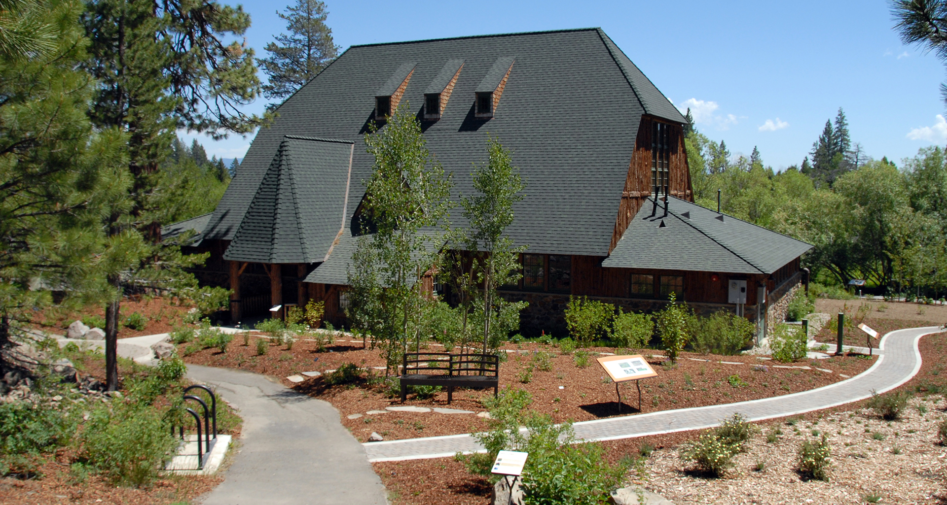
From here head over to the North Lake Tahoe Visitor Center where you will find a selection of books, magazines and Tahoe nick-nacks as well as a public restroom.


From the Visitors Center walk back toward the parking area, via the historic Fanny Bridge. According to Tahoe folklore, David Stollery, Jr., the road crew foreman in 1928 gave the bridge the name "Fanny McGillicuddy Wilkerson" in honor of his aunt. The name was shortened over the years to Fanny Bridge. However it may have received its name from more obvious circumstances. Built across the Truckee River at the lake's edge, Rainbow trout gather to feed at the outlet. This attracts rows of people who line up along the rail and bend over the side for a better look at the trout. The row of fannies visible may also have something to do with the name. Anyway, make sure you lean over the bridge to have a look at the trout in the water below.


Alright it is time to get driving. Exit the Gatekeepers Parking lot and turn right, cross Fanny Bridge and veer to your right to turn right onto West Lake Blvd. We are on our way to Commons Beach for a scenic walk along the lake.


In one mile, on your right, you will pass the Fish Hatchery. This was constructed in 1920 by the California Fish and Game to hatch Cutthroat Trout, and Kokanee Salmon. However the cold waters of the lake caused the fish to grow too slowly to meet the demand and operations were discontinued in 1956.
Between 1925 and 1928, author John Steinbeck lived and worked off and on in Lake Tahoe. During the summer of 1928, after completing his first novel, Cup of Gold, Steinbeck met his first wife Carol Henning while he was working as a tour guide at the fish hatchery.
It was a whirlwind courtship and by September of that year they were engaged and moved together to San Francisco.


The highway heads inland a bit as we enter the Dollar Point area. Originally this was part of Chinquapin, a name given to the area by the Washoe native peoples. Chinquapin is a scrub tree with edible nuts that grew plentifully in the region.

Chinquapin
Whatever the origin the name became Promontory Point in the mid 1870s after it was considered for the site of San Francisco philanthropist James Lick’s observatory. Ultimately the observatory would be built in the Santa Clara Valley on Mount Hamilton but Old Lousy was replaced by the more pleasant name, Observatory Point.

In 1884 D. L. Bliss who was logging on the east shore near Glenbrook timbered 337 acres of Observatory Point. After logging in the area ended Bliss took over title to the land.
In 1916 Mrs. Laura Knight purchased the area and built a cluster of cabins around a main structure she named Wynchwood. Ms. Knight sold the property to San Francisco shipping magnate Stanley Dollar, for which the area now takes its name.

Ms. Knight then purchased the land near Emerald Bay and built Vikingsholm Castle. We visit Vikingsholm on our South Lake Tahoe driving tour.

The road curves back along the water as we pass Chinquapin a gated condominium complex.
The private cove along the shoreline at Chinquapin is the location of Ms. Knight’s historic Wynchwood Estate that I spoke about earlier. Parts of this estate may be rented for weddings and other gatherings.


View from Cabins
The next community, Cedar Flats rolls upward along the mountainside with many lakeview homes. Some of the properties even back onto a hiking and cross country skiing area and many have private docks lakeside.


Carnelian Bay was a popular spot for boat racing and recreational boating in the 1930s and 1940s. In the 1990s it became the home to the most acclaimed and prestigious wooden boat show in all of North America, the Concours d’Elegance Wooden Boat Show. In 2014 this event was moved south to Homewood on the Westshore.


Next to Gar Woods is Carnelian West Beach a dog friendly public beach with free parking and restrooms.

As you continue your drive, on your left after the beach is popular Carnelian Bay restaurant, the gray wooden Old Post Office Cafe. Open for breakfast and lunch this is famous for, well at one time being a post office. If you have time for lunch either Gar Woods or the Old Post Office Cafe would be a good choice.

This section of our Lake Tahoe driving tour will end midway up Mount Rose in Incline Village with a spectacular view back over Lake Tahoe.
Continue straight along the highway and enjoy the charming old Tahoe cabins intermingled with more modern architecture.

At this park during the summer you will find a children's playground, dog park, hiking and biking trails as well as Treetop Adventures where you may be challenged by a variety of bridges and ziplines. During the winter this turns into a cross country skiing, snowshoeing, and sledding area.

Sledding at North Tahoe Regional Park


After exploring North Tahoe Regional Park, return to Highway 28 the way you came and turn left back onto Highway 28.
Our next stop is Kings Beach in about one mile which sits on beautiful Agate Bay. Kings Beach is a small but charming north Lake Tahoe town. Local lore has it that the name originated from a card shark named Joe King who won the town in a poker match.


Kings Beach is a large sandy public beach with picnic tables under stately Jeffrey pine trees. There is also a public restroom and a playground.


Early travel in the Lake Tahoe basin was along Washoe Native American trails. In the 1840s these trails were used by the first immigrants to the area. These first roads were little more than improved trails.

John Calhoun Johnson

Steamer Tahoe - Library of Congress

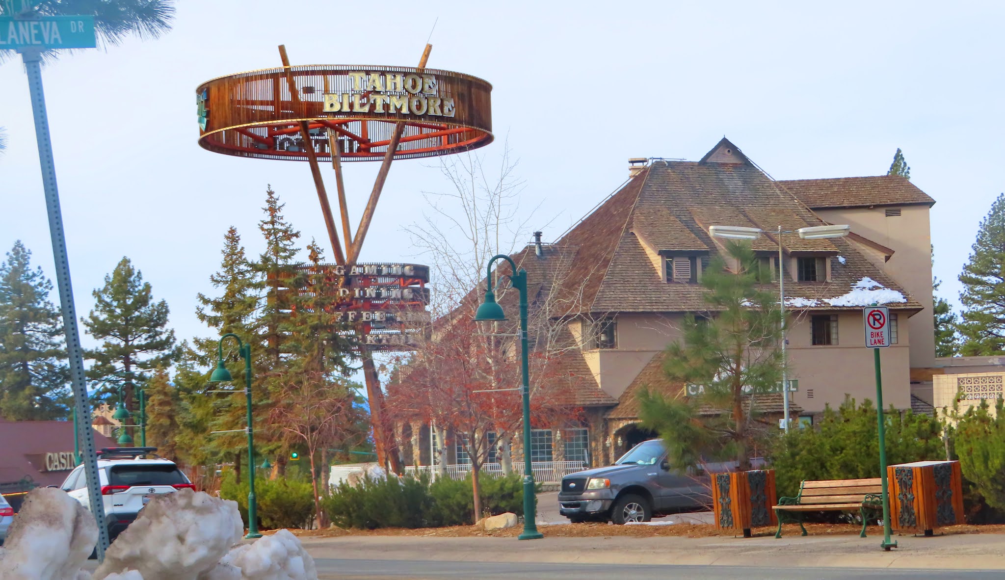
Up ahead off to the right you should see the sign for the historic Cal Neva Resort & Casino. Slow down and veer to the right off the highway down the road toward the sign. We are on our way to Summertide, which at one time was owned by Howard Hughes.

Howard Hughes (1938)


Frank Sinatra

North Lake Tahoe Fire Station #12
Continue along Cala Neva Road past the fire station and watch for the Summertide sign on your right. It will be over a wooden gate.

Gate at Summertide

While some have written that Hughes threw lavish parties there and rubbed elbows with Hollywood royalty, notorious gangsters and titans of industry, other say that it is quite possible Hughes never set foot on his property. Whatever the truth is, we do know that the Howard Hughes Company sold the property in 1995 for $3.5 million dollars. These owners, who made very few changes to the property over the years sold their incredible estate with over 500 feet of lake frontage and 180 degrees of waterfront views in 2018 for $17.5 million.
Alright let’s get going. Continue along CalaNeva back to Highway 28. Our next stop is for an optional 1 ¾ mile round trip hike to the Stateline Fire Lookout trail.
In less than 1/8th of a mile turn left onto Reservoir Road, then a right onto Lakeview Avenue as we make our way to the Stateline Fire Lookout Trailhead.

Up ahead you will see a sign for a "y" in the road. Stay to the left on Lakeview Avenue. Shortly you will come to another "y". To the left will be a gate for the trailhead for Stateline Fire Lookout. Do not park in front of the gate. There are a few parking spaces on the right side of Lakeview Avenue. Park here off the road for the Stateline Fire Lookout Trail.

This 1 ¾ round trip hike follows a paved road to the top of Stateline Peak to the site of an old fire lookout. It is a stiff uphill climb to the lookout. There is a map below of the hike.


Once you have explored Stateline Peak follow Lakeview back the way you came. Turn left on Reservoir Road and left back onto Highway 28.
This portion of your drive is along Crystal Bay, a small north shore community that sits upon a granite boulder strewn point and straddles the California Nevada stateline. Lake Tahoe, here at Crystal Bay measures the deepest at 1645 feet.

We are now on the outskirts of Incline Village, established in 1882, this north Tahoe town has deep ties with the lumber and logging industry.


George Whittell Jr.
One of the larger parcels was sold to Crystal Bay Development Company in 1959. This development company was largely responsible for the development of Incline Village as it stands today. By 1968 over three thousand homes had been built in the village.
Continue straight on Highway 28, we are on our way to our last stop. Up ahead watch for the round-about.


Mark Twain age 31 (1866)
But with no job, Clemens decided to set out with an acquaintance and find this marvelous beauty of a lake that the everyone was talking about. They set out on foot from Carson City and here is how he describes it in his book Roughing It:
"We toiled laboriously up a mountain about a thousand miles high and looked over. No lake there. We toiled up another mountain three or four thousand feet high and looked again. No lake yet. We plodded on, two or three hours longer, and at last the lake burst upon us– a noble sheet of blue water lifted six thousand three hundred feet above the level of the sea, and walled in by a rim of snow-clad mountain peaks that towered aloft [a] full three thousand feet higher still! As it lay there with the shadows of the mountains brilliantly photographed upon its still surface, I thought it must surely be the fairest picture the whole earth affords.”
Samuel Clemens would go on to spend three years working and writing in the Tahoe area. In 1863 while working for the Virginia City Territorial Enterprise he first signed one of his articles with what would become his pen name, Mark Twain.
Continue straight we are coming to our last stop and the end of this driving tour from Tahoe City to Incline Village, the Lake Tahoe Scenic Overlook.
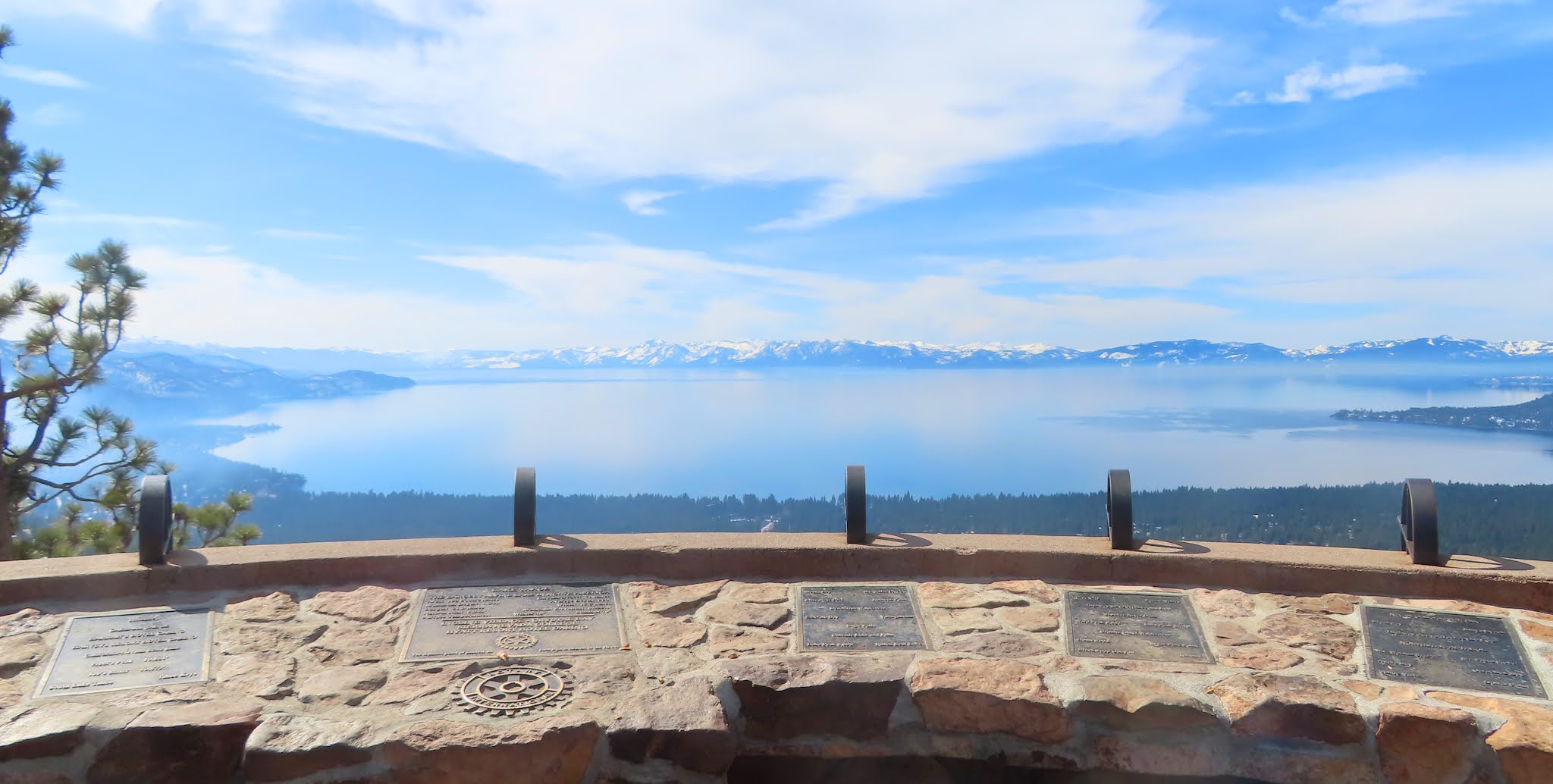


Now this is where I am leaving you. I hope that you have enjoyed your driving tour from Tahoe City to Incline Village and all of the stops in-between.
I have two other companion tours to this one, South Lake Tahoe to Tahoe City, and Incline Village to South Lake Tahoe. Until next time, Happy Adventures!
D. L. Bliss and Elizabeth Bliss - Find a Grave
Tahoe Tavern - University of Nevada collection by C O Valentine
Tahoe Fish Hatchery - Photo by Siegel & Strain
John Steinbeck - Photo Wikipedia
Chinquapin - Photo Wikipedia
Pictures of North Tahoe Regional Park - Website
Pictures of TreeTop Adventures - Website
John Calhoun Johnson - Find a Grave
Steamer Tahoe - Library of Congress
Howard Hughes 1938 - Wikipedia
Cal Neva 1962 and Frank Sinatra - Wikipedia
Summertide - Reno Gazette Journal
The Saw Mill - Library of Congress
George Whittell Jr. - Onlinenevada.org
Mark Twain age 31 (1866) - Wikipedia
Comments
Post a Comment