Driving Tour of Pacific Grove to Asilomar, California
Interested in being your own tour guide? I have over 20 published GPS audio tours with VoiceMap (Carmel, Monterey, California Gold Country, Folsom, Tahoe, Sacramento) and over 40 tours published with GPSmyCity (Carmel, Monterey, Big Sur, Folsom, Sacramento, Boston, Cinque Terre, Kotor Montenegro, Copenhagen, St. Petersburg, Helsinki, Stockholm, Estonia, Covadonga, Spain, Montserrat, Spain, Manresa, Spain, Loyola, Spain, Santiago de Compostela, Spain, Fatima, Portugal, San Sebastian Garabandal, Spain, Lourdes, France, Santarem, Portugal). Happy Adventures!

We start our tour in the parking lot of the CVS parking lot at 686 Lighthouse Avenue in Monterey. Park here for a moment while I tell you about this tour.

CVS Pharmacy 686 Lighthouse Avenue, Monterey
On this tour we will explore Pacific Grove, New Monterey, and Asilomar. Along the way you will view some of the homes of John Steinbeck and Ed Ricketts and learn about their connection to Pacific Grove and Monterey. As we zigzag through the lives of John and Ed and through the streets of Pacific Grove, you will also have the opportunity to visit the Pacific Grove Museum of Natural History, Chautauqua Hall, Monarch Habitat Sanctuary, Lovers Point, Point Pinos Lighthouse, and Asilomar Conference Grounds.
Along the way I will explain the history of the area, interject some stories about some of the people who lived here and point out interesting places to explore. But as always, this is your adventure, so make the most of it!

Before we set off, let me tell you about the Sardine Factory. We will be passing it early on our driving tour.

The Sardine Factory - founded by Bert Cutino, left, and Ted Balestreri, right, pictured in the restaurant’s conservatory - celebrating its 50th birthday October 2018 (Monterey County Weekly, photo by Nic Coury)
In 1968 restaurant managers Ted Balestrei and Bert Cutino saw great potential in this, at the time, run-down industrial area on the other-side-of-the-tracks and opened their restaurant The Sardine Factory.

Play Misty for Me (From Reel to Real Movie and TV Filming Locations)
Other's saw potential in this area as well. In 1971, actor Clint Eastwood chose the bar at the Sardine Factory for several scenes from his movie Play Misty for Me, and for over 50 years, celebrities from all over the world have frequented its dining room.
In 1976, after operating the Sardine Factory for a few years, Ted and Bert partnered with Harry Davidian and George Zarounian to form the Foursome Development Company. This eventually became the Cannery Row Company which was the driving force behind the purchase of the crumbled remains of the abandoned canneries that lined the streets of Cannery Row in the 1970s.

Westgate-Sun Harbor Canning Company warehouse burns 1951
( Monterey Fire Department)

InterContinental Hotel Monterey
Alright it is time to get going, exit the parking lot and turn right onto Prescott Avenue. Continue through the first traffic light. On your left you will pass the Sardine Factory. It will be the building with the Monterey clipper boat out in front.
Continue two more blocks to the stop sign at Cannery Row. At this stop sign if you look straight ahead you will see a bronze bust of John Steinbeck.

John was born in 1902 in Salinas, California. With much of his 33 literary works set in central California, he is a beloved local author. The plaque on the bust is a portion of the opening paragraph from his 1945 novel Cannery Row.
It reads: “Cannery Row in Monterey in California is a poem, a stink, a grating noise, a quality of light, a tone, a habit, a nostalgia, a dream. Cannery Row is the gathered and scattered, tin and iron and rust and splintered wood, chipped pavement and weedy lots and junk heaps, sardine canneries of corrugated iron, honky tonks, restaurants and whore houses, and little crowded groceries, and laboratories and flophouses.”
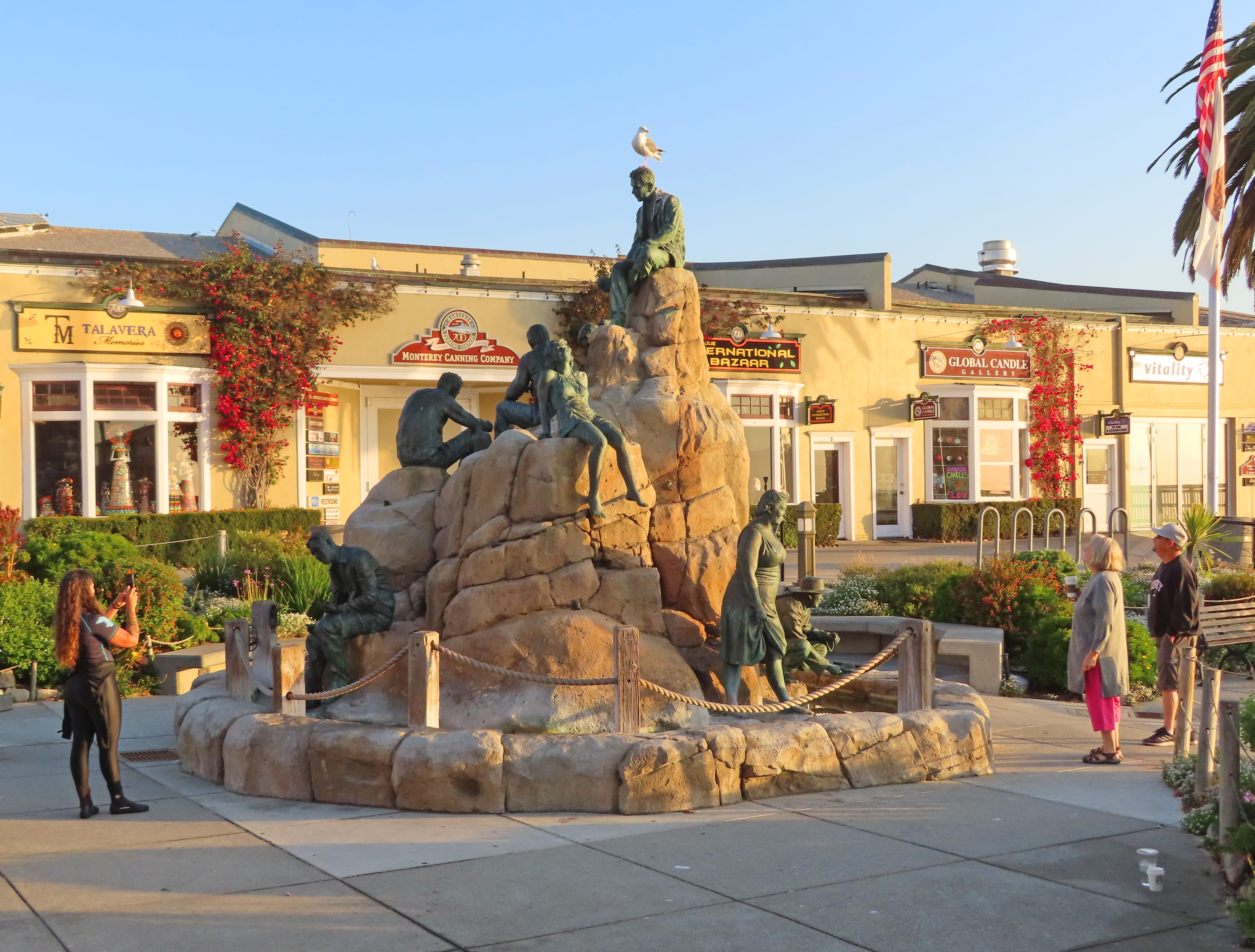
Behind John's bronze bust you will be able to see the Cannery Row Monument. This large work which features the main characters of John Steinbeck's novel Cannery Row, Ed 'Doc' Ricketts and Madam Flora Woods, is the work of figurative sculpture artist Steven Whyte (his studio is actually in the Carmel Barnyard not Carmel-by-the-Sea as his website states).

If you are interested in an in-depth history and tour of John Steinbeck's Cannery Row check out my blog post here. I also have an entire VoiceMap audio driving tour devoted to this subject. You may find that here.


Continue straight and pass under two elevated crossovers. These crossovers connect the coast to the land side of Cannery Row.
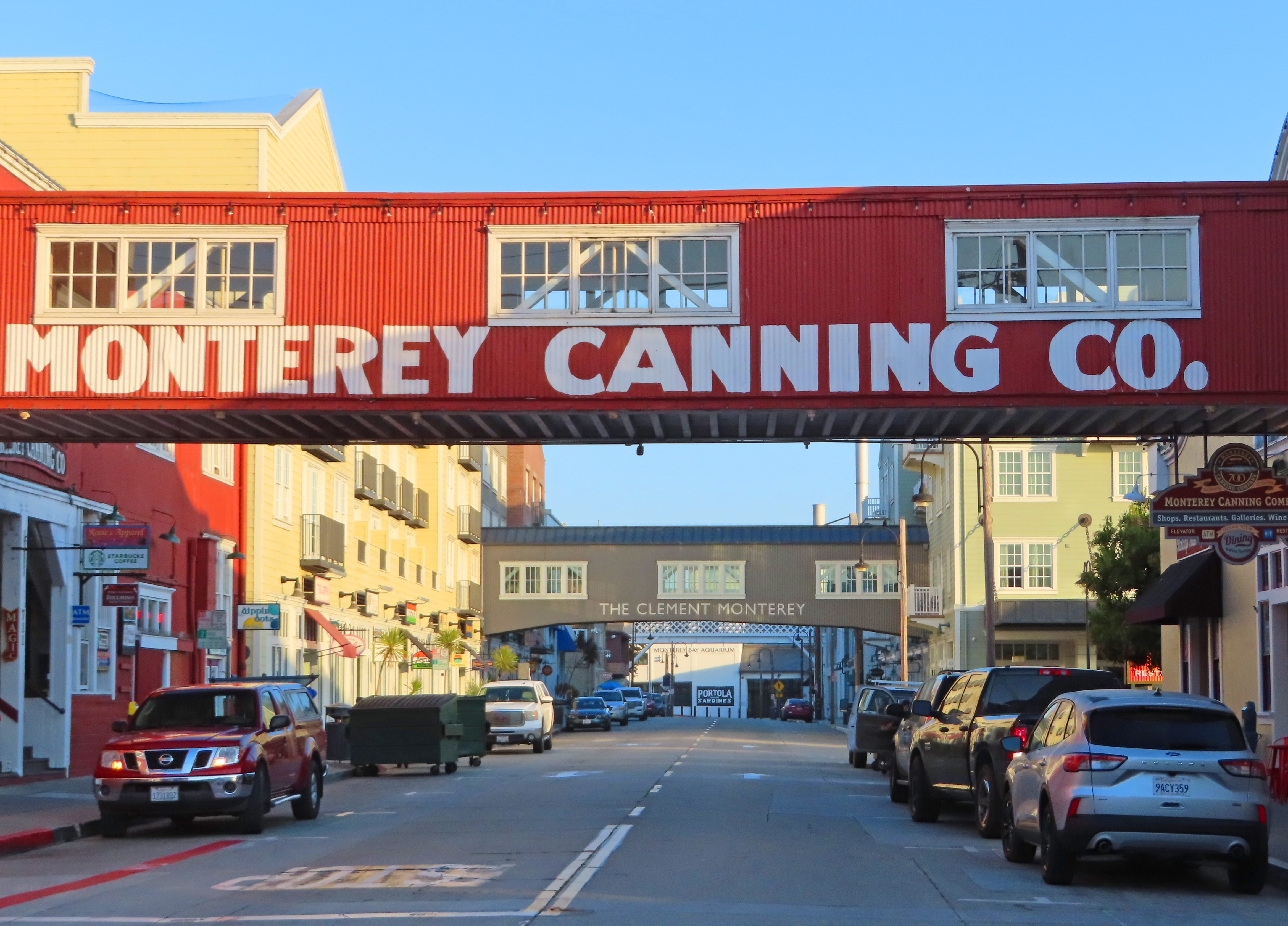
They date back to the district's sardine-canning days when conveyor belts transported round metal cans filled with fish, boxed and labeled for distribution, to railroad cars.


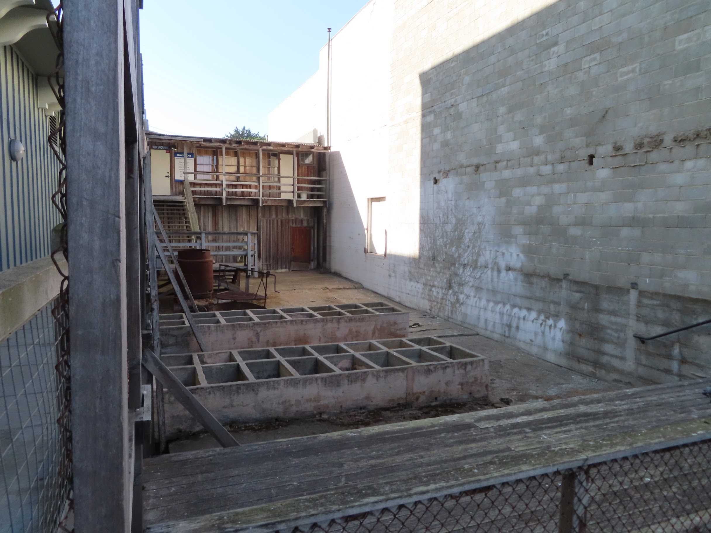
After you pass the Intercontinental Hotel and under the second elevated crossover, look to your right. Here you will see a ramshackle wooden one-story cabin. It looks kind of out of place as it sits wedged between two former sardine canneries.

This was the location of Ed Ricketts Pacific Biological Laboratories. John Steinbeck would fictionalize Ed as Doc and his Pacific Biological Laboratories as the Western Biological Laboratories in his novel Cannery Row.
Ed was born in Chicago in 1897. After serving in the Army Medical Corp in 1917, he studied zoology at the University of Chicago, but dropped out before earning his degree.

Ed Ricketts in his laboratory
(California History Room Monterey Public Library)

Ed Ricketts with Squid Specimen
(California History Room Monterey Public Library)
Originally located in Pacific Grove, the lab was moved to this location on
Cannery Row in 1930 when Ricketts became the sole owner.
As a result of his marital problems with Nan, Pacific Biological Laboratories also became his home. We will be driving by the location of Ed's original laboratory later on this tour.

John Steinbeck (1939 Wikipedia)
Ed Ricketts is known for his work called Between Pacific Tides. This study of
intertidal ecology, is considered to be the most complete intertidal record of the
west coast of North America, and still a seminal marine biology text today.
Chasing the low tide at night Ed would leave the lab in his old
Packard, head to the coast and load his car with all kinds of animals and
marine life. Back in his yard, he used concrete containers to separate
and store the larger animals like sharks, rays and octopus.

Ed employed the residents of Cannery Row to find various specimens that he needed to fill orders, paying five cents each for frogs. He also bought butterflies, crayfish and cats.
Looking at the historic pictures of Ed's Biological Laboratories above, the downstairs housed Ricketts lab and garage. The upstairs was where he lived for 18 years.
Since the mid 1950’s this building has served as a meeting place for a men's
group. The group purchased the building in 1956 and, in 1994, it was added to
the National Register of Historic places.
The structure is now owned by the city of Monterey and can be visited four times a year when the nonprofit Cannery Row Foundation leads public tours. I highly recommend going on one of these tours. But if you are unable to find the time, the video below was made during the COVID-19 pandemic, when the laboratory was closed for tours.
Across the street from Ed's laboratory was originally a vacant lot. Today you will find a historic reproduction of a series of typical shack homes that would have been used by cannery workers.

During the heyday of the canneries, this vacant lot was where cannery workers would hangout, smoke cigarettes and converse with their countrymen while waiting for their cannery whistle to call them to work.

Each cannery had a distinct whistle and every worker knew their unique call.
AAAA.jpg)
(Fred Harbick photograph, Colton Hall Museum, City of Monterey)

Wearing rubber boots and standing in cold water, the men and women who worked in the canneries along the row made 25 cents an hour in 1936.
.jpg)
(Photo by George Robinson, California History Room, Monterey Public Library)
The work was smelly and dirty, but it was work. Usually the men operated and maintained the machinery while the women worked on the packing lines, filling Cannery Row’s trademark one-pound oval cans with sardines or salmon.

Though the canneries prospered through WWII, the peak season from that era was from 1941 to 1942. That season, canneries packed over 250,000 tons of fish. After 1945, the industry’s capacity to harvest was outdistanced by the sardine’s ability to reproduce. Workers were laid off and canneries began to close. When Ed Ricketts was asked in 1947 where all the sardines had gone, he replied, “there’re in cans.”

Just past Ed's Lab is a grey cement building. This is the beginning of the structure that houses the Monterey Bay Aquarium.

This building was originally the location of the Sea Pride Packing Corporation, a company which was entirely owned and operated by Japanese-Americans. Some of its top products were abalone, filleted and kippered sardines as well as tuna and mackerel. In 1926 and 1930, the facility was severely damaged by fire.


Turn left in front of the Aquarium and continue on David Street. Continue through the next three traffic signals and at the stop sign turn right onto Pine Street.
Pine becomes Spruce Avenue. Stay to the right and at the stop turn right onto Eardley Avenue.

(421 Eardley in 2017)


Continue straight four blocks then turn left onto Laurel Avenue. In three blocks watch for the First Baptist Church, located at 246 Laurel Avenue. It will be on your right.
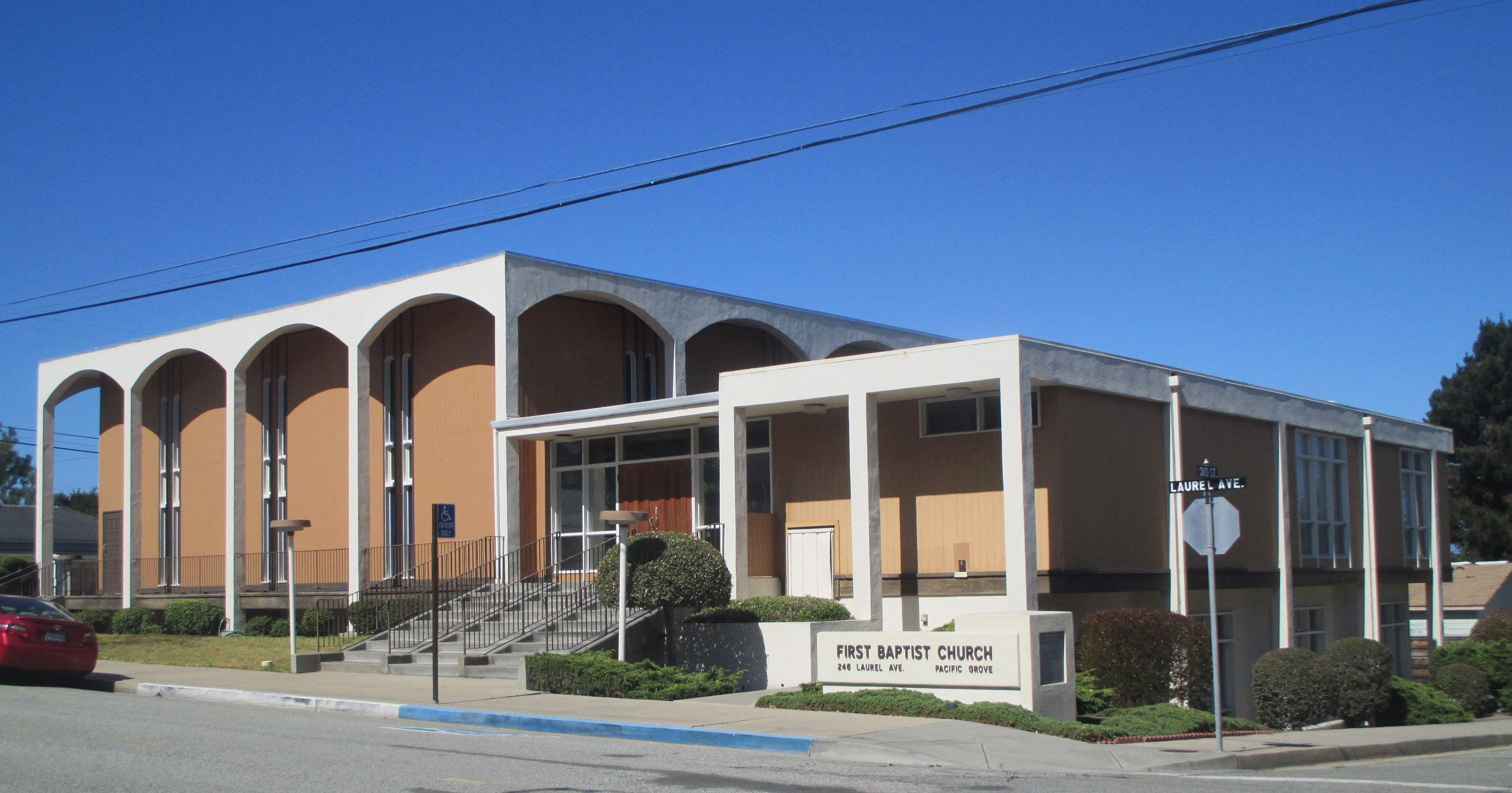
The First Baptist Church of Pacific Grove was built in 1909 and the Monterey Peninsula Branch of the NAACP was founded here in 1932 by Reverend Wellington Smith Sr. the churches pastor.
Continue straight on Laurel for two blocks. Then look to your right on the corner of 6th Street for the two-story Queen Anne Victorian.

Located at 230 6th Street this was built in 1893 for Dr. Oliver Smith Trimmer, a surgeon and also the first mayor of Pacific Grove. It is a perfect example of Stick - Eastlake detailing with turret towers and arched entryway.


Dr. Trimmer moved to Pacific Grove in 1888 from Salinas where he had a very successful medical practice. He had intended to retire, but instead purchased the Heintz Drug Store in Pacific Grove. Reputed to be a clandestine whisky saloon, this store was operated by Dr. Trimmer's nieces' husband, Charles K. Tuttle for decades.

Tuttle Drug Store 1901 (500 block of Lighthouse -
Photo by C. K. Tuttle - Pacific Grove Museum of Natural History)
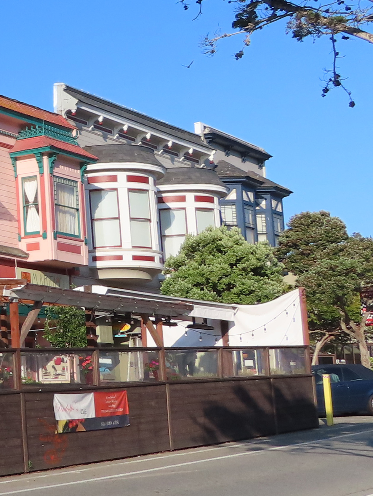
Marita's Boutique (551 Lighthouse, Pacific Grove)
Continue straight and turn right onto 8th Street, and continue to the end of the block.

At the end of 8th, look to your right at the white two-story wooden house. The address of this house is 331 Lighthouse Avenue. This home was built in 1910. In 1926 it became Ed Ricketts family's second home in Pacific Grove.

331 Lighthouse Avenue (cross street 8th)
They would reside at this location until 1930. Nan gave birth to Cornelia their third child when the Ricketts lived here, and it was a short walk to Ed's first lab on Fountain Street. At least for a short time. The city would demolish the building containing Ed's lab on Fountain Street later in 1926 forcing him to move his business to the wooden structure on Cannery Row that we viewed earlier on this tour.

Midway down the block look for one-story cottage where the chimney cuts through the center two windows. It will be on your left.

This is 219 4th Street. At one time the home of Joseph Campbell, author and expert in mythology. Campbell was born in New York in 1904, he received his Bachelors in English literature from Columbia University in 1925 and his Masters in medieval literature in 1927.
In 1932 Campbell was introduced to John and Carol Steinbeck, poet Robin Jeffers, as well as Ed Rickett's. Campbell's house was next door to Ed Rickett's third residence in Pacific Grove.
Campbell's time living next to Ricketts was a pivotal period in his life: "It was Ed who was especially important to me...and from our long talks about biology, I eventually came up with one of my basic viewpoints: that myth is a function of biology; a manifestation of the human imagination stirred by the energies of the organs of the body operating against one another. In other words, myth is as fundamental to us as our capacity to speak and think and dream." (1)
%20(1).png)
In 1934, Campbell moved to New York where he taught Literature at Sarah Lawrence College. He is best known for his work, The Hero with a Thousand Faces (1949). His philosophy has been summarized by the phrase: "Follow your bliss," and his work is credited with influencing George Lucas's Star Wars saga.


Turn left back onto Laurel, pass the First Baptist Church again and continue straight four blocks. At the stop sign turn left back onto Eardley.

Back of First Baptist Church
Continue through the stop sign to the yield sign. Then turn left onto Lighthouse Avenue. In two blocks, turn right onto 2nd Street.

At the "t" turn left onto Evans Avenue. Stay to the right and at the stop sign turn right onto Central.
On your right on the corner at 225 Central, is a three-story Italianate-style Victorian.

This home was built in 1884 for State Senator Benjamin F. Langford. Back in the 1880s Pacific Grove was surrounded by a fence. There was one gate and it was locked early in the evening. Langford was well known for arriving at the gate after it was locked and taking an axe to the lock so that he could get to his home.

You might be wondering why there was a fence around Pacific Grove at one time. Well that is an interesting story.
The history of the town of Pacific Grove begins in 1874 when Reverend J. W. Ross a Methodist minister visited the area and decided it would be a perfect place for a west coast Methodist Retreat. This retreat was patterned after the New York Chautauqua Assembly Center organized by Methodist minister John Heyl Vincent and businessman Lewis Miller on the shores of Chautauqua Lake in New York.
In 1875 David Jacks and the Pacific Improvement Company provided the land for the Pacific Grove Methodist Retreat. Initially, it was the founders intention that this would be an encampment of tents, not houses. And that they would only be up for a few weeks during the summer than taken down and stored in Chautauqua Hall. But just a year later, the area proved so popular that lots were sold for $50, 1/2 down and the balance due within one year.


Portion of the Pacific Grove Mural along the Coastal Trail
In 1883 Pacific Grove Methodist Retreat published its rules and regulations. The following were prohibited within the fenced environment of the retreat area: intoxicating beverages, gambling, dancing, profanity, fast buggy riding, bathing at the beach without costume, dirty outhouses, firearms, and smoking in or near buildings.

A curfew was passed in 1885 making it unlawful for those under 18 years old to be out after 8pm in the winter and 9pm in the summer. To help attendees adhere to the rules, a fence was erected around the entire retreat area.
By 1889 Pacific Grove already had 1300 permanent residents. It was incorporated as a city and the majority of the tent houses had been lined on the outside with a single wall of redwood.
Though the curfew bell sounded nightly until 1912, it was largely ignored after the first few years. The fence, or at least portions of it, remained until the 1930s.

222 Central Avenue
Alright, lets continue with the driving tour. From Central Avenue, make an immediate left on to 2nd Street. The house to your left on the corner at 222 Central Avenue was originally built in 1907. From 1915 to 1918, this was the home of John Steinbeck's maternal grandmother, Elizabeth Hamilton.

Lena Dinsmore House from 2nd Street
Continue straight to the end of 2nd. The last home on your right (The address is actually 104 1st Street) is a brown-shingled structure, officially known as the Lena Dinsmore House.


From 1st Street
This was designed by Julia Morgan in 1914 and construction was completed in 1916. It is the only home in Pacific Grove designed by Morgan. She took on this job while working on her award winning project at the nearby Asilomar Conference Grounds, where we end our driving tour.
.jpg)
Morgan was one of the United States' first female architects, she was most known for Hearst Castle in San Simeon. Morgan designed over 700 structures, many of which were homes and churches and most were in the Bay Area.
After the stop sign, carefully cross through 1st Street and at the stop turn left onto Ocean View Blvd. Follow the sign that reads Scenic Drive and points left.

Martine Inn
Just past 3rd Street watch for the three-story Martine Inn. Don Martine purchased this rundown property in 1972. After conducting a total renovation he furnished the property with authentic period antiques from the 1800s to 1920s.

This bed and breakfast overlooks the Monterey Bay. Many of the rooms have wood-burning fireplaces and ocean views.

On the next corner look for the Green Gables Inn, which was built in 1888 for William Lacy in the Stick-Eastlake Victorian style it was originally named Ivy Terrace Hall for the large amounts of ivy that trailed from the side of the home down to the waters edge. It was one of the first estates to be built along the oceanfront. At the time it was built there was no road separating the home from the sea.

Today this meticulously restored Victorian is a member of the Four Sisters Inns, one of a collection of independent small hotels. It offers guests a romantic get-away with its unparalleled location adjacent to the Monterey Bay Coastal Recreational Trail, and panoramic ocean views of Monterey Bay.
Everett Pomeroy House 2018

New Paint 2022
Continue to the end of this block. To your left will be 312 Central Avenue. It was built in 1883 for Margaret Tennant. Margaret owned a number of the homes along 7th Street below Central.

312 Central Avenue (built 1883)
As a memorial to her brother, John Tennant, Margaret built a retirement home for Methodists & Episcopalian Ministers in 1899. This building stood on Forest Avenue and Sinex, it was demolished in 1964. Today you will find another retirement home at this location, Canterbury Woods . Margaret was also instrumental in the construction of St. Mary's by-the-Sea church. We will pass St. Mary's a bit later.

St. Angela Inn Bed and Breakfast
At the stop sign, continue across Central Avenue. To your right on the corner notice the Old St. Angela Inn Bed and Breakfast at 321 Central. This Cape Cod style home was built in 1910 for Roberta and Anne Littlehale. In 1928, Father Kerfs payed $10 for this property and used it as the rectory for the first Catholic Church in Pacific Grove, St. Angela's. No longer a rectory, this became a bed & breakfast in 1983.


Continue to the end of this block and turn right onto Lighthouse Avenue. Ahead on the corner of 9th and Lighthouse, notice the statue of Our Lady of the Miraculous Medal on your right. This is the new rectory for St. Angela's which is coming up in the next block on your right.

St. Angela Merici Parish was established in 1928 by Father Kerfs. The original church was located next to the Old St. Angela Inn. By the 1950's the Catholic community of Pacific Grove grew out of this parish and was moved to this location on Lighthouse.

Turn right onto 10th. As you come to the end of the church parking lot, look for Ricketts Row and turn left. The street is unmarked. It is at the end of the church parking lot.

Ricketts Row
Continue straight down this narrow street. Stay on Ricketts Row and cross Monterey Avenue and continue on Ricketts Row.

Coming up on your left, the red house with the shingle siding is 147 11th Street. John Steinbeck brought this home for his new bride Carol in the fall of 1930. The couple would live here until 1936.

2018

2022
Turn right on 11th, continue through Central Avenue all the way to the end of 11th.

As you come to the stop sign at 11th and Ocean View, look to your right at the pair of whales in the park.

In 2016 a huge windstorm hit the coast of Pacific Grove and heavily damaged two large cypress trees in Berwick Park. The city trimmed what remained of the trees for safely reasons, but left two very unattractive tree trunks. Local artist Jorge Rodriquez saw this as an opportunity to make something beautiful. A few months later these unsightly trunks had been transformed into two breaching whales with the base carved to resemble splashing ocean waves.

Turn left onto Ocean View Blvd. At the corner of Carmel Avenue look to your left for the Shingle-style home built in 1922 for Josephine Ebner.
At the next corner turn left onto 12th Street. Continue to the stop sign at Central Avenue. Look across Central to your right at the Gothic-style church.

This is the first church in Pacific Grove, the Episcopal Church founded in 1887. Called St. Mary's-by-the-Sea it is modeled after a church in Bath, England.

(Heritage Society of Pacific Grove)
Stay on 12th and cross Central. Turn right back onto Ricketts Row, and continue four blocks to Fountain Avenue.

To your left on the corner of Ricketts Row and Fountain Avenue is Kidwell's Paint. From 1923 to 1926, this was the site of Ed Ricketts and Galigher's first Pacific Biological Laboratories.

Former site of Ed Ricketts Pacific Biological Laboratories
The laboratories was forced to move when the building was slanted for demolition. A bronze plaque on the side of Kidwell's marks the location, and this street was renamed from High Street to Ricketts Row in 1994.

Turn left onto Fountain Avenue then right onto Lighthouse Avenue. This is the central downtown area of Pacific Grove.

Holman's 2018
On your right was the former location of Holman's Department Store and across the street to your left look for the colorful Victorian's which were built between 1893 and 1897.

Rensselaer Luther Holman opened his first dry goods store in Pacific Grove in 1891. His son Wilford purchased this lot, here on Lighthouse, in 1918 and built Holman's Department Store. Holman's grew to become the largest independently owned and operated department store between Los Angeles and San Francisco, filling mail orders from around the world. It was also Wilford's idea to build the portion of Highway 68 from Pacific Grove over the hill to Carmel to make the department store more accessible to Carmelites.

Holeman's 2022
The structure, now known as Holman's was converted into a multiuse building with townhouses upstairs and retail downstairs in 2016.
The Victorian block across the street from Holman's started out as an Indian trading post, selling everything from seashells to barbed wire. On the corner, Aliotti's Victorian Corner has been in the restaurant business since 1977.
Continue straight along Lighthouse, pass Grand and turn right onto Forest. Continue one block to the corner of Central and turn right.
On your right will be the Pacific Grove Museum of Natural History and across the street Jewell Park.


Pat Hathaway Collection - Monterey County Historical Society)
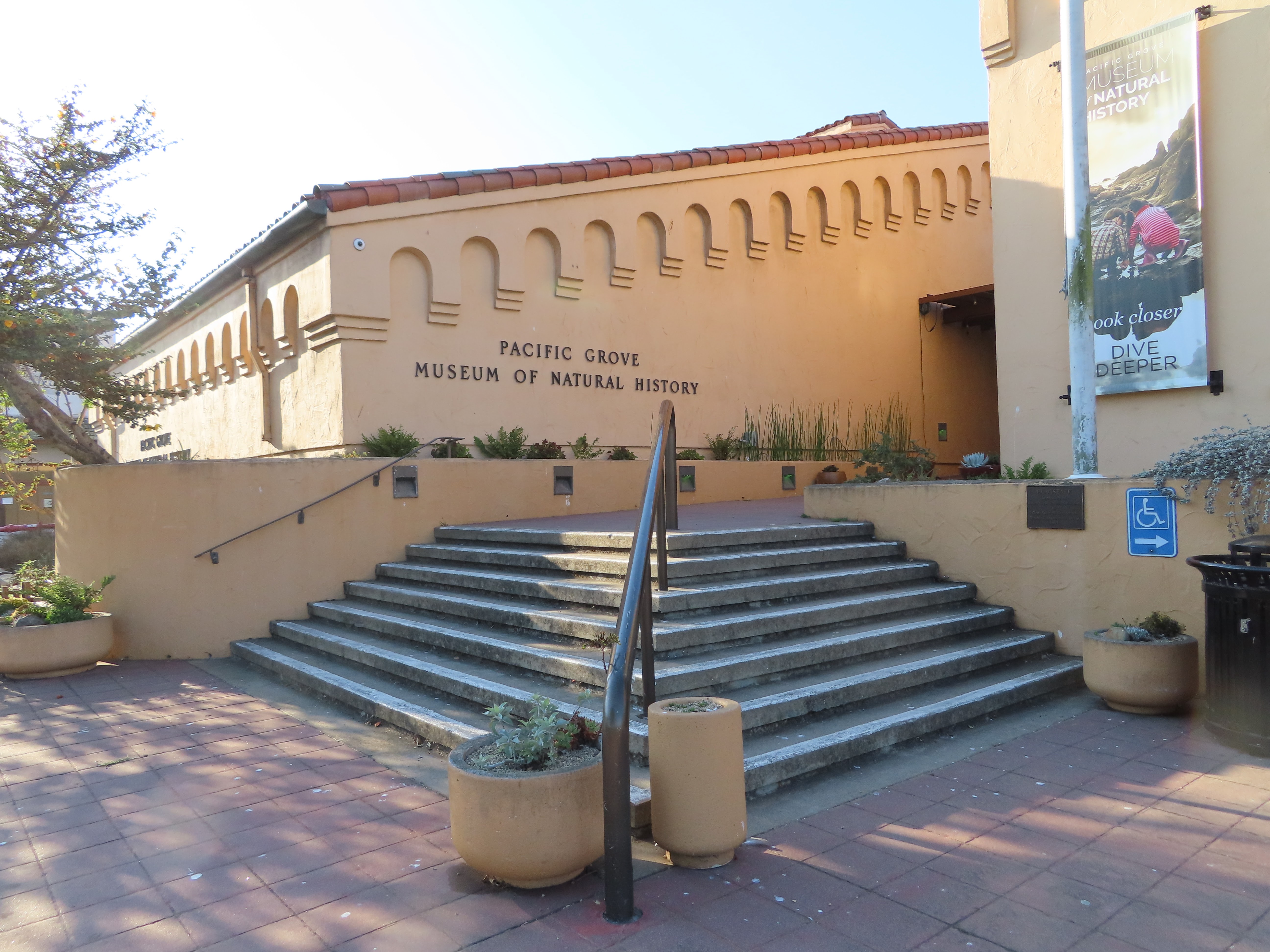
The Pacific Grove Museum of Natural History was established in 1883 when a group of individuals petitioned the Pacific Improvement Company for land to exhibit their natural specimens. A small structure was built on the site of the current museum to house those exhibits. In 1932, local philanthropist Lucy Chase funded the new building that stands here today.
Out in front of the museum notice the large sculpture. This is Sandy the Gray Whale. This life-sized sculpture was completed in 1974 by artist Larry Foster. It was exhibited elsewhere before finding its forever home here at the Museum of Natural History in 1982.

Gray whales are actually born black in color, but as they
age, barnacles and whitish scars give them a grey appearance. In place of a dorsal fin, common to most
whales, grays have a series of bumps along their backs. They use their downturned snout and bodies to
plow along the bottom of the ocean and filter out crustaceans, mollusks, and
bristle worms through the baleen, or comb-like plates, in their mouth.
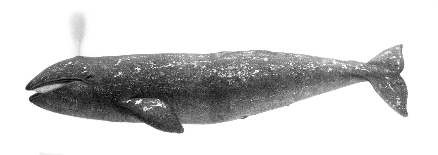
Charles Melville Scammon's 1874 illustration of a gray whale (Wikipedia)
Grays migrate 12,000 miles round trip between feeding
grounds in the Artic to breed in Baja.
They are frequently spotted off Monterey coast as they travel north to
south between December and February as well as on their return trip from Mexico
between February and May.

The Pacific Grove Museum of Natural History is one of the oldest natural history museums in the United States. It is open 10am to 4pm Wednesday through Sunday, and there is unlimited free parking on both sides of Jewell Park.

This museum has a rich diversity of interactive opportunities that educate visitors on California Central Coast's, flora, and fauna as well as historical artifacts. Ask about the Scavenger Hunt or Junior Naturalist program at the front desk. These activities are sure to keep children (and adults) engaged in this unique learning adventure. If time permits I highly recommend a stop at this museum. At the time of this writing, admission for adults is $8.95 and children 4 to 18, $5.95.

The original museum also contained a library. The books for this library were moved one block to the Pacific Grove Public Library in 1908. When you have finished visiting the museum, continue along Central. On your left you will pass the Pacific Grove Library.

The Pacific Grove Library Association dates from 1886 when books were originally housed in the museum down the block. In the early 1900s the city of Pacific Grove obtained a Carnegie grant of $10,000, the Pacific Improvement Company donated the lot, McDougall Bros. designed the building and Harry Chivers and the Granite Rock Company completed the California Mission-style library in 1908.
Turn left onto 15th and continue straight to Ocean View. At Ocean View, turn left and drive along the coast.


At the next corner look to your left to see the Seven Gables Inn. Built in 1886 it was one of several stately Victorian mansions located along the oceanfront. This property was purchased in 1982 by the Flatley family who reimagined the mansion as a luxury inn. Over the next few decades, the Flatley's purchased adjacent properties and grew the hotel into what you see today, a 25 room bed and breakfast. With its unobstructed ocean views, this hotel has repeatedly won awards for being one of the more romantic inns in America.
 Lovers Point
Beach House Restaurant and Lovers Point Beach 2017

(Board and Batten Summer 2021)

Lovers Point Beach Pacific Grove c. 1882
(Photo Carlton Watkins - Monterey History and Art Association)


Pacific Grove Museum of Natural History)
 |
| William Fielding Bathhouse and Tea House at Lovers Point c. 1910 (Board and Batten Summer 2021) |
Dr. Clarendon Atwood Foster acquired Smith's enterprise in 1913. Foster added a pool and waterslides, candy store, beach grill, shooting gallery and penny arcade. J. H. McDougall purchased the property from Foster in 1918 and held it until 1934. Unfortunately Foster was unable to maintain of the property during the Great Depression and the area fell into disrepair. The city of Pacific Grove paid $50,000 for the property in 1934, they demolished the old bathhouse and other structures and added a large outdoor saltwater pool was in 1935, a smaller version exits today.


Monterey Coastal Trail.


Continue all the way to the parking lot ahead. This is northern parking lot for Lovers Point Beach and Park.

Time to get out and explore this area and enjoy the view. Parking is free. If there is a spot open take it!

According to local legend, this park was originally called "Lovers of Jesus Point," back during the time that Pacific Grove was a Methodist retreat camp.


Currently this point has become one of Pacific Grove's best-loved spots for picnics, plein air painting, scenic photography and weddings.


Scenes from both season 1 and 2 of the HBO miniseries Big Little Lies' staring Nicole Kidman, Reese Witherspoon and Shailene Woodley were filmed here at Lovers Point. During Season 2 crews of Big Little Lies' transformed this park with a gazebo and pergola that served as the Blissful Drip coffee shop during filming.
Once you have explored the area, turn around and follow Ocean View Blvd. back in the direction you came. Then turn right onto Jewell Avenue. Then turn left onto 19th Street.

As you drive through these residential areas of Pacific Grove, you might notice small signs on the houses with a name and date. These list the year the home was built, and the person for whom it was built. Many date back to the late 1800's.
Continue straight on 19th and cross Union Street. On your left the yellow two-story with the lovely oak in front is the Elihu Beard House.

Beard House 139 19th Avenue
Located at 139 19th Avenue, this was built in 1880. Five generations of the Beard family have owned this home and kept it in pristine historic condition.

As you come to the stop sign at the corner look to your right at 150 19th Street. This green wooden home with pink trim is Toad Hall.

Built in 1904 for Ms. Cornelia Pierce, the name comes from the owners love of the story The Wind and the Willows.

Centrella Hotel 2017
Turn left onto Central. Continue two blocks to the stop sign at 17th Street. We are going to stay on Central, but take a look to your left. This is the Centrella Hotel a two-story Victorian constructed in 1892 as a boarding house.

- Monterey County Historical Society)
Across the street from the Centrella is Chautauqua Hall. Built in 1881 as a permanent retreat center for the West Coast Headquarters of the Chautauqua Literary and Scientific Circle, a Methodist education movement that started in Pacific Grove in 1879.
This four-year course which featured Sunday school teacher-training classes, musical programs and lectures, was one of the only opportunities for higher education in the days before colleges reached outside large population centers.

For years, Chautauqua Hall served a variety of uses for the Chautauqua Literary and Scientific Circle. This continued well into the 20th century until more conventual opportunities for college education developed, then attendance to the Chautauqua Literary and Scientific Circle dropped off and finally discontinued.


Continue to the second stop sign. Across the street to your left will be the Pacific Grove Visitor Center,

and directly ahead of you the Pacific Grove Museum of Natural History.

Turn right onto Forest and pass by one of our favorite Mexican restaurants, Peppers Mexicali Cafe.

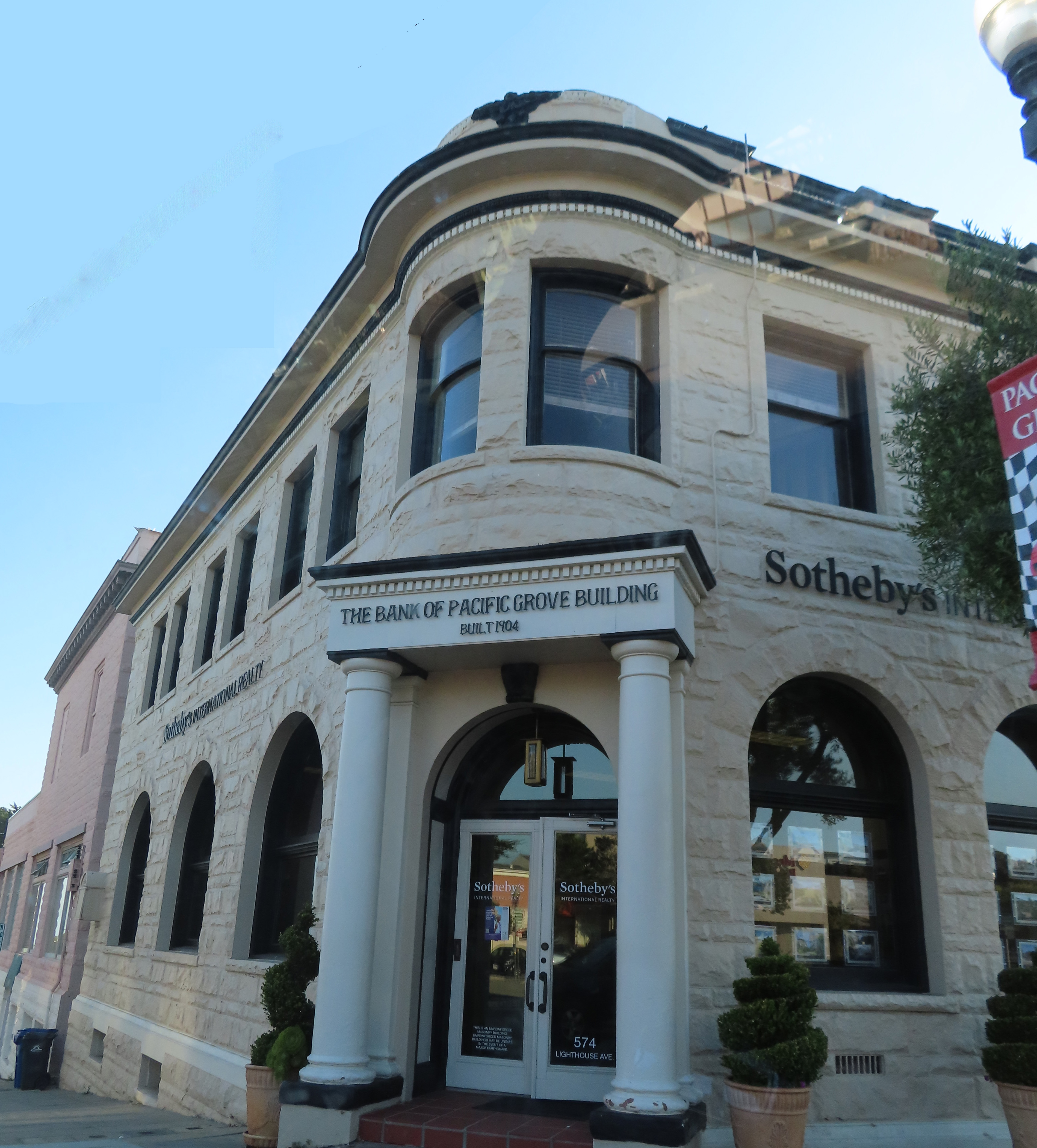
Continue to the end of the block. At the stop sign look to your left. This two-story Romanesque-style building with sandstone veneer was designed by Watsonville architect William H. Weeks and constructed by Thomas A. Work in 1904.

Bank of Pacific Grove c. 1904
(Photo by C.K. Tuttle - Pacific Grove Museum of Natural History)
It originally opened in 1905 as the Pacific Grove branch of the Bank of Monterey. Today this is the home of Sotheby's International Realty.
Turn right onto Lighthouse and continue straight. In two blocks as you cross 18th Street, take a look to your left across the median.

On the corner is a two-story with shingle siding Queen Anne Victorian. This is Gosby House Inn a charming bed and breakfast originally built in 1887. Joseph F. Gosby was Pacific Grove's first shoemaker. He owned the Pioneer Boot and Shoe Store on Lighthouse.

Next door on the other corner, also to your left is the Hart House. This Queen Anne style home was built in 1894 for Dr. Andrew Hart. He had his medical practice on the ground floor and his family lived upstairs. This is a nice example of Stick-Eastlake with the turret, arched entry and plenty of spindles and stick work.
Continue straight along Lighthouse, on your right you will pass the Pacific Grove Post Office.

The historic building was constructed in 1938 with federal Treasury Department funds. Inside there is an oil-on-canvas mural called Lovers’ Point. It is shown in the pictures below. The work of Victor Arnautoff, it was part of the WPA New Deal project, funded by the federal Treasury Section of Fine Arts. The piece was installed in the lobby of the Pacific Grove post office in 1940. It is still viewable there today.

In front of the Post Office notice the bronze statue called Butterfly Kids, by Christopher Bell.

Pacific Grove is the self proclaimed Butterfly Capital of the world. Every year since 1939, on the first Saturday of October, Pacific Grove holds its annual Butterfly Parade. This celebrates the return of the Monarch butterfly to Pacific Grove for its annual wintering stop. We will be visiting the Monarch Sanctuary later on this tour.
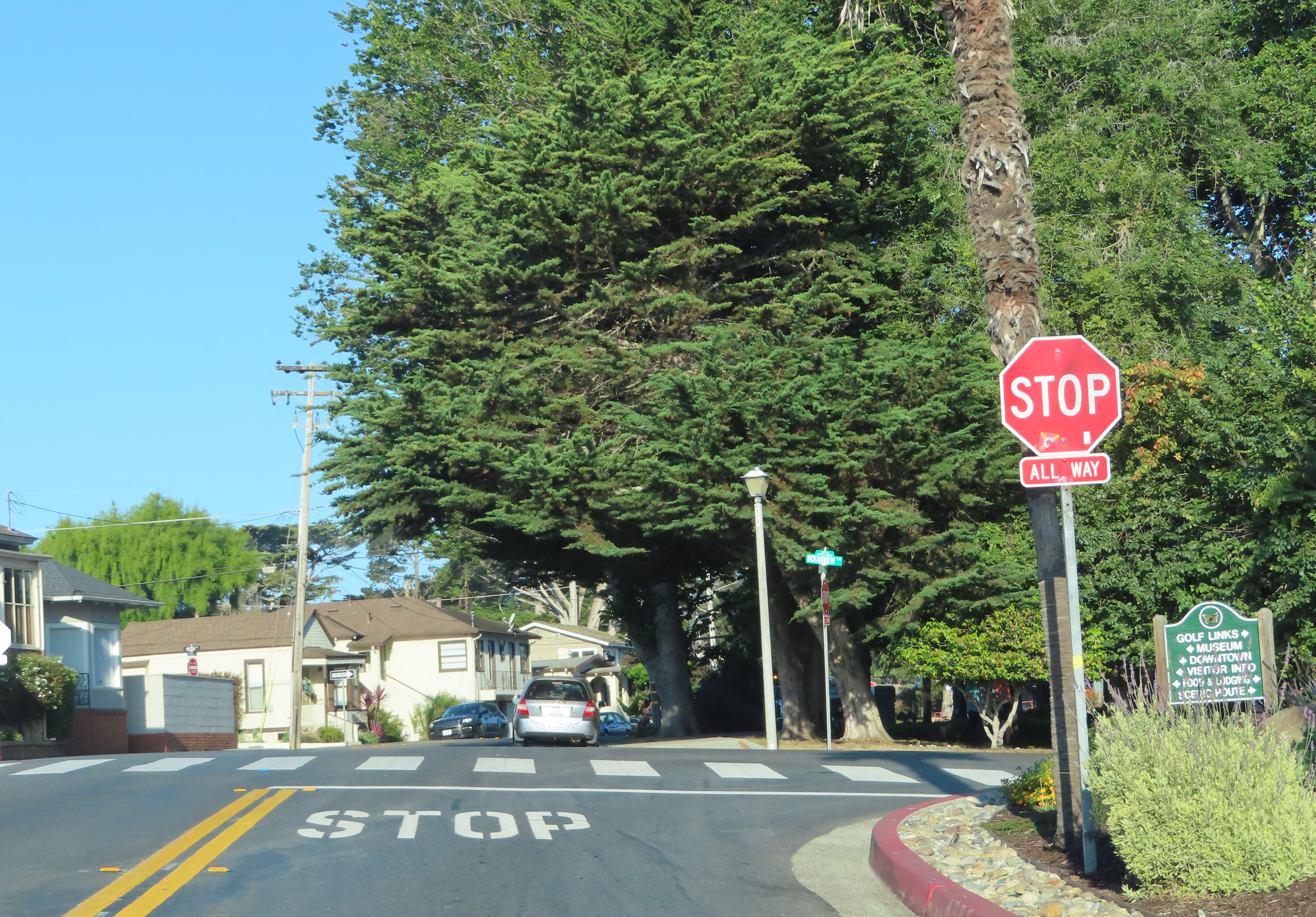
In about half a mile turn left onto Ridge Road. We are on our way to the Monarch Grove Sanctuary. You should see a sign in the middle of Lighthouse pointing you straight ahead.

Once you pass the Pacific Grove Adult Education Center get ready to make the next left turn onto Ridge Road.

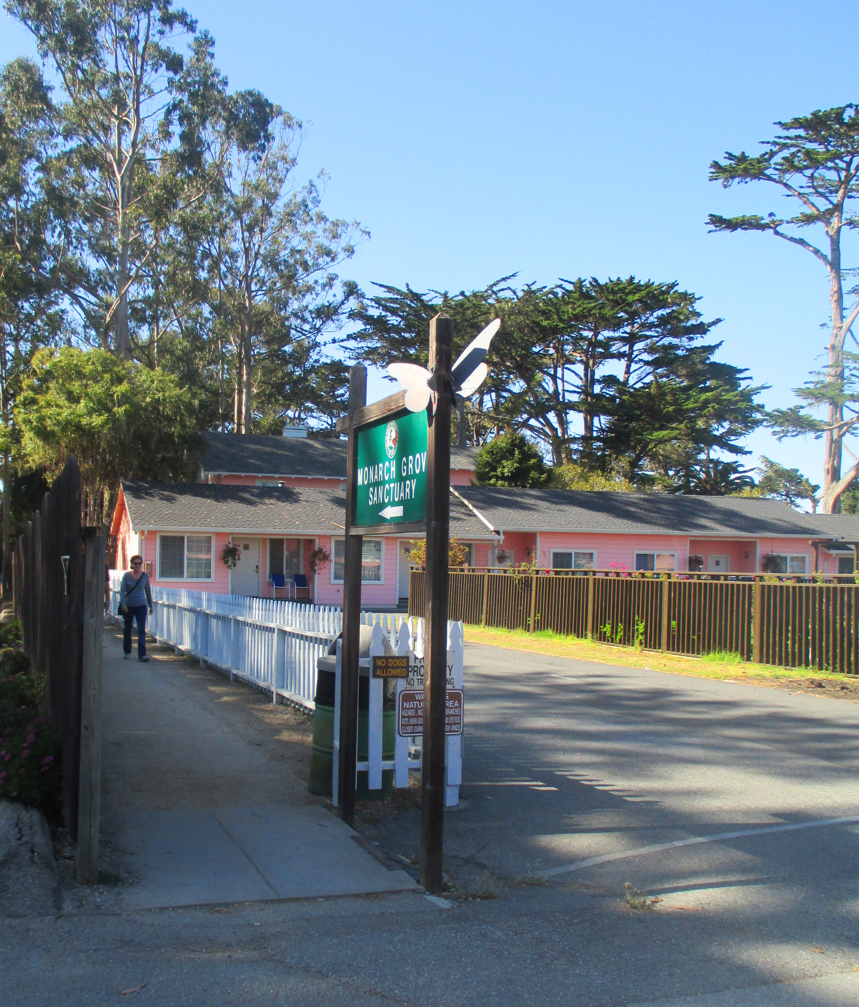
There will be sign on the corner that reads Monarch Grove Sanctuary.


The entrance to the Monarch Grove Sanctuary is at the end of the driveway to the Butterfly Grove Inn.
The Monarch Butterfly spends its life between southern Canada and central Mexico. They are a tropical insect, and cannot survive in freezing temperatures. So they embark on an interesting migration traveling between 1,200 and 2,800 miles yearly.
Monarchs east of the Rocky Mountains spend the winter in the high mountains of central Mexico. Monarchs west of the Rockies migrate to California's central coast. One of those over wintering sites is here at the Pacific Grove Monarch Sanctuary.

Most migrating species, such as birds and whales, are the same individuals traveling their migration route to and from every year, but migrating Monarchs have never been to their destination before. Several generations of Monarchs will have lived and died since last year's butterflies departed. In the sanctuary, the Monarchs live up to 6 weeks, but a migrating adult can live up to 6 months giving them time to make the 1,200 mile journey.

In 1990 the citizens of Pacific Grove authorized the City to purchase this 2.4 acre grove as a permanent Monarch sanctuary. It has become one of the most important overwintering sites for western Monarch butterflies in California.
Monarch populations migrate in two directions, going south in the winter and returning north to breed and lay their eggs on milkweed plants in spring and summer. Every winter they return to the sanctuary. They can be found here from November through February.

If you happen to be here when the Monarchs are in the sanctuary, look high into the eucalyptus. They hang in clusters with their wings closed on the branches. They look like bunches of brown leaves.


There is no fee to explore the sanctuary, but donations are gladly accepted. Take some time to explore the area. The best time to visit to view the butterflies - October through February.
When you are finished, head back the way you came on Ridge Road and turn left back onto Lighthouse Avenue.


On your right will be the El Carmelo Cemetery. This cemetery has been a part of Pacific Grove's history since the 1800s. The oldest section has wooden markers. John Steinbeck's sisters Elizabeth Ainsworth and Esther Rogers as well as their husbands are buried there. Across the street from the entrance to the cemetery is the parking area for Point Pinos Lighthouse.


There is a $5 fee to tour building.

When the United States acquired the Pacific Coast in 1848, there wasn't a single navigational aid from Mexico to Canada. During the 1850s, the Treasury Department constructed lighthouses for the safely of mariners.

Point Pinos Lighthouse is the oldest continually operating lighthouse on the West Coast and is on the National Register of Historic Places. The building, lenses and prisms in this lighthouse are all original and still an active aid to navigation.
If you do not have time, or the lighthouse isn't open when you stop by, take a look at this very informative video.
When you are finished, continue along Asilomar past the Pacific Grove Golf Links to the stop sign and turn right onto Ocean View.

Continue straight a few hundred yards and turn left into the turnout off Ocean View Avenue.

Park here to explore this area. Besides some incredible views you will also find a memorial to singer and song writer John Denver.

On October 12, 1997, John Denver's experimental plane, a Rutan Long-EZ, crashed into the Monterey Bay near this site . Known for his songs "Take Me Home, Country Roads," "Sunshine on My Shoulders" and "Rocky Mountain High," among others, John was 53 years old when this accident occurred. The following is an interesting YouTube of John Denver's life and his last flight.
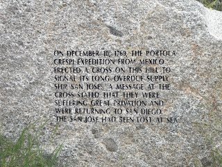
Once you are finished exit the turn out and turn right back on to Ocean View Blvd. On your left you will pass Crespi Pond.

Currently part of the Pacific Grove Golf Links, it was here in the vicinity of this pond in December of 1769 that Fr. Juan Crespi erected a cross marker. Fr. Crespi, a Catholic priest and historian, accompanied Gaspar de Portola on an expedition that year to rediscover the Port of Monterey, mapped out by Sebastian Vizcaino in 1602.

Using Vizcaino's map, the Portola Expedition left San Diego in
July 1769. By the end of October, they
reached Monterey Bay but failed to recognize it as the port Vizcaino had
described 167 years earlier.
Portola writes “The 1st of October we proceeded for
an hour which brought us near the mouth of the river. Here the expedition remained for five days to
explore the circuit made by the mountains.
We all agreed that undoubtedly, we would find the Port of Monterey.” (3)
But they didn't agree that they had found the Port of Monterey. Fr. Crespi writes they camped
within a league and a half of the river’s mouth, “shortly afterwards, the
commander and myself accompanied by five soldiers went to examine the beach. We ascended a little hill…from the summit
beheld a grand Ensenada or open bay and we conjectured that it was the one
which Cabrera Bueno places between Point Ano Nuevo and Point Pino de Monterey;
for we saw the latter covered with tall pines so that near it must be found the
Port of Monterey.” (4) After agreeing that they had not found the bay, they pushed onto San Francisco Bay.
Portola writes in October 1769: “The 31st, we travelled for two hours on a very bad road up the slopes of a very high mountain. We halted on the summit…Having seen some small islands a point of land, and a bay we decided that we were in the neighborhood of the Port of San Francisco.” (5)
On November 11th the Portola Expedition, having believed that they missed Monterey Bay, began to retrace their trek back toward the open bay with the tall pines they had passed earlier.
On November 26 the party had
again reached the Monterey Peninsula. Portola writes: “The 26th, we proceeded
for two hours and a half to the foot of the Sierra de Santa Lucia…Here Captain
Fernando de Rivera set out to explore this range…he reported that he had not found
the Port of Monterey." (6) Still not recognizing this bay as the one they were
indeed looking for, and almost out of provisions, the expedition decided to
return to San Diego.


 |
| Rock at Crespi Cross Carmel River |
Long story short Portola realized he must have passed Monterey Bay on his previous journey and set out again overland on April 17, 1770. Fr. Crespi and his diary journeyed along as well. They followed the same route they had taken before and arrived at Monterey Bay in May.
Fr. Crespi wrote on May 2, 1770, “After a journey of three leagues we arrived at one of the salty lagunas of Punta Pinos where a cross had been erected. The cross was surrounded by arrows and little rods, tipped with feathers, which had been set into the ground by the Indians. Suspended from a stick, at one side of the cross, was a string of half-spoiled sardines, a number of clam shells, and a piece of meat.” (9)
This time the expedition determined that what had found just a few months ago had indeed been Monterey Bay. There is a lot of history in and around Monterey Bay. I cover a bit more on some of my other walking tours. You may find them here at Adventures of a Home Town Tourist or on VoiceMap.

Continue along Ocean View around the point. Just as you get around the point pull into the turnoff. This is what Ed Ricketts called the Great Tidepool area and where he collected many of his specimens for the Pacific Biological Laboratories. There are actually a number of great tide pooling areas along the stretch of coastline.

"It is a fabulous place: when the tide is in, a wave-churned basin, creamy with foam, whipped by the combers that roll in from the whistling buoy on the reef. But when the tide goes out the little water world becomes quiet and lovely. The sea is very clear and the bottom becomes fantastic with hurrying, fighting, feeding, breeding animals." (Cannery Row, Chapter VI)

Tide pools form as sea water washes over the rocks and fills the rocks natural depressions. They range from small, shallow puddles high up on the shoreline to large deep pools near the sea. These pools are home to dozens of different animals and plants. When sea water flows into the pools, it brings fresh oxygen and food to inhabitants. Some animals spend their entire life in one tide pool, while others swim in and out with the tides. The best time to explore these tide pools is at low tide.

If you do happen to enter the tidepools here remember never to turn your back on the ocean, it is very unpredictable. Also be extremely careful as the rocks are slippery. As this it a Federal Marine Sanctuary now, it is illegal to take anything from the rocks.

Continue straight just a few hundred yards to the entrance to the Asilomar Coastal Trail. Park on the right side of the street if you would like to take a short walk along the trail. Stay on the trail. If you look across the street you will see the Point Pinos Lighthouse.

The Asilomar Coastal Trail is about 3 1/2 miles out and back. The trail is generally flat and alternates between sand, dirt, and wood planks. The beach and bluff walk provide ready access to spectacular coastline, tide pools, and sandy beaches. Informational plaques are placed along the trail. The one below explains the diversity of the dune plant community.

This trail is a very popular trail for visitors and locals. Dogs are welcome but must be on a leash.
Once you are finished exploring the area continue along Ocean View Blvd which becomes Sunset Drive.

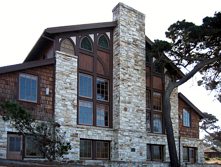
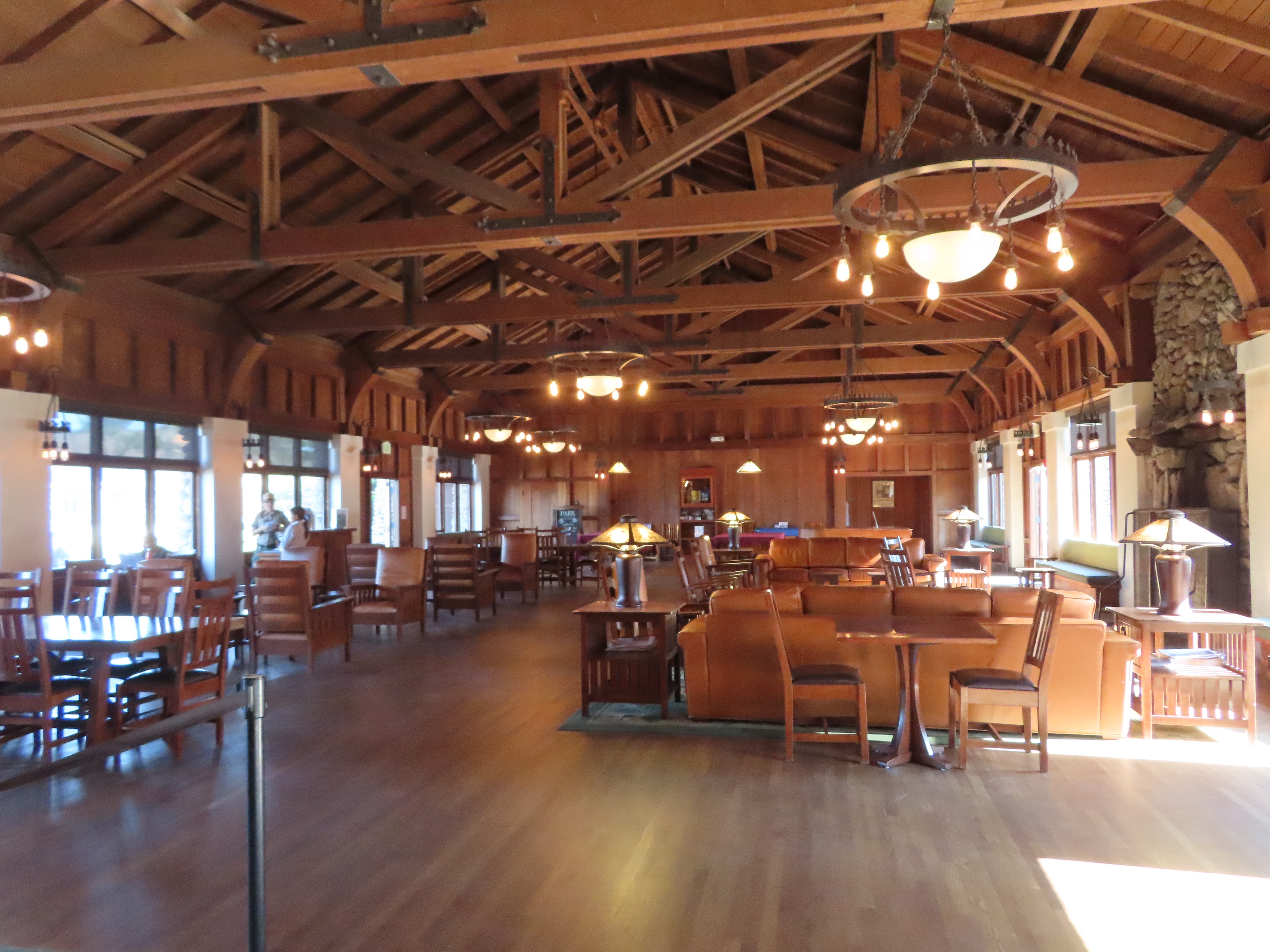
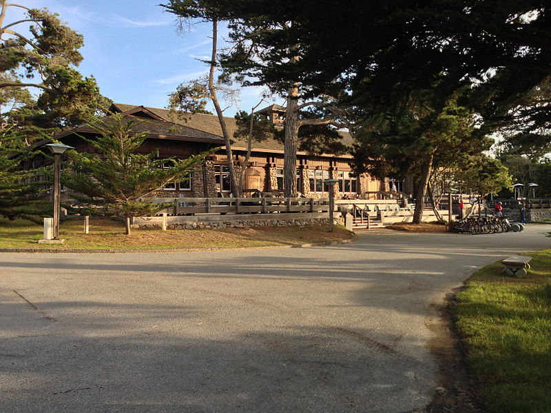
Continue straight and watch for the sign for Asilomar Conference Ground and Asilomar Beach.

Stop here and take a walk about on the path. One way leads to the beach, one way to the conference grounds.
On the Asilomar Conference Grounds side walk up the boardwalk. You can take this straight to the Conference buildings or wander along the boardwalk into the dunes area. A walk along this boardwalk offers visitors a rare close-up glimpse of this dune restoration project.


A walk on the beach side brings you to a small beach and a sandy shore habitat. During spring and fall migratory seasons look for shorebirds such as Willets, Whimbrels, Marbled Godwits and Sanderlings. Here they fuel up for their flights north towards the Artic Circle during spring migration -- and again coming back south in the fall as they head towards Central an South America.

From the beach look out to sea. These are the surface waters of the Monterey Bay National Marine Sanctuary which stretches from Point Pinos in Pacific Grove, south to Point Joe in Pebble Beach. It is designated as a marine reserve, which means that no fishing or collecting of marine life is allowed. This level of preservation allows for some stunning marine wildlife which can be viewed in this area.

Once you have explored this area, continue along Sunset Drive. Up ahead you will see the Spanish Bay Lodge in the distance on your left. Now continue just a bit further along Sunset.

If you are interested in taking a 1 mile walk along side the Spanish Bay Golf Links to the Inn at Spanish Bay, watch for a parking pull out on your right just .2 miles from the Asilomar Beach and Dunes walk. The trail head is located at this GPS coordinates 36.617415, -121.938649.


.JPG)
.JPG)
.JPG)
.JPG)


.jpg)


Comments
Post a Comment