Interested in being your own tour guide? I have over 20 published GPS audio tours with VoiceMap (Carmel, Monterey, California Gold Country, Folsom, Tahoe, Sacramento) and over 40 tours published with GPSmyCity (Carmel, Monterey, Big Sur, Folsom, Sacramento, Boston, Cinque Terre, Kotor Montenegro, Copenhagen, St. Petersburg, Helsinki, Stockholm, Estonia, Covadonga, Spain, Montserrat, Spain, Manresa, Spain, Loyola, Spain, Santiago de Compostela, Spain, Fatima, Portugal, San Sebastian Garabandal, Spain, Lourdes, France, Santarem, Portugal). Happy Adventures!
Sand Harbor
If you are interested in this driving tour as an audio tour, the companion audio tour is available on VoiceMap and listed under Lake Tahoe. To use VoiceMap, you will need to download the VoiceMap app from the Apple Store or Google Play. The app is free. There is a cost for this audio driving tour, which is one of three that takes you entirely around Lake Tahoe. Adventures and enjoy the tour!
+++
Hello and welcome to this driving tour of Lake Tahoe. I have lived in California all of my life and have been exploring Northern, Central and Southern California for decades. I love to discover new areas as a hometown tourist and bringing adventures to life on these tours. You may find more of my walking and driving tours on my VoiceMap profile.
Entrance to Sierra Sotheby's off Lakeshore Blvd.
This 27 mile tour begins with a tour of Lakeshore Blvd. then heads south along Highway 28 hugging the eastern coast of Lake Tahoe. While you take in these spectacular views, you will hear stories about the area that will compliment those you heard on my other tours of the Lake Tahoe area.
Along the way you will have the opportunity to do some hiking, visit tiny hidden beaches, do some shopping, or take in a meal. This driving tour can be completed in about 1 hour without any stops. On the other hand, this is your adventure; it is up to you as to when and where you stop along the way.

Sotheby's
Before we begin our tour let me tell you a little about Incline Village. This charming woodsy community located along the
north shore of Lake Tahoe was originally home to the Washoe Native people who
encamped along its shores during the summer months to hunt and fish.

Washoe in Tahoe
Later,
after silver was discovered in Virginia City, Nevada in 1859, Walter Hobart and
Sam Marlette began operating a small sawmill in Little Valley, near Incline
Village to supply timber for the mining operations in Nevada. In 1878 they incorporated as the Sierra Nevada
Wood & Lumber Company and two years later built an incline railroad that
carried the timber from Incline Village up the mountain where it was then
dropped down the other side via a V-flume into Carson City, Nevada. Incline City which incorporated in 1882 got
its name from this incline railway.
The picture below is the remains of the only Bull Wheel ever used in logging. From 1880 to 1894 this steam-powered wheel hauled cords of lumber up the incline before they were dropped into the V-flume. This wheel was found on the property of the Ponderosa Ranch just outside of Incline. More on the Ponderosa Ranch later on this tour.
By the 1930’s summer homes were being built within the village along the beach
and what is now Lakeshore Boulevard. In
the late 1950s Crystal Bay Development Company created a master planned
community for the area. This company is largely responsible for the unique village that
stands here today.
Alright it is time to get driving. Exit
the parking area of the Sotheby's Realty by heading down the hill toward the
lake and turn left onto Lakeshore Boulevard.
Millionaires Row
Once called “Millionaire’s Row” a drive along Lakeshore offers views of some of
Incline Villages' grandest estates.
Lining both sides of the street, these summer homes of the Bay Area’s rich and famous showcase a wealth of architectural designs in park-like landscaping.
As you continue along Lakeshore look to your right, besides periodic peaks of the shimmering lake, notice the paved bike and walking path that has been incorporated into the community plan.
Walking path along Lakeshore
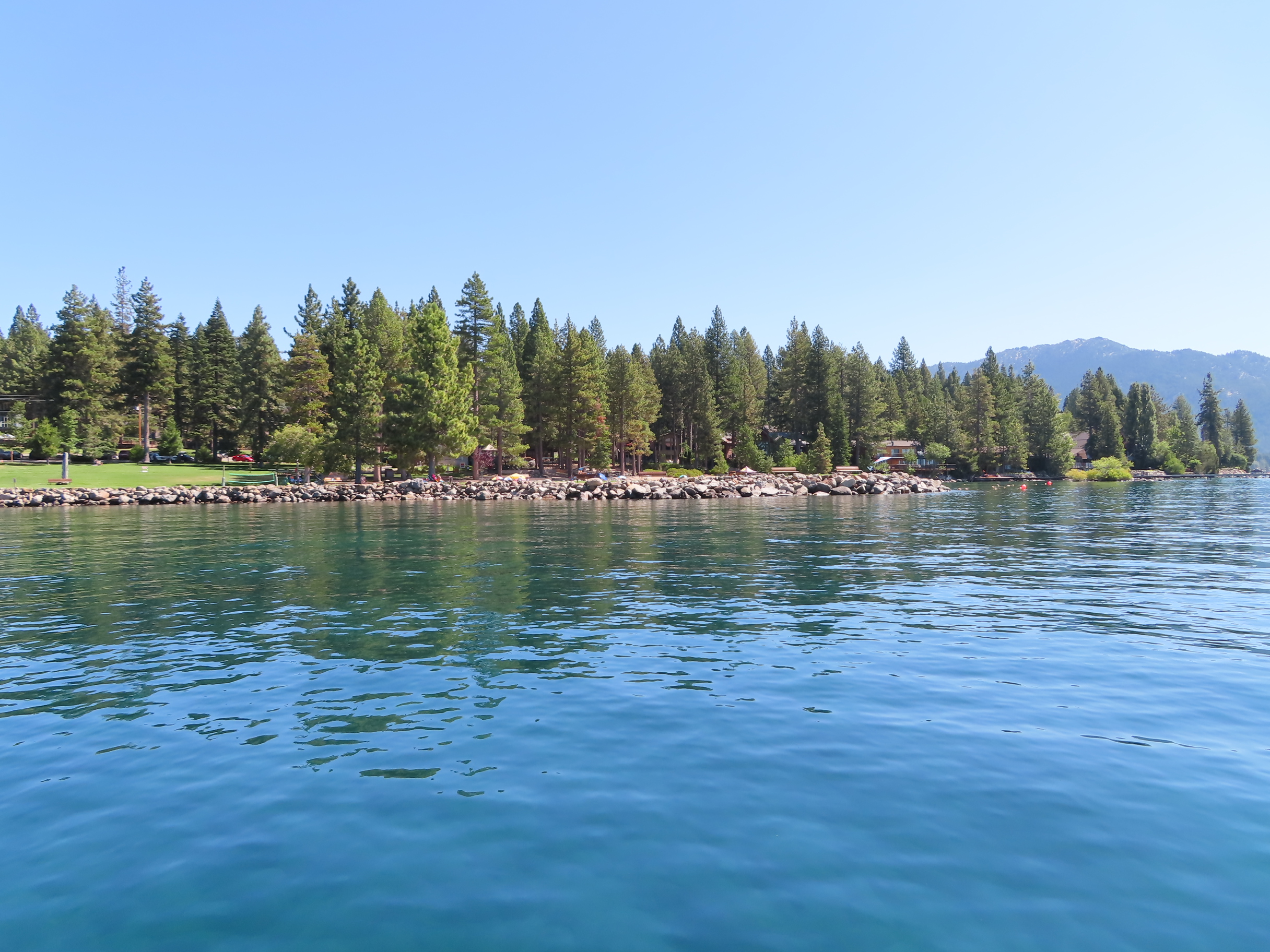
Coming up on your right ahead is Burnt Cedar Park and Beach. One of the advantages of renting an Incline Village property or staying at the Hyatt Regency Lake Tahoe during the summer is access to three private beaches along this boulevard, Incline Beach, Ski Beach and Burnt Cedar.
Burnt Cedar is
one of the more popular because of its protected jetty lakeside. Here you will also find a volleyball
court, picnic area and playground.
Just past Burnt Cedar watch for Jobs Peak Road. After passing through this intersection look for second the house on your left with the red front door. The address is 806 Lakeshore. This is owned by David Duffied, the founder of PeopleSoft and co-founder of
Workday Inc. Both companies are located
in the Bay Area city of Pleasanton.

David Duffield
Lake Tahoe is a second, or third home for many of Silicon Valley’s famous. Facebook CEO Mark Zuckerberg owns two properties lakeside near Tahoe City. Oracle billionaire Larry Ellison owns multiple properties on the lake as well
as the historic Cal Neva Lodge which he plans on turning into a casino and
luxury hotel.

Cal Neva Lodge 1960s
Mike Love, American singer songwriter and co-founder the Beach Boys as well as
R&B musician Kenneth “Babyface” Edmonds both own homes on the north end of
Incline Village near the Mount Rose scenic overlook.
Continue straight. We will be passing
under a green sky-walkway soon. It is hard to see as its color makes it blend
in with the environment. This is the beach access from the swanky Hyatt Regency Lake Tahoe Spa and Casino.

Hyatt Regency Lake Tahoe
Once you pass under the sky-walkway, to your right will be the Hyatt hotel Lone Eagle Grille. Open for lunch and dinner,
it is a spectacular dining experience on the beach and a great place to enjoy
your favorite beverage at sunset. At the corner after the sky-walkway turn left onto Country Club Drive.
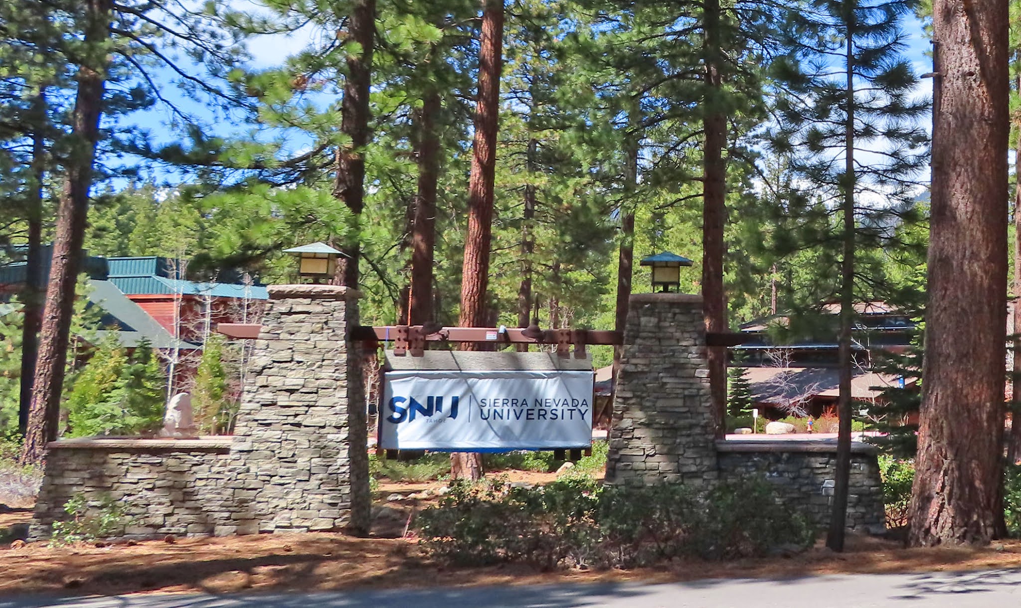
After passing the Hyatt Regency you will enter the campus of Sierra Nevada College. Opening in 1969, this private accredited
four-year liberal arts school offers 30 undergraduate majors and a masters in
education.
Also on the Sierra Nevada College is the U.C Davis Science Center. This organization leads the research efforts of TERC the Tahoe
Environmental Research Center, which provides the research and science
necessary to guide the future management and preservation of Lake Tahoe as well
as educate the public on the ecological issues facing the lake.

Intersection of Tahoe Blvd.
At the stop signal ahead, turn right onto Tahoe Boulevard. This will become Highway 28.
Program from Ponderosa Ranch
In about two miles you will drive by the location of what was once the Ponderosa Ranch theme Park. Based on the 1960s television western Bonanza, this park operated from 1968 to the late 1990s and portions of the last five seasons of the television series were filmed there.
Ponderosa Ranch
This television series, which starred Loren Greene and Michael Landon, was set on the Ponderosa, a fictional location on the shore of Lake Tahoe near a forest of Ponderosa pine.

Ponderosa Ranch
Theme park visitors were treated to rides in a Conestoga wagon,
being “robbed”
by “outlaws,”
chowing down on “Hoss Burgers,”
and other wild-west adventures.

Ponderosa Ranch
In 2004 the park was purchased by David Duffield. What he plans to do with the
land is a mystery. We saw Duffield’s home earlier on Lakeshore Blvd. Ahead on your left is the only visible reminder, the Bonanza parking lot. Reminds me of the lyrics of that old Joni Mitchell song, Big Yellow Taxi:
Don't it always seem to go
That you don't know what you got 'til it's gone
They paved paradise and put up a parking lot
Ahead on your left is the Tunnel Creek Station Cafe. This is a great starting point for hiking or biking the trails in Nevada State Park.
The Tunnel Creek Station Cafe operates a
shuttle for the one-way bike ride of the 14-mile Flume Trail. Usually
rideable around Memorial Day, it begins at Spooner Lake and ends at the Tunnel
Creek Cafe.
Behind the Tunnel Creek Station is the
trailhead for Tahoe’s 3-mile East Shore Trail. Dubbed “America’s Most Beautiful
Bikeway,” this trail meets American Disability Act requirements so everyone,
can enjoy the path. The trail with several beach access points and vista
overlooks begins on the mountain side and crosses over the highway near Hidden
Beach before ending at Sand Harbor. As we continue along the highway you will notice the trail alongside the highway.

East Shore Trail
Continue along the highway and soon you will enter the boundaries of Lake Tahoe State Park. This park runs lakeside from Incline Village to Spooner Lake, and features many beaches tucked in hidden coves.

The park also runs east into the Carson Range, where visitors have many opportunities for backcountry hiking.
This portion of the highway is call the Lake Tahoe National Scenic Byway. It is one of only 150
given this honor in America. This scenic byway runs from Crystal Bay,
California to Stateline, where we end our driving tour. It offers motorists some of
the most spectacular views of this alpine lake, all set against the backdrop of
snow-capped mountains.
Our next stop is a scenic overlook in 1/4 mile.
Pull off to the right into the scenic overlook.
This is Memorial Point Overlook.
Parking here is free for 20 minutes.
If parking isn’t available continue through the parking area back to the highway. But if there is parking available stop here. The views are spectacular. Below is a map of the area.

From this stop mid-way on the 3-mile Tahoe East Shore Trail,
you may walk north or south along the trail and be rewarded with beautiful views.
When you're ready to continue turn right back onto the highway.
As you come around the next bend you pass by Emerald Cove.
Pictures of this cove are shown above and below.
When walking or cycling
here along Emerald Cove, the trail branches off onto a foot bridge, where one is rewarded with a
view of the shimmering emerald waters of the lake below.
Sand Harbor
At our next stop, Sand Harbor Beach in less than ½ mile, you will have the
opportunity to take a lovely hike along the shore to view those emerald
waters. There is a parking fee for Sand Harbor State Park. If signage indicates the
parking lot is full or you prefer not to stop, continue past the park entrance.
On your right watch for the turn off to Sand Harbor. Turn right and stop at the ranger station. Here pay the parking fee, request a map and then proceed to park in one of the
parking areas. Keep your parking receipt
as it is valid for other Nevada State parks you visit on the same day.

Parking Lot Sand Harbor
Visitor Center
Above is a map of Sand Harbor State Park. To explore the area we suggest taking the 1/2 mile Sand Point Nature Trail Loop.
This pathway is wheelchair accessible and lined with interpretive signs that will fill you in on the background of this area of Lake Tahoe.
Take the walk around the point counterclockwise and enjoy the views of the rocky coves, sandy beach, reflections off the smooth lake surface and unique rock formations.

Common Merganser at Sand Harbor
At the end of your walk you will pass the entrance to an amphitheater, home to the annual Tahoe Shakespeare festival.
Amphitheater
When you have finished exploring Sand Harbor turn right back onto Highway 28. In about 1 1/2 miles we will come to our next stop, the trailhead for the Lodge Beach Trail and Secret Beach. Before we arrive though, shortly you will come to the Thunderbird Lodge viewpoint along the highway.
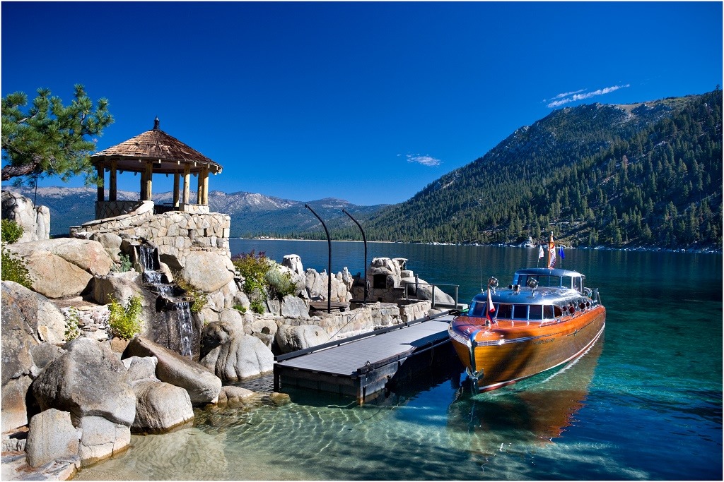
The Thunderbird Lodge, a rustic residence designed for George Whittell Jr., was completed in 1938.

George Whittell Jr.
Born in 1881, Whittell was heir to one of San Francisco's wealthiest families. With the intention of building a high-end real-estate development and casino, he purchased 27 miles of Tahoe's shoreline from Crystal Bay to Zephyr Cove in 1935. He built his multi-unit estate along with a card house, and elephant house for his pet elephant Mingo lakeside in 1939.

Cove with Thunderbird Lodge as seen from highway
After years of entertaining friends with long nights of excessive drinking and high stakes poker games, Whittell realized he preferred the privacy his estate afforded, and decided not to develop the surrounding property. Which is why the east shore remains mostly undeveloped to this day.

Close of up Thunderbird Lodge and Boathouse
Look to your right toward the point along the shore and you should get a glimpse of Whittell's boathouse and mansion. It is a distant view, but a view all the same.
Continue driving and watch for a small parking area on your right. This is the trailhead for the Lodge Beach Trail.

Small parking area for Lodge Beach Trail
This trail, is a ¾ mile round trip hike to Secret Beach. A map of the hike is shown below.
This beach is nestled in a secluded cove just north of the historic Thunderbird Lodge, the rustic lodge built in 1938. The lodge is not visible from the cove, but the Thunderbird Boathouse is.
The pictures from this hike were taken in January 2021. Even with snow on the ground it was possible to follow the trail which begins just west of the small parking area.
Stone steps halfway through trail lead down to the lower half of the trail. Here the boathouse begins to comes into view.

View from the trail of Thunderbird Boathouse

Thunderbird yacht stored in boathouse (Thunderbird Site)
The trail ends with more stone steps down to Secret Beach and very secluded beach where you can view the Thunderbird Boathouse, but not the Thunderbird Lodge itself.
Boathouse from Secret Beach
Reverse your hike back to the parking lot and continue south along the highway another 1/3 mile. On the right look for a small driveway. The address is 5000 Highway 28 and will be posted on a tree at the foot of the driveway.


Go ahead and take the driveway off to the right. This brings you to the gate for Thunderbird Lodge.
Tours must be reserved ahead of time. There is a land tour and a boat tour. The boat tour begins and ends at Zephyr Cove at the Round Hill Pines Beach Resort.
Currently the lodge is managed by the Thunderbird Lodge Preservation Society which offers pre-arranged docent-guided tours of the magnificent grounds.

Thunderbird Website

Thunderbird Website

Thunderbird Website
Turn around and head back down the driveway the way you came and turn right back onto Highway 28.
The highway around Lake Tahoe was completed in sections with the first section being California State Highway 89 linking South Lake Tahoe to Tahoe City in 1913. Next California State Highway 28 linked Tahoe City to Stateline in 1915. Highway 50 from Glenbrook to South Lake Tahoe was added in 1931 and finally the section you are on now Nevada State Route 28 was completed in 1932.
In about 1/2 mile there will be a pull out on your right for a public restroom. This area is seasonal and not open during the winter months. As you can see below it was closed in January 2021 when we took this picture.
This parking area is also the trailhead for five tiny secluded beaches located
along the next 2 miles of highway, which are frequented by locals and others who know how to get to each of these isolated locations. Some are clothing
optional, others allow “textiles”, or what are also known as swimsuits.
Our next stop, the trailhead for Skunk Harbor, is in about 2 miles. With parking so limited along the east shore
it might be possible that the parking area will be full when you get there. If it is, you will have to continue straight
along the highway.
Skunk Harbor is a small secluded inlet with a small sandy beach and the historic George Newhall House built in 1923.

George Newhall House
Like George Whittell who later owned the property, George Newhall also derived
his wealth from his father’s fortune, which was earned as an auctioneer during
the Gold Rush. Newhall purchased Skunk
Harbor for his wife Caroline as a wedding gift and built her a summer cottage.
There are two pull outs for parking for the Skunk Harbor trailhead. The closest you can park to the metal gate the better, as this is a 3 mile round trip challenging hike. You may see a map below of the hike area. Notice the fork off of Skunk Harbor trail to Slaughterhouse Canyon. We are not taking the Slaughterhouse Canyon trail but it is important to be aware of the fork as it will tell you how far you are on the trail.
The trailhead is near an old green pipe gate just off the highway.
Enter the trail here and head downhill where
the pavement will give way to a dirt path.
About halfway down this path the fork off to the left leads to
Slaughterhouse Canyon. Don't take this,
but rather, stay straight on the main trail. I have made another map which I show below. Slaughterhouse Canyon trail is not shown on this map but #2 is where the fork for this trail is.
Three switchbacks after the fork to Slaughterhouse Canyon take the fork to the left and cross a small
stream to view the Newhall house, now a stone shell.
Once you cross this bridge you may explore the area of the Newhall Mansion and Skunk Harbor Beach.
While at the beach you will notice some old railroad trestles in the water of the cove.
This was part of a narrow-gauge railroad built in 1875.
This railroad hauled timber to sawmills near Glenbrook.
This lumber was used primarily in the Comstock Lode mines of Virginia City, Nevada, a lode of silver ore found in 1859.
The underground tunnels where the ore was extracted were prone to frequent and deadly cave-ins. Mining engineer Philip Deidesheimer solved this problem with the invention of a square-set timber framing system of interlocking rectangles that supported the mines walls.

Mining the Comstock - Wikipedia
The timber for the framing systems came from the trees of the Sierra Nevada around Lake Tahoe. At the time land-stripping or clear cutting was the standard practice, and the mature sugar, and Jeffrey pine trees were exactly what was needed to shore up the silver mines.
The two lumber companies responsible for cutting and processing this lumber were D. L. Bliss’ Carson and Tahoe Lumber and Fluming Company near Glenbrook and the Sierra Nevada Wood and Lumber Company near Incline Village. By 1881 more than two billion board-feet of timber had been removed from the Lake Tahoe area.
After you have enjoyed the crescent shaped
beach, return on the trail the way you came and continue south along the highway.

Spooner Lake
Our next stop is Spooner Lake. Here you may take a number of hikes, we suggest the 1 1/2 mile loop around the lake through a lovely Jeffrey pine forest and quaking aspen grove. The turn off for Spooner is in less than 1/2 mile. You will see signs for the lake on your right and the turn off will be to your left.
This hike is most spectacular in late spring for wildflower season and in the fall when the aspens turn from green to gold.
The map below shows the trail.
The trailhead is next to the restroom. There is a sign there which states "All Trails." Head toward the lake then turn left and follow the trail clockwise around the lake.
You will cross over a small dam and pass through a Jeffrey pine forest.
Along the way there will be interpretive signs to explain what you might see along the hike.
When you come to the opposite end of the lake you will curve through a spectacular grove of quaking aspen,
walk along a raised pathway, then wind your way back to where you began.
Breaks in the trees allow for views back across the lake and sightings of ducks and other waterfowl. Once you return to the parking area, follow the park road back to the highway and turn left. Then in less than ½ mile use the right lane to merge onto Highway 50 toward South
Lake Tahoe.
As you make your entrance onto Highway 50 look to your right. This is Spooner Summit Snow Play area, an informal sledding
hill during snow season.
Our next stop, Logan Shoals Vista Point, is in about 5 miles. But before we get there you let me tell you a bit about the highway your are on.
You may, or may not have seen a brown sign on the right of the highway designating this area of the
highway an Auto Tour Route of a National Historic Trail. This segment of
highway connects The California Trail at Carson City, Nevada to the central
route of the Pony Express National Historic Trail.
The California Trail was a 3,000 mile trail that ran from Missouri to
California. The trail was initially laid
out by mountain men and fur traders traveling on foot or horseback in the first
half of the 19th Century.
The first recorded party to use the California Trail to get to California was
the Bartleson-Bidwell Party in 1841. It
was an arduous journey from Missouri, and though they survived by killing and
eating most of their oxen the entire party made it to California.
The first group to cross over the Sierra’s via the California Trail by wagon
train were the Stephens-Townsend-Murphy Party in 1844. Though they had to disassemble their wagons
to cross the Sierra Nevada’s, and re-assembled them once they crossed, the
entire party plus two born along the way survived the ordeal and made it to
Sutter’s Fort near Sacramento. As the
first American emigrants to haul wagons over the Sierra Nevada’s their crossing
officially opened the California Trail.
Two years later the more infamous Donner Party would not be as lucky. Trapped for months and reduced to cannibalism
near Donner Lake, nearly half of the 81 members of the party died before
reaching California.
This portion of the highway was also part of the Pony Express Trail. I will tell you about the Pony Express later
on this tour.
The next thing I want to mention before we get to Logan Shoals is something that might be a bit hard to imagine. But just under 150 years
ago, the forests you see in front of you today were not here.
Before the logging industry entered the basin in the 1880s, Tahoe’s forests
were dominated by Jeffrey and sugar pine. These old growth forest stands
were essentially clear cut, some of these trees as old as 300 to 400 years,
what was left behind were mostly the red and white fir trees. It would be the fir
that would provide the main seed source for the second growth forest with the
pine competing for space.
The result is
what you see here today in the Tahoe Basin, an over-dense fir dominated forest
that is more prone to fire, and supports a narrower range of plant and wildlife
species. The land management agencies of the Tahoe Basin are working a variety
of projects to improve both the short and long-term health of the forest.
On your right, watch for the turnout for Logan Shoals Vista Point. There is no charge to park and the hike is about 1/4 mile out and back. There is also a public restroom at this site.
It is a very level path with stunning views of Lake Tahoe.
At the first overlook you will find an interpretive sign
that points out the mountain you can see across the lake.
Continue a bit further to a sign about
Cave Rock. You can see Cave Rock way in the
distance. We will be driving through it shortly.
You make get a better view of Cave Rock
if you proceed to the next overlook.
From here follow the well worn path a few
hundred feet to a
Native American grinding rock.
Then look south and there you
will see Cave Rock.
Part of an ancient volcano, Cave Rock is sacred to the Washoe Native Americans', the people who lived in the Tahoe Basin for thousands of years prior to the arrival of the first recorded American’s in 1844.
Alright it is time to continue south on Highway 50. In less than one mile we will drive through Cave Rock an area of highway that was quite a challenge to construct. Originally the road was built around the rock. But the single lane proved too dangerous.
Road around Cave Rock 1935
So the 200 foot section known as Cave Rock tunnel was blasted through this massive monolith.
The first tunnel in 1931 then a second in 1957.
Entering Cave Rock from North
Entering Cave Rock from South
Continue through the tunnel then make a left just past the Cave Rock Estate
sign. You will be crossing the highway
to turn left onto Cave Park Drive.
Follow Cave Park Drive as it curves right and then left. In about 1/4 mile the road comes to 3 parking spaces
at the Cave Rock Trailhead.
If you take this hike, enter the trailhead to the left of the parking area. Follow the path 1/4 mile uphill to the base of the rock wall.
You will probably see people on top of Cave Rock or scaling the side. I do not recommend climbing the rocks of Cave Rock it is dangerous.
The view is just splendid from the trail! When you have finished exploring the area. Follow the road back to the highway and turn left. This is a difficult left turn so just be patient.
Our next stop, the Zephyr Cove Resort is in 2 ½ miles. This charming resort was built in the early 1900s. In 2013 it underwent a renovation restoring the main building to its original architectural character and equipped the 28 lakeside cabins with modern conveniences.
As well as plenty of water sport activities, this resort features the Zephyr Cove Restaurant which locals refer to as The Lodge and the Sunset Bar and Grille lakeside on Zephyr Cove’s mile long sandy beach.
The Marina at the cove is home to the stern-wheeler the MS Dixie II. One of two paddle wheeler’s now running on Lake Tahoe, the MS Dixie II operates year-round and the Tahoe Gal sidewheeler operates out of Tahoe City from spring through fall.
Some may remember a third paddle wheeler that operated here on the lake, the
Tahoe Queen. This stern-wheeler was
based in South Lake Tahoe and ran trips around the lake for 33 years. In 2016 it caught fire while undergoing
renovations and was destroyed.
Lake Tahoe paddle wheeler boat tours are an opportunity to see Lake Tahoe from
a whole different perspective.
If you want to stop at Zephyr Cove make a right into the resort.
Turn left into the parking area for the Zephyr Cove Restaurant and Lodge. Turn your car so that you are facing the lake and stop for a moment. From here you should be able to see the historic MS Dixie paddle wheeler if it is in dock.
If you are interested in lunch or dinner, we recommend this locals favorite, the Zephyr Cove Restaurant.
To visit the beach or the bar on the beach, you will have to continue into the resort past the parking kiosk and pay a parking fee.
Once you are done here, turn right back onto Highway 50. We are about 4 miles from
the end of our driving tour near Stateline.
But before we get there I have one more story to tell, it is about how overland mail and the Pony Express.
As the west became more and more populated with pioneers, and gold miners,
there was an increased need to deliver mail overland from Salt Lake City to
Sacramento.
Much of these 750 miles were isolated and unsafe. For most that crossed this road, they did so only
once, and they can attest to the waterless deserts, the rugged mountains and
the deadly blizzards that were encountered along the way.
Despite this the United States government negotiated a contract for mail
delivery in 1851. The first to tackle the job were Colonel Absalom Woodward and his partner Major
George Chorpenning, Jr. Using mule
trains to transport the mail, their line referred to as the “Jackass Line, ”
was successful for several months until one of their mail trains was attacked
by Native Americans near the Humboldt River, all the mail deliverers were
killed and the mail scattered.
Shortly thereafter another mule train set out.
This one was caught in a blizzard in the Sierra Nevada’s and all of the
mules froze to death. For the next several years, other methods of transporting mail during the
winter were attempted. Cross-country
skiers, dog teams, and even horse-drawn sleighs were used.
Probably the most unusual method of mail delivery over this route occurred in
1855 when camel’s were used to transport the mail. Unfortunately these camels
immediately developed a bad reputation.
They were known for spooking horses and cattle, attacking and spitting
on townspeople, and eating laundry off clotheslines.
After this method failed, the camel’s were sold to the circus or left in the
desert to survive on their own. Which
they did, as quite a number of stories were reported in the saloons of the
Comstock Lode by silver prospectors who insisted they saw a strange animal with
a large hump in the desert. Or maybe it was the liquor talking.

Pony Express Wikipedia
With the delivery of mail overland still a great need, the next idea,
horse-mounted riders was developed by businessmen William Russell, Alexander
Majors and William Waddell. Together they created the Pony Express.
This portion of highway was part of the
Carson City to Sacramento section. The heavy winter snowfall here, made it the
most treacherous portion of the Pony Express route.
This mail service between Missouri and Sacramento delivered mail in 10 days. The initial cost per ½ ounce letter, $5.
Ads were placed for riders: Wanted “Young, skinny, wiry fellows anxious for
adventure, not over 18. Must be expert
riders and willing to risk death daily. Wages $25 per day. Orphans preferred.”
Relay stations were established every twenty-five miles, and riders were
expected to cover seventy-five miles per run. The Pony Express lasted eighteen months from April 1860 to November 1861
when the transcontinental telegraph made
the service obsolete.
Well you have made it to South Lake Tahoe.
Up ahead you will pass through South Lake Tahoe’s casino row.
On your right you will see the Hard Rock
Hotel and Casino which is the beginning of one of our three driving tours
around Lake Tahoe.
After you pass the Hard Rock, look to your left. Outside Harrah’s Lake Tahoe stands a bronze
reminder that the Pony Express ran right through town. This statue was created by world-famous
sculptor Avard Fairbanks at Bill Harrah’s request and placed here in 1963.
Now this is where our tour ends. I hope
that you have enjoyed your driving tour from Incline Village to South Lake
Tahoe Stateline and all of the stops in-between. If you did you may want to check out the
companion tours, South Lake Tahoe to Tahoe City and Tahoe City to Incline
Village. These complete the 72 mile
drive around Lake Tahoe. You will find all of my tours on my VoiceMap profile page.
Until next time, Happy Adventures!


Comments
Post a Comment