Native Americans, Boomtowns and Literary Legends: A Highway 49 Driving Tour from Jackson to Angels Camp, California
Interested in being your own tour guide? I have over 20 published GPS audio tours with VoiceMap (Carmel, Monterey, California Gold Country, Folsom, Tahoe, Sacramento) and over 40 tours published with GPSmyCity (Carmel, Monterey, Big Sur, Folsom, Sacramento, Boston, Cinque Terre, Kotor Montenegro, Copenhagen, St. Petersburg, Helsinki, Stockholm, Estonia, Covadonga, Spain, Montserrat, Spain, Manresa, Spain, Loyola, Spain, Santiago de Compostela, Spain, Fatima, Portugal, San Sebastian Garabandal, Spain, Lourdes, France, Santarem, Portugal). Happy Adventures!

This blog follows my VoiceMap audio driving tour Native Americans, boomtowns and literary legends: A Highway 49 Driving Tour from Jackson to Angels Camp. As you drive along some of California's most peaceful backroads, we'll share the history of the California Gold Rush as we visit the towns of Volcano, San Andreas, Angels Camp, and Mokelumne Hill. We also visit Jackson Rancheria Casino, and Kennedy Tailing Wheels park as well as Black Chasm Cavern and Indian Rock State Park.
You may download a souvenir brochure for this tour here. We have also created a companion brochure, Hiking and Walking Tours of the Gold Country. Download that here if you are interested.
The audio driving tour, is available at VoiceMap and listed under Amador County. To use VoiceMap, you will need to download the VoiceMap app from the Apple Store or Google Play. The app is free, this audio driving tour, which is one of four that takes you along the Mother Lode from Auburn to Jamestown currently sells for $11.99. If you have any interest, you may read the first blog in this series California's Gold Rush: A Highway 49 Driving Tour from Auburn to Placerville, and the second blog in this series Hard-rock mining in California: A Highway 49 driving tour to Jackson.

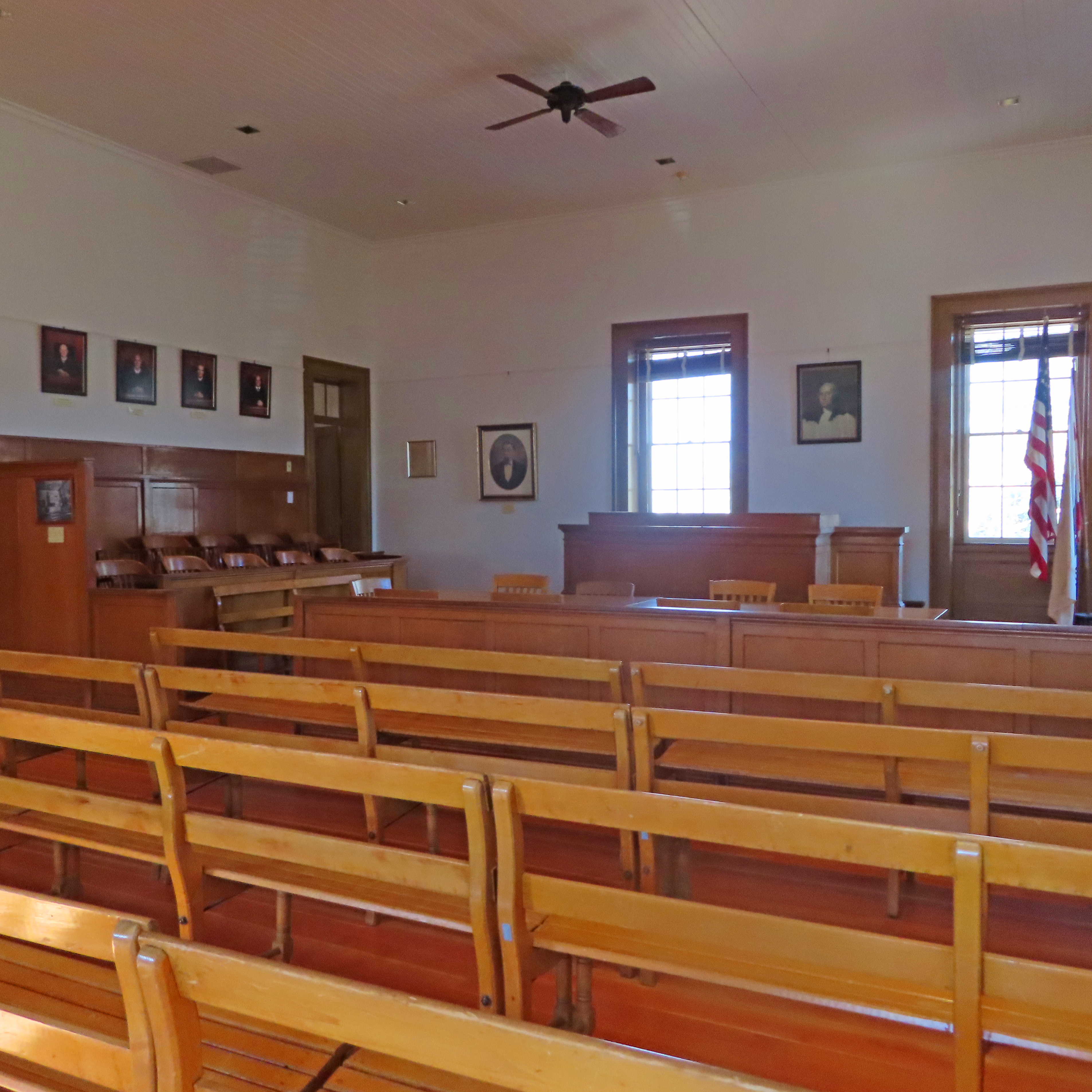
Indian Rock State Historic Park Museum

Indian Rock State Historic Park Museum
On this driving tour from Jackson to Angels Camp you will experience California's historic Gold Country. We will cruise along Highway 49, taking a few detours along picturesque backroads to learn about the Miwok Native Americans, who lived in the area long before early pioneers swarmed California in search of their fortunes Along the way we visit a number of Gold Rush towns, each western boom-style town offers a unique picture into the life of the early pioneers and gold rush miners. While you wind your way through these towns, you'll also hear tales about the outlaws Joaquin Murrieta and Black Bart, and find out how literary hero's, Mark Twain and Bret Harte have ties to Angels Camp.
On this tour, you’ll also have the opportunity to:
• Learn about the California Gold Rush from a miner’s prospective
• Explore Kennedy Tailing Wheels Park and learn how miners dealt with the tons of waste product that hard-rock mines produced
• Visit Jackson Rancheria Casino and learn the history behind its creation
• Take in the awe-inspiring Black Chasm Cavern and view the unusual helictites (a type of cave-formed mineral) that make this a National Landmark
• Hear how Angels Camp became known as Frogtown USA
• Wander through the old western-style gold rush towns of Volcano, San Andreas, Mokelumne Hill, and Angels Camp with the help of our nifty brochures
This tour is the third in a series of four driving tours that explores the California Gold Country and covers the area from Auburn to Jamestown. This 65-mile driving tour may be completed in about two and a half hours without any stops. On the other hand, this is your adventure. You may stop where you want, when you want and for as long as you want. It’s up to you. Or just use this guide to create your own trip. Happy Adventures and enjoy the tour!
+++
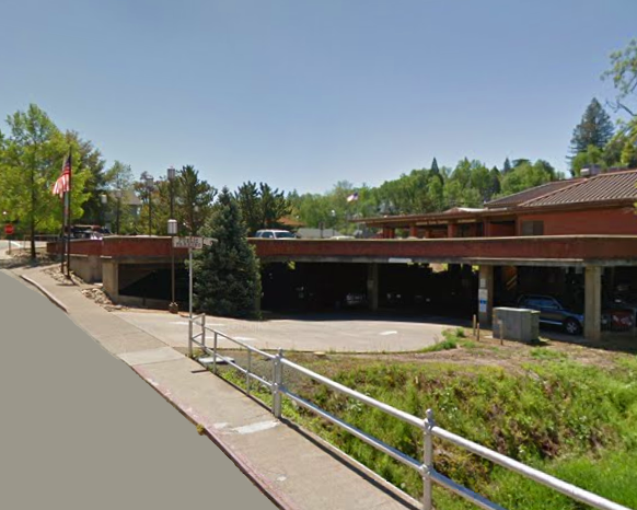
This driving tour begins at the public parking lot for the Jackson Civic Center, located at 33 Broadway Street, Jackson, California.
We drove through the historic Old Town of Jackson on our last driving tour from Placerville to Jackson. If you did not take that tour and you would like to explore this town on foot, there is a self-guided walking tour of Jackson in our companion brochure.
Now, before we start on our driving here is a bit of background on the City of Jackson.
Jackson is located near the forks of two small creeks which have their heads in the Mokelumne River. This was a favorite place of gold seekers in 1848. Early miners left behind numerous bottles near the creek, leading to the towns first name, Bottilleas, which is Spanish for bottles. In 1849 the name was changed to Jackson Creek after local attorney, Colonel Aldan Jackson.

Early prospectors mined the easy pickings of gold out of the creek bed quickly. Once unable to make a day’s wages panning, miners turned to prospecting gold in California Mother Lode's rich mineral deposits. In 1851 gold was discovered in a quartz rock ledge nearby and another rush began in Jackson, this one, lode or hard-rock mining. That same year a post office was established, Jackson was incorporated, and mail was delivered by stagecoach. In 1853 Jackson became Amador’s county seat.
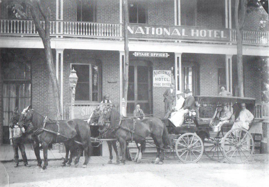
As the town of Jackson grew, wood and canvas buildings spring up along Main Street. In 1855 they were destroyed by fire, which was all too prevalent in early gold rush towns. Merchants quickly rebuilt, only to be hit by fire again in 1862. Within two years buildings rose from the ashes, this time they were constructed mostly out of brick or cement.

In the late 1800s the Kennedy, Argonaut and Zeile hard-rock mines were paying off richly. The success of these mines laid the economic foundation for Jackson. By the turn of the 20th century Jackson had 3,000 residents, a few churches, several saloons, gambling halls, grocery stores, boarding houses, a physician and dentist as well as a girls dormitory. This was the name insurance maps used for houses of ill repute.


Our driving tour begins with two optional stops as we leave the City of Jackson, the Amador County Museum open Friday through Sunday starting at 11am and Kennedy Tailing Wheels Park which is open daily.
So let's head off now. Exit the parking lot and turn left onto Broadway. At the corner, turn right onto Water Street and left onto Summit. Follow the signs for the Amador City Museum.


The Amador County Museum is located in an 1859 Greek Revival-style home. The rooms of this home are set up with exhibits and collections, including a gold history exhibit, fashions of the past, a Native American collection and Chinese American collection. The front of this building is shown below.

When you are ready, continue along Summit, and turn left onto North Street then right onto North Main. Our next stop, Kennedy Tailing Wheels Park is in about 1 mile. Along the way you will pass the historic Catholic and Serbian cemetery, as well as a Victorian-style home subdivision.


After passing the Jackson Gate Inn watch for the Kennedy Tailing Wheels Park sign and turn right into the parking lot. There is a public restroom at this park and parking is free.

This park features iconic symbols of the City of Jackson, the Kennedy Mine tailing wheels. These wheels were designed by James Spears to remove mine tailings, the waste created during the hard-rock mining process. When running at full capacity, Kennedy Mine created approximately 850 tons of tailings every twenty-four hours.

Originally, mines would dump their tailings in a nearby creek. In 1913 a California law was established to prohibit this action, requiring mines to impound their tailings or close their operations. Four giant wheels connected by flumes were erected to shuttle the Kennedy Mine waste to an impound area 1/2 mile away.
The Kennedy Tailing Wheels Park is an outdoor exhibit which features the remains of two of the four Kennedy Mine Tailing Wheels. Wheel #3 now a tangled array of steel, lies broken on the ground.

While Wheel #4 has been fully preserved and stands as it once did a full 58 feet in diameter.

Kiosks around this park include historical photographs and information about the engineering of these wheels.

Once you have learned all there is to learn about the tailing wheels, exit the parking lot and turn right. Watch for China Graveyard Road and turn right.


At this stop you have the opportunity to play video slots, video Keno, poker or try your hand at over 30 table games including Texas Hold ‘Em, Blackjack, Four-Card and Three-Card Poker. Or if steak is your game enjoy lunch or a sunset dinner on the terrace at the Lone Wolf Restaurant Steakhouse and Lounge. Voted Amador County’s best casino. You must be 21 years of age to enter the casino or the restaurants.
At the stop sign ahead, turn left onto New York Ranch Road and continue straight while I tell you the story of Margaret Hughes Dalton and the history behind the Jackson Rancheria Casino.

Margaret Hughes Dalton was born in 1940 in Tuolumne, California to a Native American mother and non-Native American father. It was the dream of Margaret and her husband Earl to make their small Band of Miwok Indians self-sufficient. They knew in order to do this they had to form their own government to strengthen their position while dealing with local, state and federal governments. The Tribe met in 1979, established a government and elected Margaret Tribal Chairperson, a position she held uncontested for 30 years. In 1980, Earl died, leaving Margaret to pursue their dreams on her own.

Five years later the Tribe opened their first Bingo Hall on the Jackson Rancheria property. It was a rocky start. The hall opened and closed several times over the next decade. In 1998 California voters approved Proposition 5, the Tribal Government Gaming and Economic Self-Sufficiency Act. The following year Margaret’s Tribe signed a contract with the State of California and by 2000 gaming on tribal lands was legal.
Over the years that first Bingo Hall has grown into a grand casino complex which includes a hotel, restaurants, general store and gas station. It took a number of decades, but Margaret and Earls' dream came to fruition, their Tribe is self-sufficient, and Jackson Rancheria Casino Resort is the largest employer in Amador County.

Continue past the authorized vehicle entrance for the Jackson Rancheria Hotel and watch for the signs for the casino. Turn right into the entrance of Jackson Rancheria Casino. There will be two welcome signs in front.


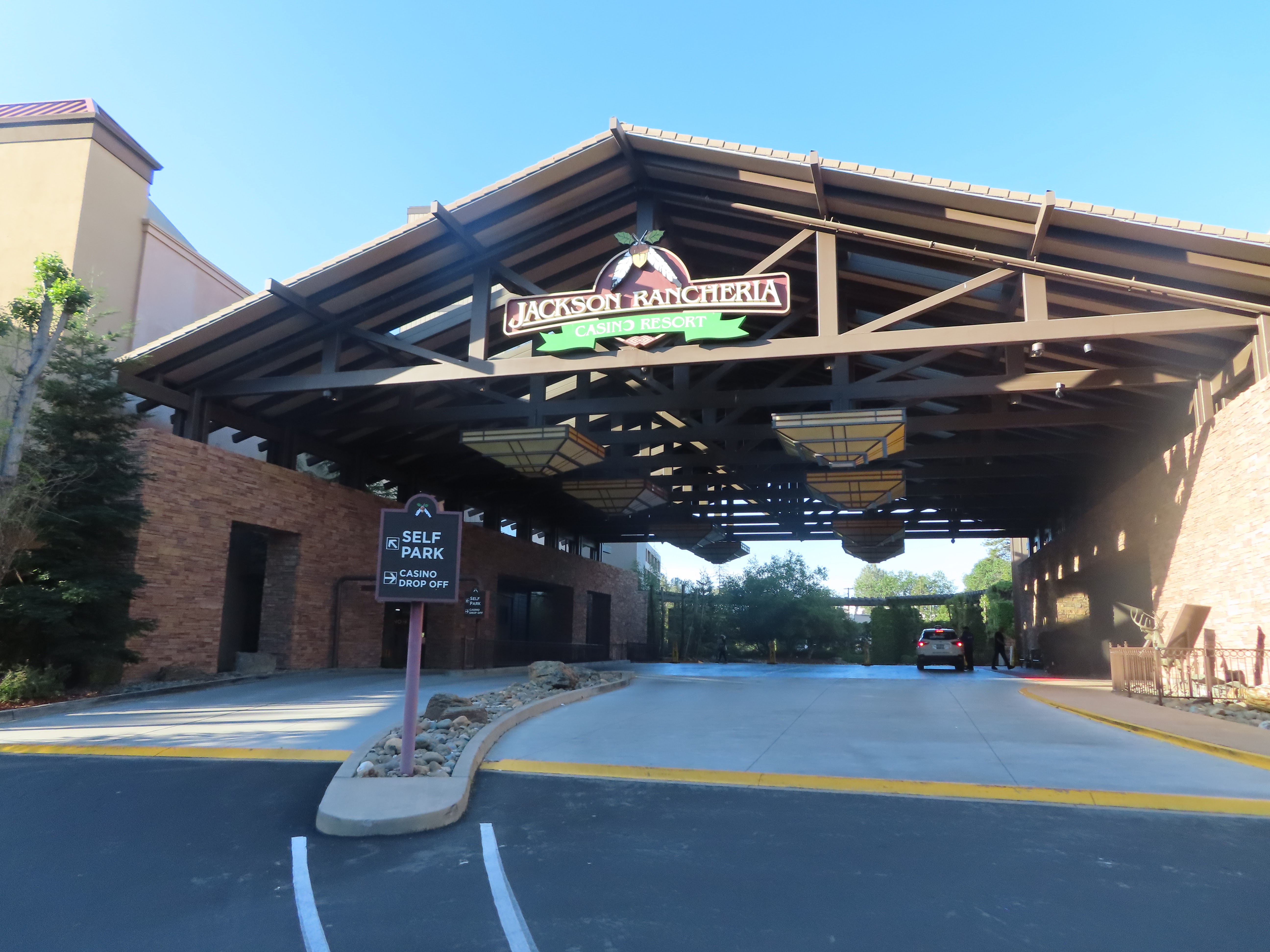
Continue straight up the hill. Follow the road and arrows toward the hotel and casino and self-parking. The self-parking is just past the statue of the eagle and to the left of the main entrance to the hotel and casino.

Enjoy your meal at the Lone Wolf restaurant or the Pacific Grill, take in a game or two, then head back out on the highway by turning right back onto New York Ranch Road.

In about 1 mile you will come to a traffic signal. Use the right lane to turn right onto Ridge Road and continue straight toward Pine Grove.

Ahead on your right watch for the Ferris wheel, bumper cars and variety of metal animals. This property is what locals call Amador Castle. It is owned by slightly eccentric wealthy entrepreneur John Hertzig who enjoys purchasing things that make him happy and putting them on his property for others to enjoy from the road. Locals and visitors appear to be in favor of the metal menagerie, which John continues to add to whenever he finds something that just makes him smile.
After Amador Castle watch for the turn off ahead. Here Ridge Road forks to the left. Turn left and follow Ridge Road.

The Isthmus of Panama (1850 by Charles Christian Nahl)

San Francisco 1848
In our driving tour from Placerville to Jackson, we learned about his experience in San Francisco, his subsequent journey to the mines in Latimer Gulch near what is today San Andreas, California, and his first gold strike at Alabama Gulch just east of what is today the town of Jackson. In his first gold strike, John made .20 cents. Not quite enough to pay his weekly room and board at Angiers boarding house of $10, but enough to fan the flames of his gold fever.
On this driving tour we continue with John's story. Though he did not have much success, John Doble continued to work the Alabama
Gulch near Algiers. Here is an excerpt
from his journal dated February 8th, 1852.


Working the Placers 1850


+++
Use the left lane at the traffic signal ahead to turn left onto California Highway 88 and follow the sign toward Silver Lake.
Shortly we will arrive in Pine Grove. Located on the wagon road that ran between Jackson and Volcano, John would have traveled this way often. It's main establishment, the Pine Grove House was built in 1856.

Pine Grove House 1917
Twice destroyed by fire, the Pine Grove House was rebuilt in brick in 1901. In 1977 it was purchased by Al Giannini who turned the roadhouse into a restaurant. Giannini’s has been in continuous operating ever since.

Giannini's Italian Restaurant will be on your left as we pass through the town of Pine Grove. Once through this town watch for the intersection of Pine Grove Volcano Road and turn left toward Indian Grinding Rock State Park and the town of Volcano.
Continue Straight on Pine Grove Volcano Road we are about 2 miles from Indian Grinding Rock State Historic Park. This state park is nestled in a little valley surrounded by lush meadows, and filled with large valley oaks.

Slow and watch for the entrance on your left for Indian Grinding Rock StatePark. This park is open daily 10 to 4. Turn left into the entrance and proceed to the ranger station. Once you have paid your parking fee you are ready to explore the area. You may use the map below or the information in the Companion Brochure.

Inside the park is the very informative Chaw’se Regional Indian Museum which features a large collection of Sierra Nevada Indian artifacts.


Outside the museum use the trails to access the large outcropping of limestone which is covered with over 1,000 mortar holes. This is where the Miwok women prepared the acorn, their most important food source. Placed in the holes of the rock, the acorn was pounded into a fine meal by a stone pestle and then cooked in water to make a kind of mush.


Visit the reconstruction of a Miwok village and the ceremonial roundhouse which is used today by Tribes for various social gatherings. When you are finished exploring the park, exit the park the way you arrived along Indian Rock Road and turn left back
onto the highway. We are on our way to Volcano a tiny historic town with a population today of around 100 souls.
The first to prospect the Volcano area were soldiers from Colonel Stevenson’s army. They arrived in California in 1846 and were
discharged in 1848, just in time to catch gold fever. While mining, the soldiers said the rock
formations reminded them of a volcano. The name stuck, and Volcano was
born.
Early mining here was quite profitable, as noted by Bayard Taylor in his book
El Dorado: Adventures in the Path of Empire, “In 1849 one miner took out $8,000
worth of gold in a few days, and another, got 28 pounds of gold from a single
pocket.”
After working the gulches near Algiers Roadhouse, John Doble packed up his tools and set off for Volcano. It was there that he spent most of his life. Here is an excerpt from his journal dated June 23, 1852.
“I arrived at Volcano a lively town, with some 300 clapboard houses, and many hotels, and gambling houses. I stopped at Volcano House to inquire about lodging and met Smith. He has just finished a house at the spring and offered me a place to lodge for $2 a week. I prefer sleeping on the floor and the Volcano House is full of vermin. Man has to be very sleepy to sleep among them. Being Smith’s house is new I reckon it is clear of vermin. I accepted his offer.”
Veer right ahead toward Volcano and the 3-story St. George Hotel will come into view. Veer left in front of the hotel, which was built in 1862, onto Main Street.


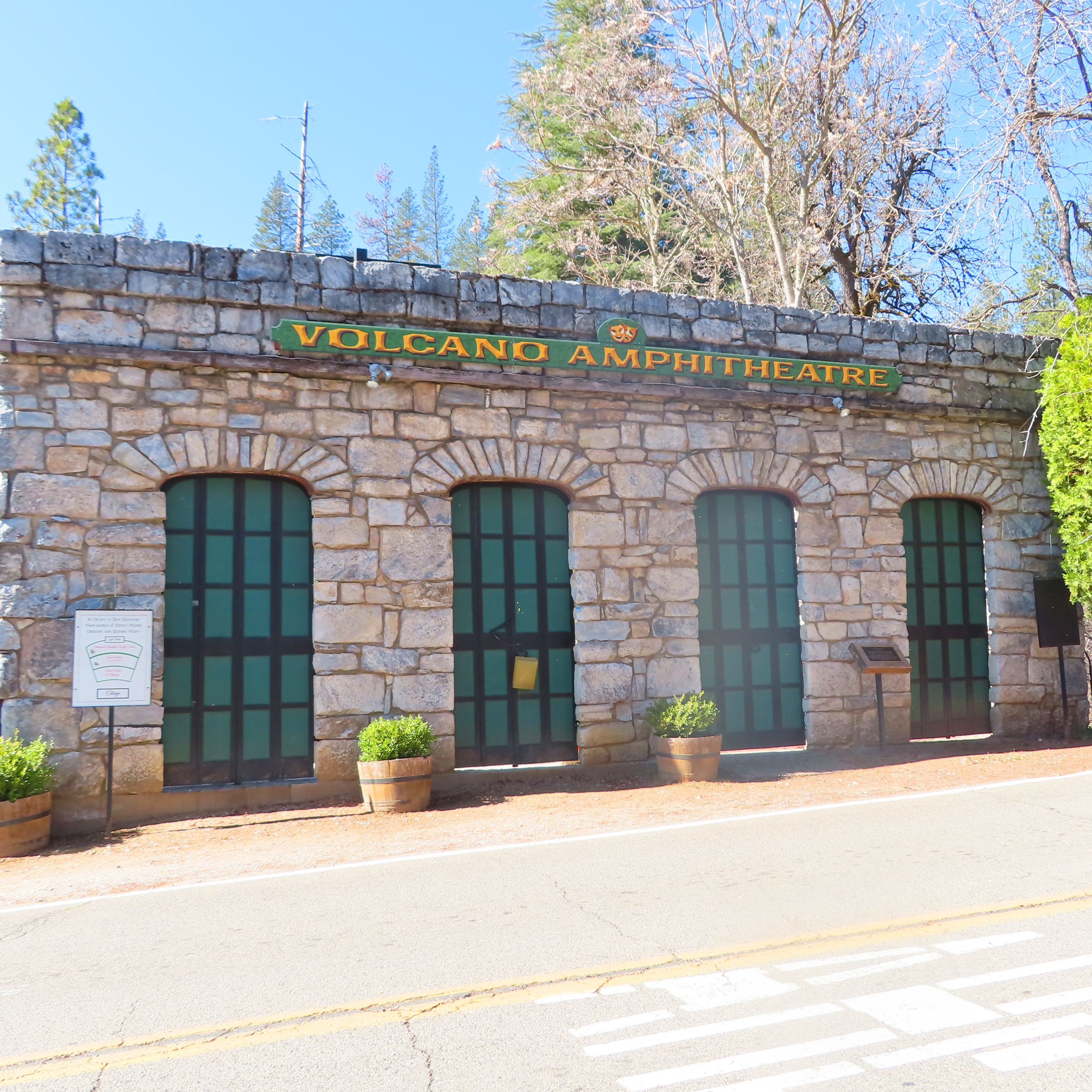


When you come to the corner, look to your left. There are a number of historical markers here, including the historical marker for the town of Volcano itself. Turn right onto Consolation Street.


Then make the first left onto Emigrant Street. As you turn to the right is the King bell, donated to Volcano by Thomas King in 1863, out of gratitude for the towns support of the Union and election of Abraham Lincoln in 1861.

At the intersection ahead carefully cross Consolation Street and continue straight on Plug. Turn right onto National Street and pass by the Volcano schoolhouse. Just past the schoolhouse there is a public parking lot near the corner of Jerome and National Street. Park here if you would like to explore the town on on your own. You will also find a public restroom just off this parking lot.


Though we can not know for sure, it is quite likely that the Miwok people who lived in this area well before the miners arrived, were also familiar with the Black Chasm Cavern.

Living along the rivers and streams nearby, the Miwok were hunters, gatherers, fisherman and basket weavers. They lived a rather undisturbed existence until the arrival of military explorers, fur trappers and settlers of the early 1800s.
But it it would be the California gold rush in 1848, and the influx of over 300,000 migrants into the Sierra Nevada area that had the greatest negative impact on the Miwok way of life.
Though some of the Native Americans remained and tried to assimilate, mining the placers or working on ranches, most were pushed further and further away from their natural hunting and gathering grounds. As the Miwok dispersed, many lost their heritage over the decades that followed.
Today the population of the Miwok is around 3,500; far less than the 6,000 plus that were here during the gold rush. But along with Margaret Dalton who worked to bring her Tribe to self-sufficiency with the creation of the Jackson Rancheria Casino, other Miwok Tribes are currently organizing and handing down their heritage to the next generation, bringing hope that the Miwok population will continue to grow.
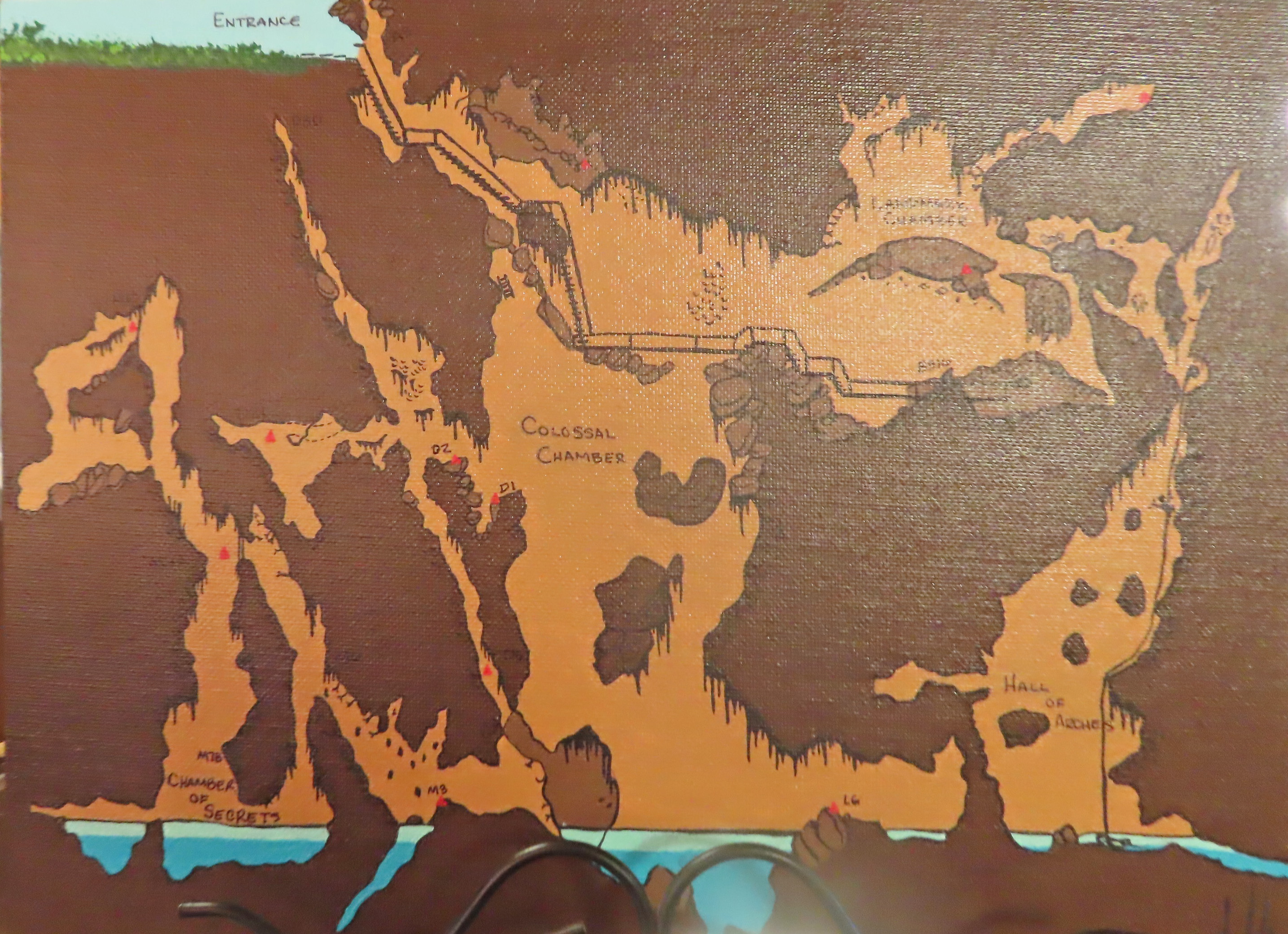
Map of Cavern


Staircase in Black Chasm
On July 2nd, 1852 John Doble wrote of his experience exploring a cave near Volcano. His description of three chambers and hanging stalactites sound like John might very well have been inside what years later would be known as Black Chasm Cavern. In his journal he noted:
“This forenoon done nothing. After dinner I went up the South Branch to see a cave there. I found an Irishman up there who went in with me. The entrance is in a large pile of rocks on the hill side about 30 feet above the branch. It is a small irregular hole and goes down perpendicular about 20 feet and then goes off downward in a slant 10 feet farther then opens into the cave. We clambered down letting ourselves down by the projections of the rock holding in one hand a candle. I then clambered all through it, in many places I had to crawl on my hands and knees. It consists of 3 rooms of irregular and rough shape, sharp points of rock which are hanging stalactites stick out on every side, as well as the roof. The whole inside above the floor is full of stalactites like icicles. Some are broken off. I broke a few off and brought them home with me. The floor at the bottom is damp and covered with a dark vegetation.”
It sure sounds line John was exploring Black Chasm Cavern.
Continue along Highway 26, we will be on this stretch of highway for 25 miles as we make our way to
Mokelumne Hill. Along the way we will pass through the old gold rush towns of West Point, Glencoe, Rich Gulch and Happy Valley. While you drive we will tell another gold rush story.
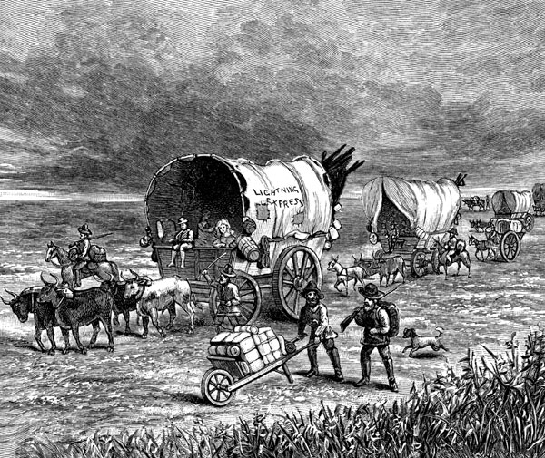
Lightening Express - Wagon Trains
Other gold seekers took the overland trip to California. One wagon train, the Pioneer Line's advertisement read, “Comfortable ride from Independence, Missouri to California, $200 in only 55 days.” The $200 price tag of this all inclusive adventure covered transportation, food, and space for 100 pounds of baggage per person. Inclement weather, disease, exhaustion and starvation were included at no additional cost.

California Emigrants - Wagon Train

Just a few days out two men died of cholera and others were infected. The dead were buried along the road and the journey continued. When the wagon train reached the North Plate River, it proved too difficult for the oxen to cross on their own. The first of many additional costs occurred as a ferry was hired to shuttle the oxen.

Emigrants Fording the Platte

Traveling to Goldfields
The life of a miner was not an easy one. These men, and some women, left their homes taking little with them to a very rugged country. They bet it all in hopes of making a fortune, then returning home to their families and continuing with their lives.
The truth is not everyone made a fortune, most were not at all successful at mining. In fact, not everyone even made it to California, dying on the way from starvation or disease. Those that arrived didn’t find a home built waiting for them upon their arrival. They didn’t find fireplaces for cooking or wash boards for washing either. And general store's for purchasing daily necessities were typically miles away from the small mining camps that sprang up along the rivers of the Mother Lode. Still the miners came. They built canvas tent houses, and shared cooking and washing duties with other miners.
Some of the towns, such as Jackson, and Angels Camp became extremely prosperous. Their quaint western style downtowns remain active to this day. Others such as the ones we are driving through now on Highway 26 contain just a few buildings, and a modest population. These small towns along Highway 26 were the ones John Doble frequented the most. It was here that he spent hours panning, digging and washing gold.
By August 1852, our friend John Doble had been panning and washing gold throughout Volcano and its surrounding area. After having lived in both boarding houses and tent cabins, John was ready for a place of his own. With what he had saved from mining, John partnered with his friend Doc. They purchased a small piece of land and set about building a cabin.

John wrote about the building his cabin in his journal: “Doc and I went up to the mountains to cut the lumber for our house. By the 17th of October we had what we needed and began working full time on the cabin. Within a week the walls and roof were complete. The rock chimney was finished on the 1st of the month, and the canvas door hung a few days later.”
John and Doc moved their belongings, a few blankets, picks, and shovels, into their home in the evening of November 4th less than 30 days after beginning their project.

We are just a few miles from West Point. The story of West Point is quite possibly part legend and part truth. Some historical references say that while seeking a path across the Sierra Nevada Mountain Range, American frontiersman Kit Carson discovered West Point in 1844. It was the farthest point west Carson was able to reach before being blocked by the high waters of the Mokelumne River. After waiting unsuccessfully for the river to recede, Carson proceeded up the Mokelumne Canyon and created what is now known as Carson Pass through the Sierra Nevada range. Though other historians do not place Carson in West Point, the Carson Pass trail does indeed run along what is today California Highway 88 from Jackson to the Nevada border and West Point is in the general vicinity. The Historic Marker (shown above) also gives credit to Kit Carson.

Born in 1809, Kit Carson was a frontiersman, trapper, and soldier. He teamed up with General John Fremont and the two of them conducted three expeditions mapping out routes from Missouri to California between 1842 and 1845. It was on their second expedition from July 1843 to July 1844 that Carson may have come across West Point.

In 1848, miners making their way south from Coloma looking for open claims arrived at the Mokelumne River, and found it rich with gold. After the placers ran dry, prospectors continued their search for gold in rich quartz deposits nearby. The large number of individual lode or hard-rock mines were consolidated into the West Point Mining District and worked until the 1940s when logging became West Point’s main industry.

Lumberjack Days

Pass the one short block of western style buildings, the West Point Market and Willow Bar on Main then follow Main back to Highway 26. Just before you get to Highway the Historic Marker for West Point will be on your left. The coordinates for this marker are 38.397734, -120.529353. When you get to the end of Main, turn right back onto Highway 26. Cross over the Middle Fork of the Mokelumne River and continue straight. Follow the sign toward Mokelumne Hill.

Mokelumne River Near West Point
The Mokelumne River flows west from the Sierra Nevada, 95 miles into the Sacramento – San Joaquin River Delta. The name is from the Miwok language constructed of the word moke meaning fishnet and umne meaning people of. Or people of the fishnet. Mokelumne Hill was named after the river in 1850.
Besides being a popular site for fishing, the Mokelumne River is also home to five whitewater kayaking runs ranging from Class II fun and splashy all day long to Class V, no guts, no glory!


Our friend John Doble visited this area in June of 1852. Here is the excerpt from his diary.
"This morning cool clear and a light frost. Doc, Abe and myself packed up a horse with tools blankets and provisions for 3 days for a prospecting trip up among the forks of the Mokelumne. We started after breakfast and went up by Mosquito Gulch and Browns Ranch and crossed the South Fork at the lower crossing. We then steered north to the Quartz Mills on the Middle Fork, crossed this and arrived around noon to start prospecting."
"We prospected some bars but found little. Went up the river and prospected some bars and a gulch but found nothing that would pay, so we packed up and went back down the river. Found a spot near the river, cooked some supper with a drift wood fire, laid down and went to sleep."


Ballou's Pictorial Drawing Room Companion
During these years, John kept his journal religiously. It was his habit to record the weather, his expenses such as the price of bread and meat, and record how much he made from any claim he mined. But for some reason, his journal ends Saturday, February 11th, 1854 with this entry.

A Day in the Life of a Gold Miner
“Rained very hard during the night and caved in a part of the bank and smashed one of our boxes, flooding our hole so there was much time this morning spent doing repairs. We fixed up what we could but could not get enough water to do much so we quit till we can get some water. Mining has improved considerable since the rain set in but the Town does not present as lively an appearance as it did last fall. A report has lately reached us that the United States has bought a part of Northern Mexico with Lower California which has created considerable excitement. Many are making their preparations to go there, as it is supposed to be as good mining country as any part of California."
Though another journal was not found, John’s letter's from 1856 to 1865 fill in the rest of his story which we will finish shortly.

Up next is the tiny town of Glencoe, formerly called Mosquito Gulch this is the area John and company walked through to get to Sandy Gulch. Glencoe was first worked by Mexicans in the early 1850s. Before stamp mills were introduced the Mexican prospectors used an arrastra to pulverize the ore and separate the gold. This system in its simplest form required dragging two flat-bottomed stones around a circular pit using either mule or human power to turn the stone. Unfortunately, there is not one gold rush period building or artifact left in Glencoe.
John remained in contact with his brother Abner and sister-in-law Margaret in San Francisco. Writing and visiting whenever possible. Abner hoped that John would eventually give up his dream of making a fortune gold mining and come and live on the Doble Ranch in San Francisco. Margaret had hoped to marry John off to one of her friends, as she had been successful in finding a match for six out of the seven Doble siblings.

Margaret wrote January 14, 1861, “Dear Brother: The last of the Dobles, your sister, is to be married soon. Have done pretty well with six inside of five years. Hurry up now and add your name to the list before the five years are fairly out. It will never do for you to be the ‘lone’ one of the family. Yours truly Margaret B. Doble.”
John did decide to try something other than mining. In January 1857 he was appointed Deputy Sheriff of Amador County and in September of that year elected Justice of the Peace. He held this office until October 1861 when he was elected Associate Judge of the Court of Sessions in Jackson. Two years later in 1863 John finally joined his brother Abner in an iron working business in San Francisco and lived in a cabin built off the back of the shop.
That leaves us with John’s marital status.
John had told Margaret that he found the women in Volcano "a bit rough around the edges," so with no options in California, Margaret gave John the name and address of a friend of hers in Pennsylvania. She hoped her bachelor brother-in-law and old maid friend might strike up a romantic correspondence.

John responded July 22, 1864: "Your unusually interesting letter of the 24th came duly to hand and was read with much pleasure, and I would say joy if I was not afraid of stretching the truth too much. But indeed I was highly gratified to learn that one so noble and just in sentiment as you are should have found a congenial spirit with whom she could travel down life's varied course. I shall ever cherish in my inmost soul a warm feeling of thankfulness to one whom I deem so good for her kind and friendly wishes towards one as unworthy as myself. It is my earnest wish that you will find in your expected husband all that your heart or mind can desire."


John's last letter to Lizzie was written from San Francisco August 8, 1865. He would have been 37 years old. Here is an excerpt from that letter.

Nothing more is known about the life of John Doble. We leave it to your imagination as to what might have happened next. Did he go on to live many more years and get married or did he succumb to small pox? We will never know for sure, but we will always have his story from 1851 to 1865 in John Doble's Journal and Letters from the Mines edited by Charles Camp and published by Volcano Press in 1962.
Continue along Highway 26. Pass through the town of Happy Valley, originally settled in 1849 by a group of emigrants from France and we are on to Mokelumne Hill.


Chili Gulch Historic Marker
Along Highway 49 you will pass another historical marker, this one for Chili Gulch. The marker notes the gulch as one of the richest placer mining sections in Calaveras County. It received its name from the Chileans who worked the gulch in 1848 and 1849.
The legend of Joaquin Murrieta has grown so large over the years it is difficult to separate fact from fiction. His exploits were fictionalized in the novel The Life and Adventures of Joaquin Murrieta written in 1854 and he is known as being the inspiration for the fictional vigilante Zorro.

According to researcher Frank Latta who spent much of his life in search of the historical Joaquin Murrieta, Joaquin and his wife Rosa left Sonora Mexico in 1849 to join Joaquin’s half-brother working the mines in Calaveras County. Shortly after arriving Joaquin’s wife was raped, and his brother was accused of stealing a horse and hung. Joaquin himself was expelled from working the mines. For these reasons, Joaquin turned to a life of banditry, vowing revenge on the Americans who had carried out these injustices upon his family.
Joaquin formed a gang of several well-organized bands, one led by himself, and the rest led by his trusted Sonoran relatives. These bands killed at least six of the Americans who had lynched his stepbrother, they robbed and killed miners as they returned from the minefields, and ran an illegal horse trade driving captured mustangs from the Central Valley to the Sierras. By the 1850s, newspapers were reporting an outlaw named Joaquin terrorizing California.
In 1853 California Governor John Bigler, published a warrant offering a $1,000 reward for the capture of Murrieta, either dead or alive. On July 25th of that year, a group of California Rangers led by Harry Love came upon a group of armed Mexican men on the edge of the Diablo Range near what today is the town of Coalinga. There was a confrontation and three of the Mexicans were killed. The rangers claimed that one of the dead was Juaquin Murrieta and collected the reward.

San Andreas' town history records Joaquin Murrieta as a resident in the 1850s.
Charles Boles, also known as Black Bart, one of the most notorious stagecoach robbers to operate in California, also has a connection to San Andreas.

Born in 1829 in Illinois, Boles prospected gold near the American River in 1848. In 1862 he joined the army and fought in the Civil War on the Union side until 1865 when he returned to the California gold mines. It was at that time that Boles had a run in with some Wells, Fargo & Company agents and vowed revenge against the organization. He adopted the name Black Bart and began robbing Wells Fargo stagecoaches. He is credited with 27 successful hold-ups. Wells Fargo offered a $250 reward for the arrest and conviction of this stage robber.

Noticing what appeared to be rifles protruding from the boulders on the hillside and assuming they were armed bandits, the driver handed over the Wells Fargo strongbox. Once Bart had left with the loot, the driver discovered that what he thought were men with rifles, were carefully placed sticks.
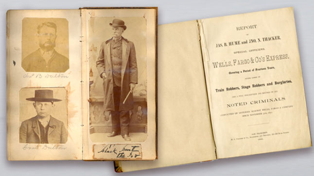
Hume's Mugbook
Bart’s last holdup was November 3, 1883. At this one he made a grave mistake, and left behind a handkerchief with a laundry mark. Authorities were able to trace this mark to a San Francisco laundry and eventually to Bart himself. Bart was tried in a courthouse in San Andreas and sentenced to six years in San Quentin.


One of the most common misconceptions about San Andreas is that it is named after the San Andreas earthquake fault. Actually the fault was named after the San Andreas Lake in San Mateo County, through which the fault runs.
The town of San Andreas, is named after the first church that was built here in 1848, San Andreas or St. Andrew.

Besides placer and hard-rock mining other business ventures sprang up in San Andreas. By 1856 the town was filled with grocery stores, a livery stable, bank, hotels, restaurants and of course more saloons and gambling halls. San Andreas became the Calaveras County seat in 1866 and remains so today.
Once you have finished exploring this town, exit the parking lot the way you arrived and turn right. Make the next right turn onto Pope Street. Then a left onto California Street and an immediate right back onto Pope Street. Continue on Pope Street for 1 mile.
We are on our way to The Red Barn Museum. This former dairy barn showcases Calaveras County’s rich history in agriculture, mining, logging, and ranching.


Post Office


When you are finished visiting the museum, exit the parking lot and return in the direction you came, by turning left on Government Center Road and right onto Mountain Ranch Road. Continue on Mt. Ranch Road as it veers left. Follow this road for about 1/2 mile. Use the left lane ahead the turn left at the stop sign onto Highway 49.
Continue along Highway 49. Our next stop is in about 11 miles, the cute western style town of Angels Camp. While you drive we will tell you the story of two American authors who have ties to Calaveras County, Bret Harte and Samuel Clemens, who you also know as Mark Twain.

Samuel Clemens age 15
Clemens was born in 1835 in Missouri. In 1861, he and his brother Orion traveled to Carson City, Nevada, Orion to assume duties as the Nevada Territory secretary, Clemens to escape fighting in the Civil War.

Statue of Mark Twain in Utica Park, Angels Camp
Samuel Clemens eventually took a job at the Virginia City newspaper, the Territorial Enterprise. It was while working this job in 1863 that he first signed one of his articles with what would become his pen name, Mark Twain.

Mark Twain's desk when he was editor of the Territorial Enterprise

Replica of Cabin at Jackass Hill (37°59'57.6"N 120°28'38.8"W)
.jpeg)
During his stay at Jackass Hill, Twain would frequently visit the saloon at the Angels Hotel in Angels Camp. It was during one of those visits Twain is reputed to have met up with an old acquaintance, Ben Coon, from his days as a riverboat pilot on the Mississippi. Coon recounted a story he had heard about a fellow who would bet on just about anything, even his pet frog. The tale goes like this.

Mural on side of Angels Hotel
There once was a man by the name of Smiley who was so proud of his pet frog Daniel Webster that he carried him around in a box, showing him off at every opportunity. Daniel was know to boast loudly to any one who would listen, "My frog Daniel Webster, he can do somersaults and make long leaps on my command. Why, I would bet that he could out jump any frog in all of Calaveras County. In fact I know he can." A stranger overheard Smiley’s boasting and said, “I don’t see any difference in your frog from any other old frog that could be caught in the town cistern. Why, if I had a frog of my own, I would be willing to bet.”
Leaving Daniel Webster with the stranger, Smiley went off to fetch a suitable challenger for this bet. While he was gone the stranger surreptitiously fed Daniel Webster a handful of buckshot. Upon Smiley's return, the two set out to compete. Smiley gave his frog the command to jump, but Daniel Webster would not budge, due of course to his stomach being full of buckshot. Having easily won the competition, the stranger quickly collected his money, and left town.

Historic Marker at Twain Cabin on Jackass Hill
After hearing this story, Twain returned to the cabin on Jackass Hill and wrote "The Celebrated Jumping Frog of Calaveras County," the book that launched his publishing career.
In all Twain wrote five versions of this jumping frog story, only three of which were actually published. Angels Camp has kept the spirit of Smiley and his frog Daniel Webster alive to this day by celebrating the Jumping Frog Jubilee on the third weekend of every May. Frog-shaped brass plaques line the sidewalk along Main Street in Angels Camp. These salute each year's winner of the annual contest. The world record is currently held by Lee Guidici whose frog Rosie the Ribiter, jumped 21-feet, 5-3/4 inches in 1986. Quite the leap when you compare it to Smiley's frog Daniel Webster's 0 feet, 0 inches in 1865.


Bret Harte was born in Albany, New York in 1839. His father died when Bret was young and his mother moved to San Francisco to make a living to support her children in 1853. The following year she had earned enough to bring her two youngest, Bret and his sister, to San Francisco to join her.
In 1855 at the age of 16, Bret caught gold fever and set off for the goldfields. Having little luck at mining he went on to try his hand at a variety of jobs: school teacher, pharmacists, law clerk and even an armed guard riding shotgun on stages for the Adams Express Company.
Finally in 1867 he landed a job as a typesetter. This position opened up a new opportunity for Bret, writing for newspapers and magazines. In 1866, while working for the San Francisco magazine, The Californian, Bret met Mark Twain. And although Twain’s jumping frog story “Celebrated Jumping Frog of Calaveras County” had been published a month earlier, it was not until Bret published it in The Californian that Twain's recognition and fame really took off.

Bret Harte 1871 (32 years old)
Bret went on to write a number of short stories and poems that romanticized the miners and the gamblers of the California Gold Rush. Most of these stories took place in Calaveras and Tuolumne counties. It was his short story, “The Luck of Roaring Camp,” published in August of 1868 in the Overland Monthly that pushed Bret to international fame.

By 1871, Bret's fame paved the way for an opportunity of a lifetime. An eastern literary magazine contracted to pay him $10,000 for one year in exchange for 12 stories. One written each month. His submissions which frequently arrived after the deadline, proved dull, and did not contain the excitement and flair his publisher and readers had come to expect from his earlier fame.
In 1878 destitute and struggling to support his young family, Bret appealed to friends in Washington D.C. He obtained a U.S. government job in Germany and leaving his wife and children behind fled to Europe finally settling in London.

Bret Harte 1898 (59 years old)
He spent the rest of his life in England, where he produced almost a volume of short fiction material annually. And though his wife never joined him in Europe, Bret did send money home to support the family. Bret Harte died in 1902 in Camberley near London.
We will be arriving in Angels Camp shortly. It is the only incorporated city in Calaveras County and has a current population just short of what it was during the height of the gold rush.

Downtown Angels Camp
Angels Camp is named after its founders Henry and George Angel of Rhode Island, who prospected the area for a short time. But like so many would-be miners they discovered more money could be made providing the miners with goods and services than laboring in the placers. They opened Angels Trading Post and the town grew up around them. The towns greatest prosperity came from the hard-rock gold mines established between 1880 and 1920.


Altavilla Schoolhouse
Ahead on your right watch for the red one-room schoolhouse. The Altavilla Schoolhouse was built in 1858 and was in continuous use to 1950. Follow the highway toward Sonora.

Coming up on your left shortly will be the Angles Camp City Museum. We are not stopping here, but note that it is a stop on our next driving tour of this series, Angles Camp to Jamestown. This museum which is located on the original land claim for Angels hard-rock Mine, consists of four buildings which feature collections of horse-drawn carriages, and mining equipment.


This was the main portion of old town. Buildings here were constructed between 1854 and 1937. The Odd Fellows building (shown above) which will be near the end of the block is the oldest and across the street, the Art Deco style Utica building was built in 1937. Turn right into the parking lot after the Utica Building. There is a bronze and stone historic marker at the entrance to this parking lot.

This historic marker at the entrance of this parking lot notes that the Angels Trading Post run by Henry and George Angel was located about 200 feet from this location. Across the street there is another historic plaque. This marker notes the location of the Angels Hotel, where Mark Twain heard the story of Smiley and his frog Daniel Webster. If you are interested in exploring Angels Camp by foot, please see the map below.


This is one of four companion tours of the California Gold Rush Back Roads and Highway 49 from Auburn to Jamestown. If you are interested in the next segment, we end our tour today in the parking lot where we begin our next driving tour, On the Road to Gold: A Highway 49 Driving Tour from Angels Camp to Jamestown. On our next tour you will have the opportunity to visit the town of Murphys, the Queen of the Sierra and Sonora, the Gem of the Southern Mines.
We will also be stopping at Columbia State Park and have stops at Moaning Caverns Adventure Park and the Natural Bridges Trailhead. Along the road you will hear more stories about the gold rush, including a number of hardy women of the gold rush. There will also be opportunities for wine tasting, dining and shopping.
Until next time, Happy Adventures!
Comments
Post a Comment