On the road to gold: A Highway 49 driving tour from Angels Camp to Jamestown

This blog follows my VoiceMap audio driving tour On the Road to Gold: A Highway 49 Driving Tour from Angels Camp to Jamestown. As you drive along some of California's most peaceful backroads, we will share the history of the California Gold Rush as well as the stories of some of the era's most headstrong women. This includes innkeeper Jennie Megquier, who caught gold rush fever three times without any success. We will visit the towns of Volcano, San Andreas, Angels Camp, and Mokelumne Hill. On this drive, you'll have the opportunity to visit Calaveras Big Trees State Park, Columbia State Historic Park and Railtown 1897 State Park. You'll also have the opportunity to explore several of the majestic wonders of the California Mother Lode, one of the state's best-known mining districts.
You may download a souvenir brochure for this tour here. We have also created a companion brochure, Hiking and Walking Tours of the Gold Country. Download that here if you are interested.
The audio driving tour, it is available at VoiceMap and listed under Calaveras County. To use VoiceMap, you will need to download the VoiceMap app from the Apple Store or Google Play. The app is free, this audio driving tour, which is one of four that takes you along the Mother Lode from Auburn to Jamestown currently sells for $11.99. Here is the link to the first blog in this series California's Gold Rush: A Highway 49 Driving Tour from Auburn to Placerville. Here is the link to the second blog in this series Hard-rock mining in California: A Highway 49 driving tour to Jackson. And here is the third Native Americans, Boomtowns and Literary Legends: A Highway 49 Driving Tour from Jackson to Angels Camp, California.
%20WIKIPEDIA.jpg)
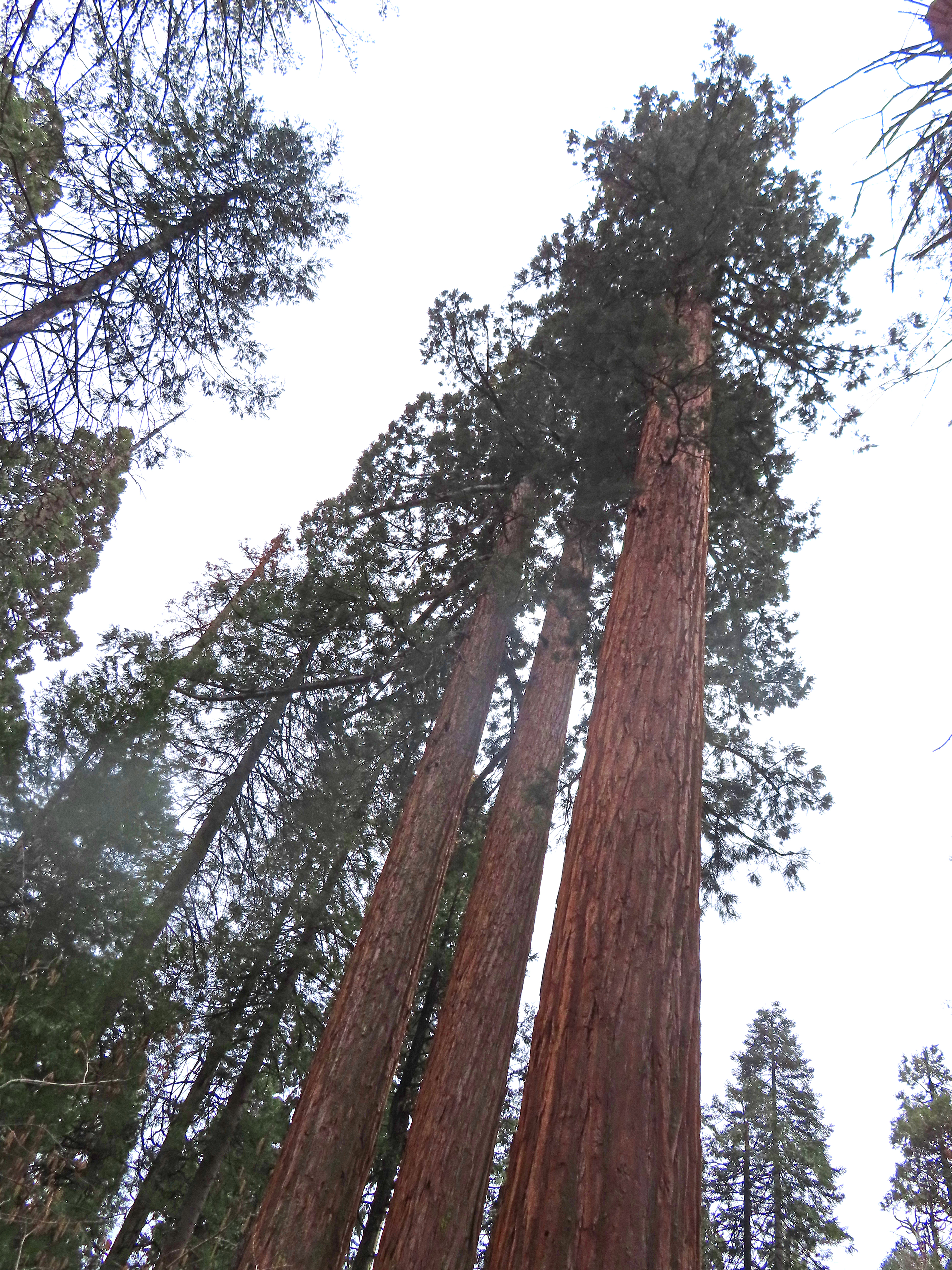
At the Calaveras Big Trees State Park, you’ll find the largest trees in the world, the Sierra Redwood which is also known as the Giant Sequoia. Well-preserved western streets await us at Columbia State Historic Park where you may experience the sights and sounds of a working gold rush town and try your hand at gold panning or take a ride on the stagecoach. You’ll be stepping back in time to the late 1800s with a visit to Railtown 1897 State Park in Jamestown where you may explore the railroad museum, roundhouse, and machine shop. In summer, on the weekends, you enjoy a ride on the Sierra #3 steam engine which sits proudly on the tracks in front of the station.
On this driving tour you can also look forward to:
• Learning how Jennie Wimmer knew that the mineral that James Marshall found at Sutter’s Mill was indeed gold
• Visiting wine rooms in the charming town of Murphys, known as the Queen of the Sierra
• Seeing the unusual stalactite and stalagmite formations in the Mercer Caverns and Moaning Caverns
• Hiking to see the unique ecological wonder of the Natural Bridges
• Finding out what it means to “see the elephant”
• Wandering the pedestrian-only streets of Columbia, a historically preserved western-style gold rush town
• Exploring the Railtown 1897 State Park and learning about the railroad and its connection to Hollywood
This 65-mile driving tour may be completed in about two and a half hours without any stops. On the other hand, this is your adventure. You may stop where you want, when you want, and for as long as you want. It’s up to you. Or just use this blog as a guide to create your own trip. Happy Adventures and enjoy the tour!
+++

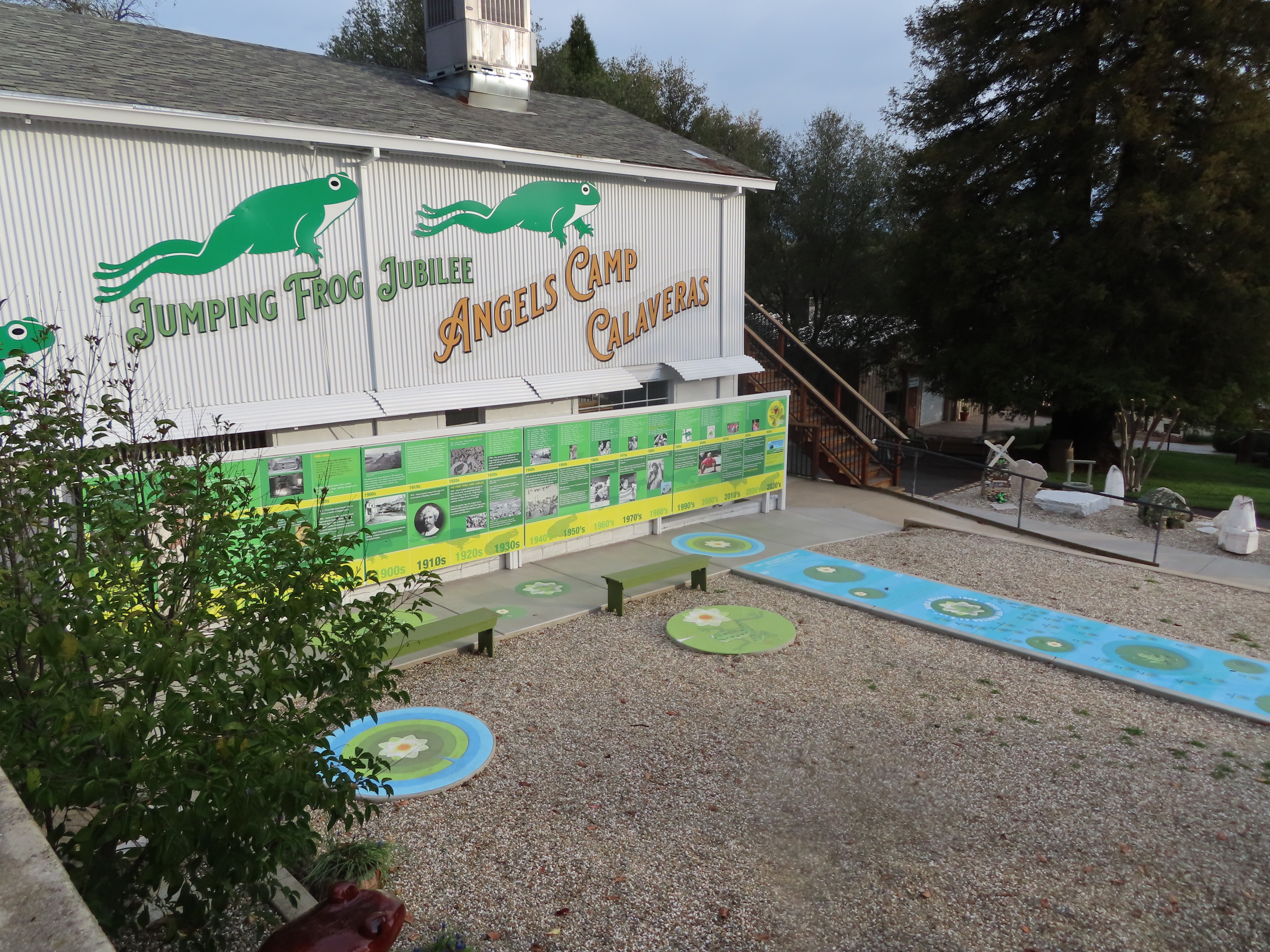
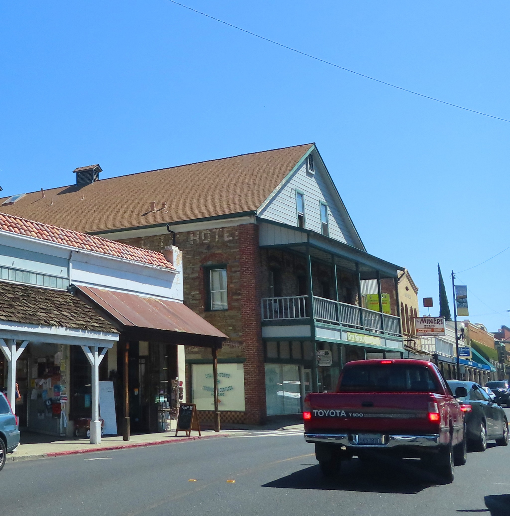
This driving tour begins in Angels Camp, California in the public parking next
to the Art Deco-style Utica building on Main Street. The bronze and stone
historical marker for Angels Camp stands at the entrance to the parking lot.
If you would like to explore Angels Camp before we set out on the driving portion of this tour please use the map in our Companion Brochure.
We covered much of the history of Angels Camp in our previous driving tour
Jackson to Angels Camp, so here is just a brief overview of the history.
Angels Camp was named after Henry and George Angel of Rhode Island, who
prospected the placers nearby for a short time. These brothers discovered they
could make more money selling goods to the miners and opened a trading
post. After the placers ran out, quartz
mining took off. By 1857 there were
eight water-driven mills and four steam mills supporting Angels Camp's hard-rock
mining operations.
The chief mine, the Utica, operated from the 1850s through 1915, and employed over 500 men. During the 1890s the Utica was one of the most productive mines in the nation with an output of around $4 million. Overall, records of the hard-rock mines in Angels Camp and its vicinity record gold production at over $100 million.

Besides being the setting of Mark Twain’s famous story, The Jumping Frog of Calaveras County, this town is also said to have been frequented by two of California’s most notorious outlaws, Joaquin Murrieta and Black Bart.

Before we exit this parking lot make note of the two-story building with the long balcony across the street. This was the location of the Angels Hotel, where Mark Twain got his inspiration for his short story, The Jumping Frog of Calaveras County.
Alright, lets get going. Exit the parking lot and turn left onto Main. The Utica Building on your left is named after the Utica Mine.

The buildings in this part of town date from between 1845 with the cement Odd Fellows Building on your right, and 1910 with the one-story red wood Angel's Creek Restaurant on your left.


The Angels Camp City Museum is located on the original land claim for Angels hard-rock mine. It is home to one of the largest collections of carriages and wagons in the nation. The museum consists of four buildings with more than 30,000 square feet of collections. It is open daily and the current fee to visit is $15.

Jenny
Out in front before you go in, make sure to note the grey steam traction engine parked next to the museum sign. This engine was built in the 1870s. Nicknamed Jenny it was purchased by Nathan and John McKay for use in their logging and sawmill operation near the town of Avery. We will be driving through Avery on our way to Calaveras Big Trees State Park later on this tour.
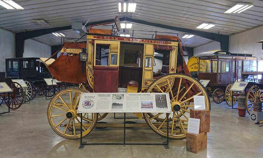
Carriage Collection
After you have explored this expansive museum and grounds, exit the parking lot, turn right back onto the highway and continue through the next traffic signal.

Turn right onto Murphys Grade Road. We will be on this road for the next 7 miles as we make our way to the truly charming town of Murphys.
While you drive we will go back and recap the history
of the gold rush which we covered in depth in our three companion California
Gold Rush driving tours: Auburn to Placerville, Placerville to Jackson, and
Jackson to Angels Camp.
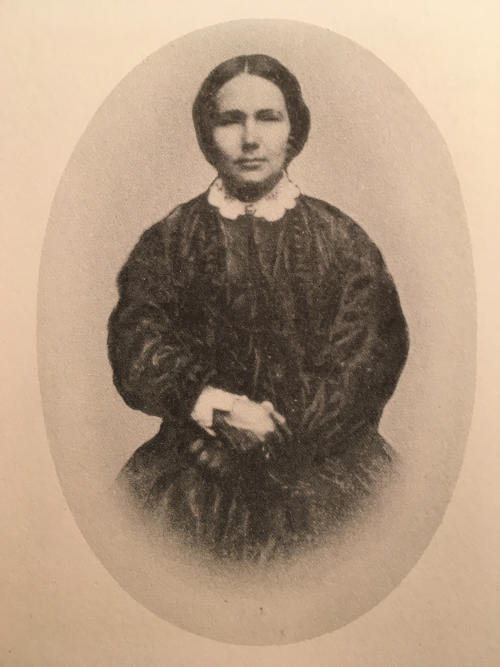
The gold rush began on January 24th, 1848 at Sutter's Mill in Coloma, when James Marshall discovered yellow flakes at the bottom of the channel under the mill's waterwheel. Marshall assumed that it was gold but he didn't know for sure, as he had never actually seen gold in its natural environment. So, the story goes, he turned to an unlikely source to confirm it, Jenny Wimmer.

Jennie Wimmer
Jennie and Peter Wimmer brought their seven children to California in 1846. John Sutter hired Peter to work on the crew digging the track for his sawmill in Coloma. Jennie was hired to be the camp cook and laundress.

Drawing of Jennie Testing the Gold
California Gold Book, by Allen & Avery (1893)

Routes to the California Goldfields
Well news spread fast, and so did gold fever. 49ers, as the first gold miners were called, came by covered wagons, ship, mule or foot. Some chose one of two optional sea routes. The seventeen thousand mile voyage around South America that took at least five months, or a fifty-three hundred mile trip including a jungle trek through the Isthmus of Panama. Other gold rushers took a different route, overland, and purchasing the 1849 best seller The emigrant's Guide to California as a guide.

Placer miners with their tools
From 1848 to 1854 the main type of gold mining was placer mining. For this method, men, and some women, worked the streams with pans, long toms, and sluice boxes. Once the placer gold was depleted prospectors turned to lode or hard-rock mining. This process involved extracting gold directly from the rock, typically quartz rock. By the end of 1851 quartz mining had become a major industry in California’s Mother Lode. It eventually would overtake placer mining in popularity, and become the largest source of gold production in California’s gold country.
The Mother Lode, which is a large system of gold-quartz veins deep underground, begins in Coloma and runs south about 120 miles to the town of Mariposa. These veins branch out, in no particular fashion along this corridor, and constitute the best-known mining districts in California.

During the gold rush years of the late 1840s through the 1850s and 60s, over fourteen hundred tent mining camps sprang up throughout the Sierra foothills, dotting the hillsides and mountain streams. Many eventually became bustling towns. We had the opportunity to visit a few, such as Placerville, Fiddletown, Volcano, Amador City and Mokelumne Hill, on our three gold rush companion driving tours.
In a few minutes we will arrive in the town of Murphys. This town, which was first mined in July of 1848 by two brothers from Santa Clara County, John and Daniel Murphy, was developed around a small Miwok village. The brothers set up a trading post. John won the respect and trust of the Tribe chief and the hand of his daughter in marriage.

By the early 1850s Main Street was lined with commercial buildings, occupied by hotels, saloons, liveries and general merchandise establishments. In 1852 the population had grown to 3000, the placer mines were overcrowded and in great need of a water source, to make them more successful. The following year, the Union Water Company built a series of flumes and ditches that brought water from the Stanislaus River 15 miles away. The next ten years were the greatest and most profitable in the history of placer mining in Murphys. After placer mining played out in the 1860s, ranching, farming, and logging took its place.
The town of Murphys, with its quaint buildings, and rich history, has been aptly named the Queen of the Sierra. Main Street is lined with shops, restaurants, and numerous wine rooms.

Follow the highway as it veers to the right ahead and becomes Main Street. As you drive, notice the different architectural styles ranging from western to Queen Anne Victorian. These buildings were constructed between 1856 and 1902. A plethora of wine rooms now occupy many of these historic structures. Ahead watch for Pop the Bubbly Champagne. Is is located in the 1856 stone western-style building across from the Murphys Hotel, at one time this operated as Wells Fargo assay office.


Make sure to take some time to visit the Ebbetts Pass Veteran's Memorial before heading off into town.


Old Jail

Main Street Murphys

Odd Fellows Building

Pop the Bubbly

Murphys Hotel
When you have finished visiting the town of Murphys, exit the parking lot and turn left. At the stop sign, cross Main Street to continue on Algiers,


Inside Mercer Caverns
The subterranean caves of Mercer Caverns were formed eons ago in limestone slabs that run deep in the ground throughout the Sierra Nevada. These were discovered quite by accident by gold miner Walter Mercer September 1, 1885. The cavern, which is open daily, is located on Sheep Ranch Road, about one mile northwest of Murphys. Summer hours, which run from Memorial Day Weekend through Labor Day, are 9 to 5 with the first guided tour beginning at 9:30. The rest of the year, this location opens at 10am. Here visitors may take a 45 minute guided tour, descend 160 vertical feet into the earth while navigating walkways and stairs. Your reward is a large array of incredible cave formations, stalactites, stalagmites and flowstones.

Down the road in the distance the Mercer Caverns sign should come into view. Exit the highway and follow the driveway past the sign to the parking lot for Mercer Caverns.

Before you tour the caverns, here is a bit of history on this location. The Sept. 12, 1885, headlines in the Calaveras Weekly Citizen announced the discovery of the New Calaveras Cave, the article read: “The cave was discovered by Walter Mercer a couple of weeks ago. It has only been partially explored, but enough has already been discovered to justify us in saying that it will prove a major attraction to tourists and curiosity seekers. The cave is in a limestone region, as in fact are all of the great caves of the world. Some of the apartments are of immense dimensions. It has been explored to the extent of seven or eight hundred feet.”

Walter Mercer began conducting tours shortly thereafter, charging guests .50 cents. The first visitors, holding candles between their teeth to light their way, maneuvered through the caves on ropes and ladders.

Cave Entrance 2022


Descending into Coral Room

Close up of aragonite


Next on your right is the stone and bronze California Historical Landmark forMurphys, designating this town historically significant to California. The marker reads: "One of the principal mining communities in Calaveras County, named for the discoverer of gold on the flat in 1849. The objective of many immigrants coming over the Sierras by Ebbetts Pass, Murphys Flat and surrounding mines produced $20,000,000 in gold. Early regulations restricted claims to 8 ft. square. Suspension flume conveying water across Murphys Creek and drainage race draining the flat, were two outstanding accomplishments of early day miners. Business portion of town destroyed by fire August 20, 1859. Joaquin Murietta bandit, began his murderous career here. Calaveras Light Guards recruiting for Civil War, organized here May 4, 1861."

At the stop sign turn left onto Big Trees Road. Then in less than 1/4 mile turn left onto Highway 4 toward Big Trees.


If you took any of our other three Gold Country driving tours you would have heard the fascinating story of American gold miner John Doble. John's journal from the 1850s and 60s gave us an inside view of a California gold miners daily life, the joys and struggles. Though men outnumbered women about 10 to 1 in California during the gold rush, there are several journals and writings left behind by the women of that time period.


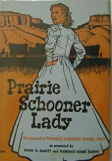
About 900 miles out of Independence Harriet's wagon train reached the fork of the Salt Lake and Sublette Routes, she wrote: "It is just four months today since we left our dear home and friends, perhaps forever, and have since been leading this wild, wandering gypsy life. Oh, when will the day arrive when we can say this long journey is over? You may possibly infer from this remark that I am becoming weary of this mode of life but indeed to me it is a perfect pleasure trip. There is so much variety and excitement, and the scenery through which we are constantly passing is so wild and magnificently grand that it elevates the soul from earth to heaven and causes such an elasticity of mind that I forget I am so old."
Margaret Frink caught gold fever when she received this letter from her friend Mrs. McKinney. "If a woman can cook at all, she could get $16 a week for each man that she cooked for. And the only cooking required to be done was to boil meat and potatoes and serve them on a big chip of wood, instead of a plate."


40 Miles of Desert
Nearly seventeen hundred miles into their journey the Frinks' had reached the Humboldt Sink. Ahead of them lay forty miles of desert. On her trip through the desert Margaret writes: "For many weeks we had been accustomed to see property abandoned and animals dead or dying. But those scenes are here doubled. Horses, mules, and oxen, suffering from heat, thirst, and starvation, staggered along until they fell and died. Both sides of the road for miles are lined with dead animals and abandoned wagons. The owners left everything, except what provisions they could carry on their backs, and hurried to save themselves."
In September 1850, Margaret and Ledyard reached Sacramento and jumped right into the hotel business. They rented a two-story house on K Street for $175 a month, purchased a stove for $50 and paid $18 for the lumber to build a dining table and benches. Ledyard placed the finishing touches on their establishment by nailing a sign over the front door that read, "Frink's Hotel." By the end of the first month, the Frink's had cleared a tidy $200 profit.


Head back to the highway and turn right. We are entering the Stanislaus National Forest, which manages almost 900,000 acres of land in four counties of Northern California. Named after the Stanislaus River, it was established in 1897, making it one of the oldest national forests.
As we continue to climb in elevation along the highway making our way to Calaveras Big Trees State Park, we will pass through two rural mountain towns, Hathaway Pines and Avery.
Joseph and Sarah Goodell arrived in this area in 1851 and built a four room house. It was known by the name The Half-Way House, as it was located half way between Murphys and Big Trees. The Goodell’s sold Half-Way House to the Avery family in 1869.
This roadhouse was a major stop for overnight lodging in the 1880s. Emigrant Road ran right through what later became known as the town of Avery. Miners would stop here on their way to or from the Comstock Lode in Nevada. Logging and freight teams also frequented the hotel.
Today Half-Way House is called the Avery Hotel and is located just off the highway. Let's drive by it.


From Hathaway Pines we are about 7 miles to Calaveras Big Trees State Park. While you drive we have a few more stories about those early gold rush pioneering women.
Early in 1851, forty year old Elizabeth Gunn and her four children booked passage to join her husband in the California mines. They would take the traditional route around the Horn of South America, a journey that would take at least five months. Her journal while at sea details her difficulty in traveling with four young children in such a confined area.

"A gale commenced on Tuesday at noon and lasted till Friday, and we were tossed about in fine order. We could neither stand nor sit without being tossed about. The children held their plates in their laps and half the time one would spill his water or lose his spoon. No one can hold on to their things. If you try to walk, down you would fall and slide along the deck until you hit the wall. I am quite downhearted. At the slow pace we are traveling, the Captain says that at this rate we shall be five years getting to California."
Well it didn't take Elizabeth quite that long to get to California. After only six months, she and the children joined her husband Lewis in the town of Sonora. We will be visiting Sonora later on our driving tour and view her home which is now a hotel.
The Gunn family left Sonora in August 1861 and settled in San Francisco where Lewis was appointed Deputy Surveyor of the port and then San Francisco's Assessor of Internal Revenue. After the Civil War, Lewis returned to the newspaper business as the supervising editor of the San Francisco Times. Elizabeth Gunn died in 1906 at the age of 95. In 1928 her daughter Anna Lee Marston published Records of a California Family, a compellation of her father's gold rush diary and her mother's journal and letters.
We will drive by Elizabeth's home in Sonora later on this driving tour. But right now we are coming to the town of Arnold.


Ebbetts Pass Inn 2022
Arnold continues to cater to visitors drawn to the area’s myriad of year-round outdoor recreational opportunities, including hiking, camping, biking, fishing as well as winter sports. The community also serves as the western terminus of the Ebbetts Pass National Scenic Byway, which stretches 61 miles from Arnold in Calaveras county to Markleeville in Alpine county.


Our next stop is Calaveras BigTrees State Park. Watch for the park sign ahead on your right and turn right into the entrance. Continue straight to the ranger booth to pay your parking fees. Then follow the sign which points right toward the Visitor Center and Parking.


Several emigrants recorded seeing these enormous trees in their diaries dating from the mid-1840s, and surely the Native American tribes that frequented this region would also have noticed them. But Dowd was the first to promote the encounter, so history gives him the credit for their discovery.
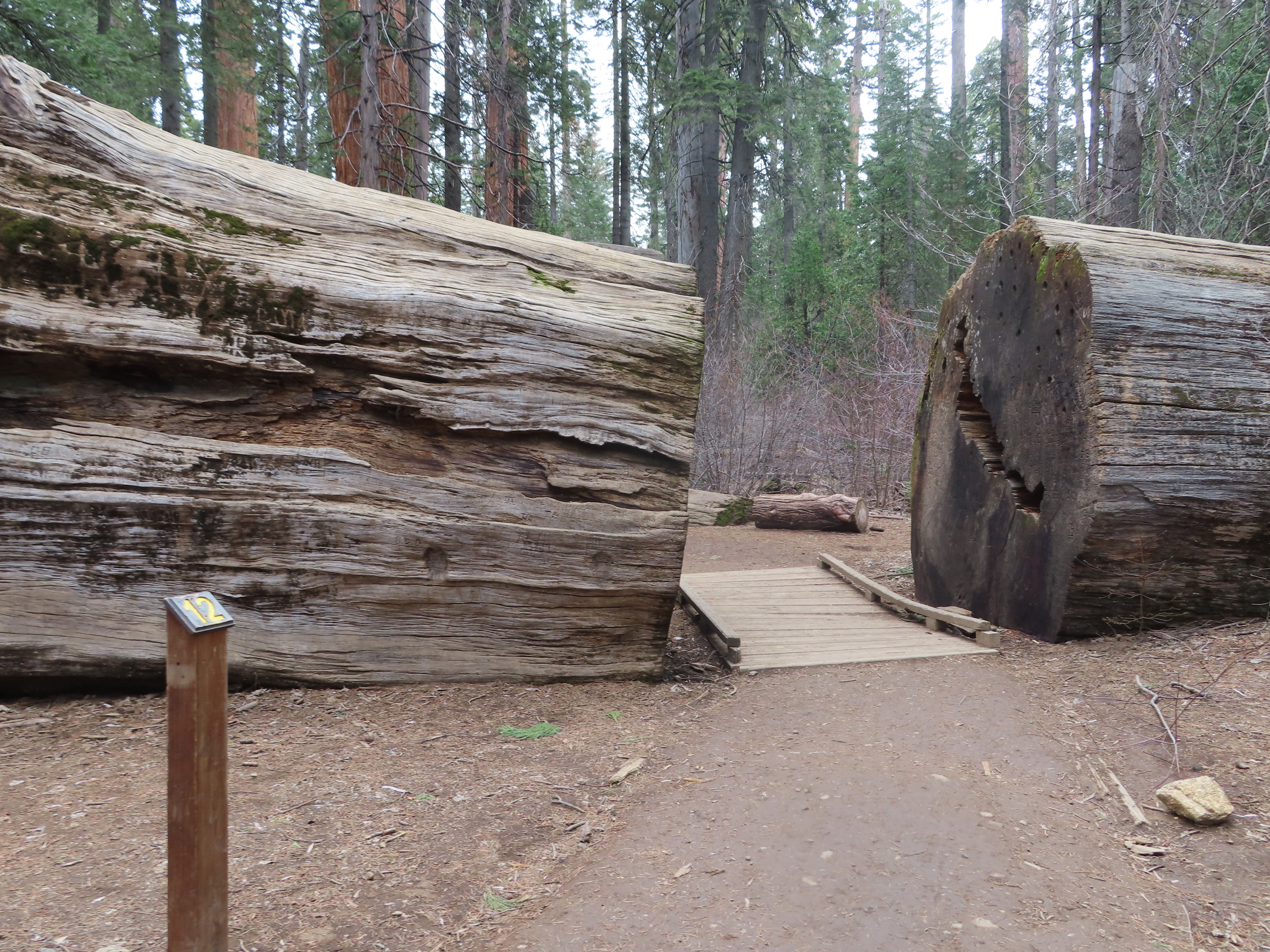
In 1900, to great public protest, the property was sold to lumberman Robert Whiteside. Whiteside declined offers from the federal government to establish the forest as a national park. In 1928, Californians voted to establish a state park system. Three years later with the help of John D. Rockefeller, Jr. and Mrs. William Crocker funding was acquired to turn the North Grove section into a state park. It would take 23 more years to acquire the South Grove. These two groves make up the Calaveras Big Trees State Park, a total of sixty-four hundred acres of the largest and most magnificent trees in the world. The North Grove, which we will be visiting, contains about 100 mature giant sequoias.

The Twisting Tree
Use the map below or the one in our Companion Brochure. When you get to the start of the North Grove Trail you may purchase a map with more information about each of the points along the trail. The price is .50 for the brochure.


Empire State Tree

Siamese Twins
The Siamese Twins are two trees that began life so close together that the first 50 feet of their trunks have merged and now appear to be one tree.


Mother of the Forest

Mother of the Forest in 1866 with scaffolding

Mother of the Forest on Display in London

Pioneer Cabin Tree fell in 2017

Pioneer Cabin Tree c. 1860 - 1880 before tunnel


Dr. and Mrs. Thomas Megquier, left their three children with relatives in Maine and traveled the Isthmus route to California in 1849. Jennie and her husband intended to "make a pile" and then return home to Maine.
The fifty-three hundred mile Isthmus of Panama route was shorter than traveling seventeen thousand miles around the Horn, yet it could end up taking just as long.

Old Chagres harbor, 1850
On the Megquier's journey, passengers were dropped off on the Atlantic coast of Panama in the city of Chagres and left on their own to get across the Isthmus to Panama City. That trip began with transportation along the Chagres River. The Mequier's had two options a dugout canoe called a bungo or a steamer. They bought passage on the Orus steamer, which shuttled them only sixteen miles up the river before they had to transfer to a bungo.

Chagres River by Charles Christian Nahl

Guide and pack mule crossing Isthmus (B. F. McCreary)
The last stop on the Isthmus before continuing on to California was Panama City. Here passengers had to compete with thousands of others impatient gold rushers for a seat on one of only four steamers that traveled back and forth up and down the coast from Panama City to San Francisco. The Megquire's waited weeks for their steamer connection. Once they arrived in San Francisco they decided they could make more money opening a boardinghouse than working the mines.
On June 30, 1850 Jennie wrote to her daughter from San Francisco: "I should like to give you an account of my work if I could do it justice. I get up and make the coffee, then I bake the biscuits, fry the potatoes, broil three pounds of steak, and as much liver. At eight the bell rings and they are all eating until nine. I do not sit until the men are nearly all done. After breakfast I bake six loaves of bread, four pies, and a pudding. Then we have lamb, beef, pork all baked with turnips, beets, and radishes. Dinner is set everyday at two. I have cooked every mouthful that has been eaten. I make six beds every day and do all the washing and ironing. If I had not the constitution of six horses I should have been dead long ago. I am going to give up in the fall as I am sick and tired of all this work."
Jennie and Thomas ultimately did not make the fortune they had hoped for and returned home to Maine in 1852, only to catch the fever again and return to the mines later that year. Amidst problems arising from finances and illness Jennie and Thomas returned again to Maine in 1854. Thomas died a year later, and Jennie sure enough, caught the fever yet again and returned to California.

On May 22, 1853, the San Francisco newspaper The Golden Era informed its readers: "The world-renowned Lola Montez, Countess of Landfeldt, arrived in this city on the Northerner."
Born Eliza Rosanna Gilbert in Ireland in 1821, she would go on to became famous as a Spanish dancer. Her dancing debut was held in London in 1847 where she was billed as "The Premier Spanish Ballerina." In order to make the act more authentic, Eliza changed her name to Lola Montez and adopted a Spanish accent. While touring Germany that same year, she managed to capture the heart of King Ludwig I of Bavaria. The king showered her with gifts and gave her the title Countess of Landsfeld. When the king allowed Lola to help him rule his country the people of Bavaria were outraged and ran both King Ludwig and Lola out of the country. The picture above was painted in 1847 for the King.
Lola went on to perform in Europe, New York and New Orleans. It was while playing to audiences in 1853 in New Orleans, Lola caught gold fever and decided to extend her U.S. tour to California. Women with any musical or theatrical talent could make a fortune entertaining gold rushers and with Lola's international fame, she planned on garnering a fair share of California's gold.

Lola Montez (1852 - 31 years old)
In 1853, Lola stood on stage before an audience filled with gold miners at the American Theatre in San Francisco and announced, "Good evening, gentlemen. I am Lola Montez. I was born in the year 1830, in Seville, the capital of Andalucía, the land of the serenades and balconies, of troubadours and romance, and the fatherland of Miguel Cervantes."
Best known for her "Spider Dance," Lola dressed in a risqué costume, fluttered around the stage pretending to be trapped inside a spider's web. At the climax of the dance, stage hands dropped giant tarantulas made of cork down on her. Some miners were thrilled, others found the dance a bit too provocative. Most newspapers gave her mixed reviews.
One newspaper critic wrote: "She unwittingly gets into one of those huge nests of spiders found during the spring time in the meadows. She commences to dance, and the cobwebs entangle her ankles. The myriad of spiders begin to colonize. As the music, a slow-measured but fascinating amalgamation of polka, waltz, march, and jig, conforms admirably to the step the spiders accumulate. These hairy monsters appear to crawl about the stage, invading the fringes of her petticoats and taking unwarrantable liberties. It is Lola versus the spiders. After a series of shaking her dress, she succeeds in getting the intruders away and does it with so much naivete that we feel a sort of satisfaction at her triumph."
.jpg)
Lola Montez (photographed by Antoine Samuel Adam-Salomon 1860 - 39 years)
Eleanora arrived and sat across from Carver and asked, "What's your preference?"
"I don't care, I've got more than two hundred dollars in gold. Let's get going, I don't want to quit until you've got all my money or until I've got all yours."
Eleanora's game was vingt-et-un the precursor to 21 or blackjack. In less than 1 hour she had cleaned Carver out of his entire bankroll.

Born Simone Jules around 1829 in New Orleans, Eleanora made her way west to San Francisco in 1849. She had one goal in mind. "The western heartthrob I'm after, is not a man, but that glittery rock lying among the foothills of the Gold Country." Her game, though was not panning, it was cards. Eleanora quickly established herself as a force to be reckoned with, easily taking money from drunk miners who had never before seen a woman gambler. A few years later she took her profits and opened a gambling establishment of her own just north of Sacramento in Nevada City.
Her advertisement in the Nevada Journal read, "Come to the grand opening of the best gambling emporium in northern California, the Vingt-et-un on Broad Street, and enjoy a game with Madame Dumont as well as free champagne for all." Citizens from all over responded to her invitation. At the entrance only well-behaved and well-groomed men were allowed in, and cursing was discouraged.
Eleanora recalls: "It was a tasteful establishment furnished with expensive chairs and settees, carpets and even gas chandeliers. I held my establishment open 24 hours a day and soon it became the most favorite spot of thirsty gold miners. Many found recreation in a hand of poker or a spin of the wheel, but my appearance behind the gambling table drew criticism from the respectable women in town. They viewed me as a threat to their marriages. Well maybe I am, as several have fallen hopeless in love with me. Dell Fallon was one such suitor. He popped the question one night while I dealt his cards."
"Madame Dumont I know I ain't worthy to ask the question, but would you consent to become my wife?"
"My friend, I am grateful that you hold me in such high regard. But I am not free to follow the dictates of my heart. I must go alone."
Actually Eleanora did have her heart set on someone, Editor Wait of the Nevada Journal. Mr. Wait though found her lacking in social standing, and did not return her affections. After he announced his engagement to another, Eleanora marched into his office and announced, "I'm leaving Nevada City to forget you. I hope you have a good life."
Eleanora made her way to Columbia, California in 1857, and set up a gaming table in one of the hotels. Over the years, her beauty faded and she started to grow facial hair under her nose. Miners nicknamed her Madame Mustache, and came from miles around to play try their luck at beating her at blackjack.

In 1879, at the age of fifty, Eleanora moved to Bodie, California. With stabbing's and shootings taking place daily, this mining camp was known for its violence. She set up a gaming table at one of the saloons and invited men to try their luck against her. This time however things did not go well for Eleanora, professional gamblers regularly won at her table and eventually left her penniless. One evening after another loosing hand, Eleanora drank a bottle of poison. When she was found, the note in her hand read, "Dear Citizens of Nevada City I am kindly requesting that you permit me to be buried next to my one true love, Editor Wait."
Continue along the highway as we have a moment of silence for Miss Eleanora Dumont.

For gold rushers, the elephant symbolized both the countless possibilities of misfortune on their journey, as well as the promises of an adventure of a lifetime.
John Doble, Jennie Wimmer, Margaret Frink, Jennie Megquier, Lola Montez and even Eleanora Dumont all would say they saw the elephant. Some had better experiences than others, some may have just barely held on to the elephant’s tail. But each one of our gold rushers, whether they came to California via land or sea would have seen the elephant, “from the tip of his trunk to the end of his tail” by the time they arrived in California. And for those who hadn’t yet, two or three weeks in any one of California’s early mining towns was certain to bring on the vision.

Douglas Flat
The prosperity of the community of Douglas Flat in 1849, was first based on placer mining in the creeks and streambeds nearby. Eventually miners traced the source of this gold to the ancient Tertiary Central Hill Channel that ran beneath Table Mountain northwest of town.
Tertiary channels are places where a river once flowed millions of years ago but is now far from any existing river or water source. It is basically a dry abandoned riverbed. Some of the highest concentrations of gold are found in these ancient tertiary gravel channels and Central Hill Channel proved quite profitable.

Hydraulic Mining 1870s

Locke Winery
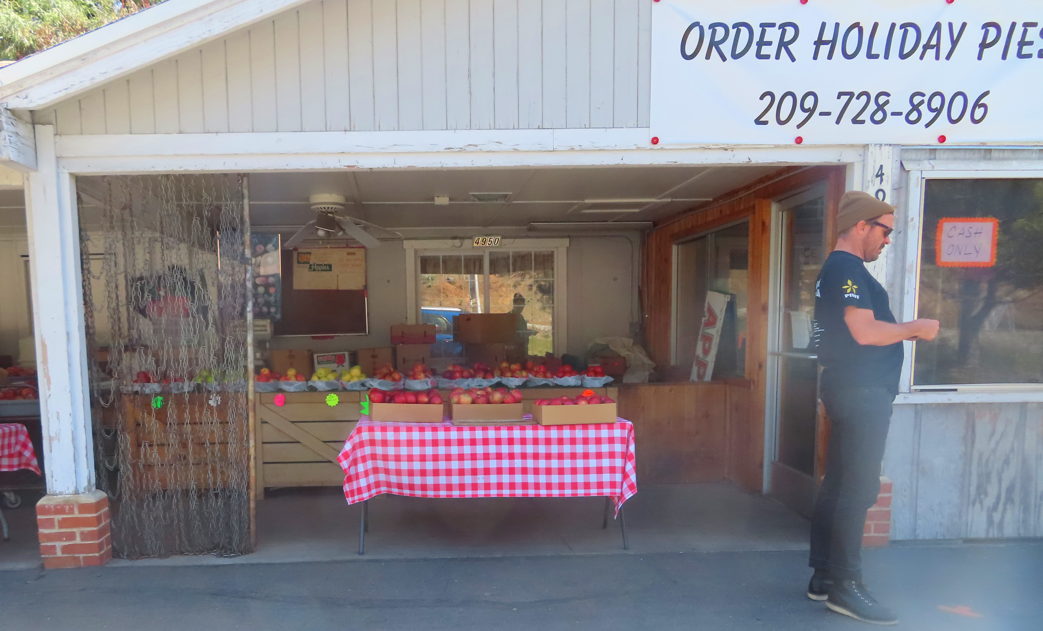
Today along this area of highway you will find three vineyards on the left side of the road, the Locke, Hatcher and Sevenot. Each of these have wine tasting rooms in nearby Murphys.


Historic Picture Moaning Caverns


Spiral Staircase Moaning Caverns


The exit for this stop is a bit difficult to find, but worth the effort. These are the coordinates 38.051689, -120.470849 for this stop. Google lists as the address as 4508-4532 County Rd E18, Angels Camp, CA. The only marker along the highway are a few boulders that sit at the entrance to the driveway that runs at a sharp right turn off the highway.

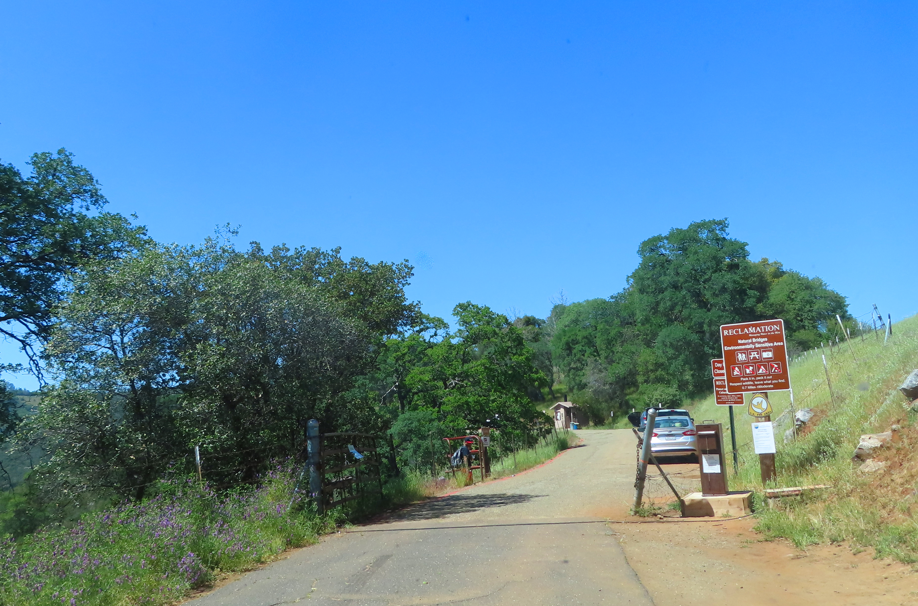


Inside Nature Bridges


.jpeg)

The Stanislaus River is a tributary of the San Joaquin River located in north-central California. It consists of three forks that originate in the high Sierra Nevada and flow southwest through parts of Alpine, Calaveras and Tuolumne County into the agricultural San Joaquin Valley. The Stanislaus is known for its swift rapids and scenic canyons. Its waters are used for irrigation, hydroelectricity and the domestic water supply.

 Lithograph of Columbia by Towle Leavitt
 In March of 1850, Dr. Thaddeus Hildreth and his brother arrived at Columbia Gulch. They pitched their tent in the rain and the next morning found golden flakes stuck to their wet blankets. Word of this discovery traveled quickly and thousands of miners arrived by April. Early newspaper reports announced several large nuggets of nearly pure gold were found at Columbia Gulch. One 72 pound nugget was valued by Wells Fargo at $14,000. By 1860 estimates of between $85 million and $150 million dollars of gold were panned, picked or dug out of the area.

Wells Fargo Express Columbia, CA

Wells Fargo Express Columbia, CA 2022
At its heyday, Columbia had four banks, eight hotels, 30 saloons, 2 churches, a theater, school and various general stores. Devastating fires leveled the town in 1854 and 1857. After that, Columbia was rebuilt using brick and cement.

A scarcity of women in gold rush towns gave rise to Columbia's theater district which showcased some of the miners favorite entertainers. Miners flocked to the theater cheering, hooting, howling and throwing buckskin bags of gold on to the stage. Child actors were particularly popular as they reminded the men of their own children back home. One of those child stars to play the Columbia theater was Lotta Crabtree.

Lotta Crabtree (1868 - 21 years old)
Born in New York in 1847, Lotta and her mother Mary Ann crossed the Isthmus of Panama in 1853 to join Lotta's goldmining father in Grass Valley about 50 miles north-east of Sacramento. Gold mining was not making ends meet for the Crabtree's so Mary Ann enrolled Lotta in dancing lessons with the idea that she could become an entertainer and help support the family. Lotta soon attracted the attention of a neighbor, dancer and actress Lola Montez. Lola who was famous for her Spider Dance, taught Lotta the Irish jig. Half of California's foreign born emigrants were Irish and this they felt would make her star material.
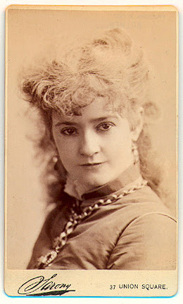
Lotta would go on to tour the East Coast as well as Europe, retiring from the stage in 1891 at the age of 44. Throughout her life Lotta continued to support her family. She died in 1924 with an estate valued at over $4 million.


Columbia State Park is one of the premier Old West mining towns and features an array of attractions where visitors are encouraged to join in. We will arrive at the park shortly to take a self-guided walking tour of the old town. Parking is free in town but there is a small cost to experience some of the adventures, such as candle dipping, gold panning or a ride on the Wells Fargo Stagecoach.
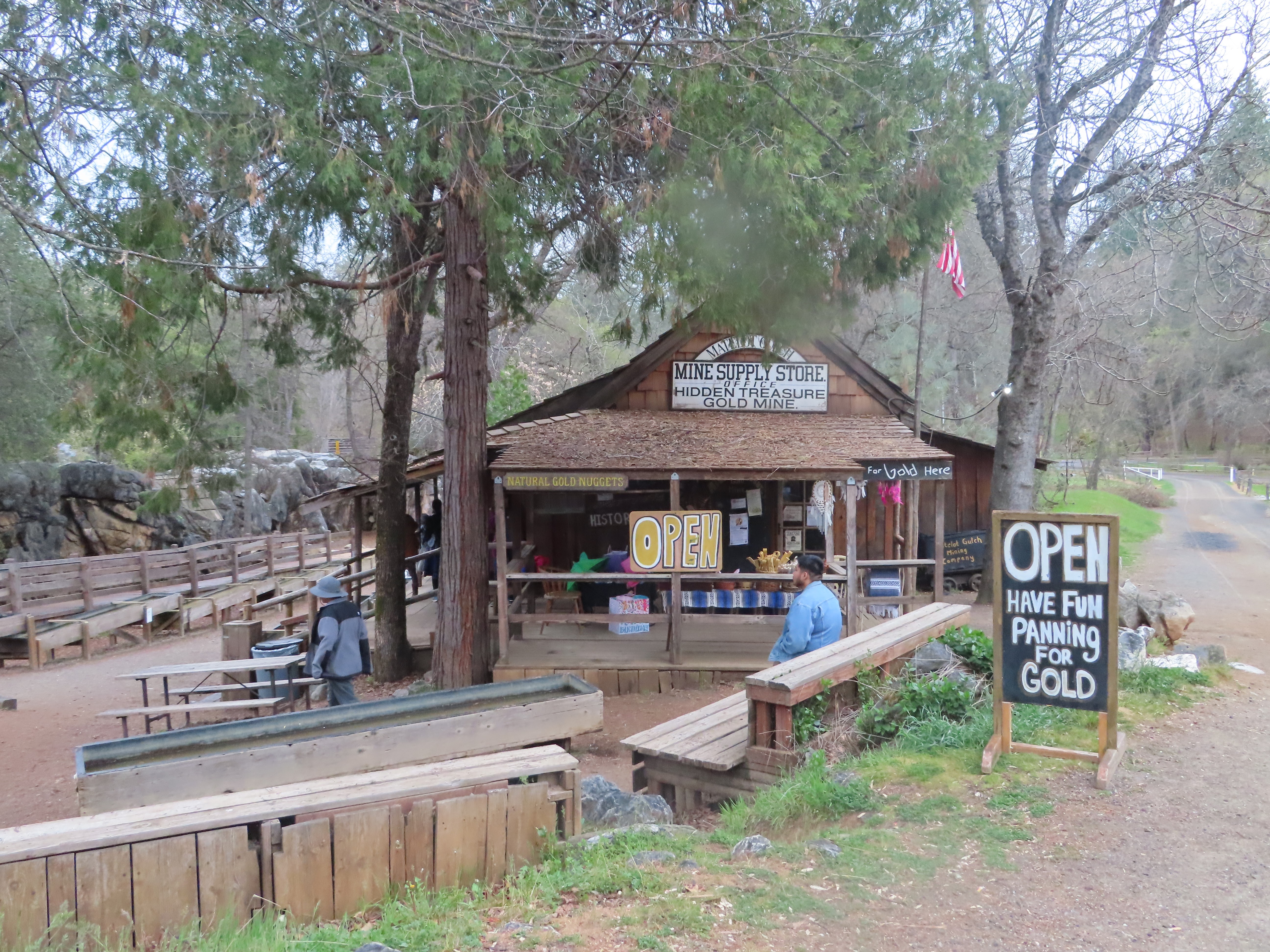
Gold Panning Columbia State Park
This highway runs through Columbia State Park. There are several parking areas here and we usually use the most centrally located one near State Street.


When you have finished exploring this town, continue along Parrotts Ferry Road for 2 miles. Then follow the highway as it curves left toward Sonora.

Sonora was initially settled in 1848 almost exclusively Mexican born miners. In 1850 the United States imposed a Foreign Miners' Tax, nicknamed the Miserable Law. This act imposed a tax of $20 a month on all foreign miners. After the Mexican's left others arrived to replace them.
By 1858 hard-rock quartz mining replaced panning the creeks. The Bonanza hard-rock quartz mine located at the northern end of town near what is today St. James Episcopal Church produced a total of one and a half million dollars in gold. In the 1870s miners broke through to a continuous solid gold vein in town that earned a $160,000 payment from one shipment to the San Francisco Mint. Over all $40 million dollars in gold was mined within a two mile radius of Sonora.
Today this colorful mining town is the Tuolumne County seat. With many historical buildings this destination is known as the Queen of the Southern Mines. Once you arrive we will take you on a driving tour through the old western part of town and point out some of the historical highlights.


The two-story red brick building in the next block was built in 1903. At the stop sign ahead, turn right onto South Washington. The buildings that line both sides of the next two blocks were listed on the 1890 Sanborn Fire map. Making them all over 130 years old.


William came to California from North Carolina in 1850 as a slave. William Snugg obtained his freedom from slavery in 1854 after paying his owner a manumission fee. He bought this property on Theall for his wife and built a three-room home there in 1860. As his family grew to 12 members, William added seven more rooms in 1885.

At the stop turn right onto Shepard Street, then right onto Gold Street, and right onto South Washington. As you make this turn look left to view Elizabeth Gunn's house. Recall Elizabeth came to California in 1851. Her husband built her this two-story adobe.


At the traffic light ahead use the left turn lane to turn left back onto Highway 49. While you wait at the light or as you make the turn, notice the two-story yellow stucco Sonora Inn. Originally built in 1896 in the Victorian-style, the building was redesigned in the 1920s in the California Mission style which you see today. The Sonora Inn has hosted some of Hollywood's elite, Grace Kelly during the filming of High Noon in 1952 and Drew Barrymore while she worked on the film Bad Girls in 1994.


_01.jpg)
At the stop sign ahead, turn right onto Main Street. On your right at the stop sign will be the historic plaque for Jamestown, the southern Gateway to the Mother Lode.

Oregonian Benjamin Wood panned a creek and found gold outside Jamestown a few months after gold was discovered in Coloma in 1848. Wood’s gold discovery was the first in Tuolumne County. The creek was named after Wood; however, the town was named after Colonel George F. James, a wealthy attorney from San Francisco.
The placers ran dry by 1854 but, a profitable hard-rock drift mine was discovered nearby and Jamestown’s population soared. In 1898 the railroad would become Jamestown’s primary industry, transporting quartz, lumber, and other goods out of the county.
The railroad continues to be a major part of life in Jamestown, as it is the home of the Steam Sierra Railway and Railtown 1897 State Historic Park. Several of the buildings in downtown Jamestown date to the 1870s and 80s, today they are occupied by quaint historic inns, restaurants, a cigar bar and wine tasting rooms.


Welcome to Old Town Jamestown, the backdrop for dozens of Hollywood television and movies including: Back to the Future III, Unforgiven, High Noon, Little House on the Prairie and the Wild Wild West . Park here and if you are interested in exploring Jamestown by foot, please use the map below.

This however is where we are leaving you. We hope that you have enjoyed your driving tour from Angels Camp to Jamestown and all of the stops in-between.
Until next time, Happy Adventures!
All pictures by L. A. or R. M. Momboisse unless listed below:
Juaquin Murrieta - Wikipedia
Picture of Jennie Wimmer and drawing of Jennie Wimmer
Routes to the California Gold Fields - Kids Britannica
Placer Miners with their tools - Courtesy Bancroft Library
J. D. Borthwick Miner - Sierra Collage
Murphys 1850s - Murphys History
Inside Mercer Caverns - Wikipedia
Movie Poster The Virginian - Wikipedia
Mercer Cave Entrance 1886 - Mercer Caverns
Three pictures inside Mercer Caverns - Mercer Caverns
Zealous Gold Diggers - Ordinary Women of the Goldfields
Wagon Train into Great Salt Lake - National Park Service
Margaret Frink - National Park Service
40 Miles of Desert - California Trail Interpretive Center
Poster of Hornet Clipper that Made trip around the Horn in the 1850s - Wikipedia
Mammoth Giant Sequoia Tree - Wikipedia
Mother of the Forest in 1866 with scaffolding - Wikipedia
Mother of the Forest on Display in London 1859 - Wikipedia
Pioneer Cabin Tree c. 1860 - 1880 before tunnel - Wikipedia
Pioneer Cabin Tree with tunnel - Wikipedia
Mary Jane "Jennie" Megquier - Women in the California Gold Rush
Chagres River by Charles Christian Nahl
Guide and pack mule crossing Isthmus (B. F. McCreary) - Diary of Frank McCreary
Lola Montez (1847 painted by Joseph Karl Steiler for Ludwig I of Bavaria) - Wikipedia
Lola Montez (1852) - U.S. History Scene
Lola Montez (photographed by Antoine Samuel Adam-Salomon 1860 - 39 years) - Wikipedia
Eleanor Dumont - Wikipedia
Pioche Record (Pioche, Nevada August 10, 1878)
Seeing the Elephant (mid-nineteenth century lithograph by W. B. McMurtrie)
Hydraulic Mining 1870s - USGS
Historic Picture Moaning Caverns - Moaning Caverns
Spiral Staircase Moaning Caverns - Moaning Caverns
Inside Nature Bridges - (Photos by Dave Bunnell for Go Calaveras)
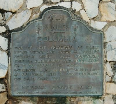
Columbia State Park Historic Marker
Lithograph of Columbia by Towle Leavitt - Columbia State Park
Wells Fargo Express Columbia, CA - Friends of Columbia
Lotta Crabtree (1868 - 21 years old) - Women in Theater (Library of Congress)
Lotta Crabtree - Wikipedia
The Virginian Movie Poster - Wikipedia
Diary excerpts were researched and paraphrased from the following books:
Prairie Schooner Lady: The journal of Harriet Sherrill Ward 1853 published by Florence DeWitt
California Women: A History by Jensen and Lothrop
Margaret Frink, Journal of the Adventures of a Party of California Gold-seekers
With Great Hope: Women of the California Gold Rush by JoAnn Chartier and Chris Enss
They Saw the Elephant: Woman in the California Gold Rush by JoAnn Levy
Women of the Gold Rush: Taming the Forty-Niner by Elizabeth Margo
Golden Dreams: True Stories of Adventure in the California Gold Rush by Frank Baumbardner
Tales and Treasures of the California Gold Rush by Randall Reinstedt
Gold Rush Women by Claire R. Murphy and Jane Haigh
Records of a California Family published by Anna Lee Marston
Comments
Post a Comment